We started our day by backtracking to the Skaftafell visitor center at Vatnajökull National Park to get advice from the rangers there about which glaciers were the best to visit at this time of year.
The Vatnajökull, which translates to “Glacier of Lakes” (literally, water [vatna] glacier [jökull]), is the largest ice cap in Iceland, as well as in mainland Europe. The National Park encompasses it in its entirety. The Park is a UNESCO World Heritage site.
Here’s a topographical map to give you some perspective. Vatnajökull is shown in white at the bottom right. It covers about 1/8 of the main island.

You can access the outfalls of several glaciers from the visitor center. We decided to hike out to Skaftafellsjökull to the east. You can’t quite get to the ice or the lagoon, but its probably the closest you can hike to any of the glaciers near the visitor center without a guide or being on a tour. Here’s a panoramic view:
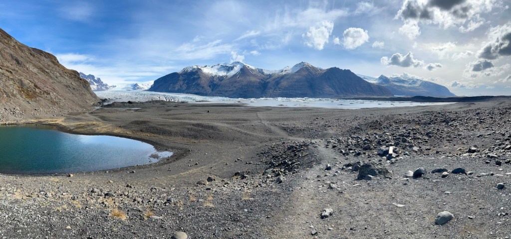
There’s not much vegetation or wildlife out here, just a couple wildflowers, geese and reindeer. You can just make out the reindeer in the distance on the right, below.

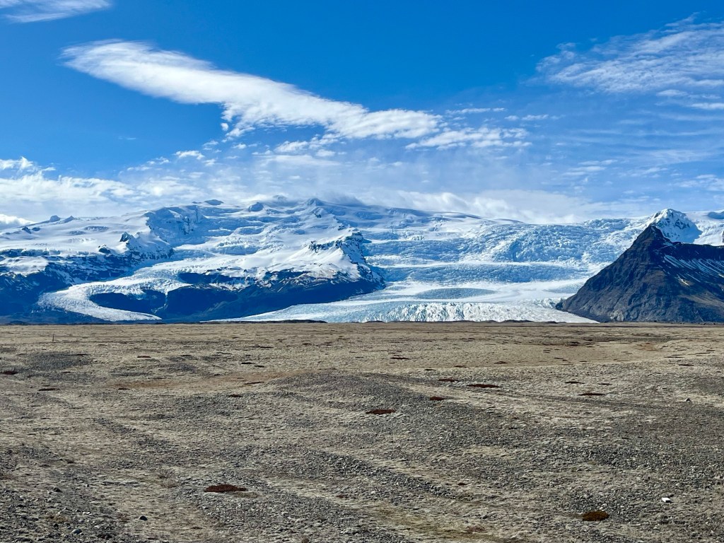
After our hike, we drove around to the east side of the Park. The glaciers flowing out of the ice cap are larger there. Here’s Fjallsárlón:
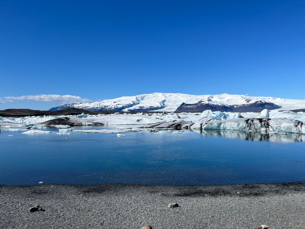
Further east is Breiðamerkurjökull and its Jökulsárlón, the “Glacier Lagoon.” The photo, below, was taken from the western end of the glacier and its lagoon.
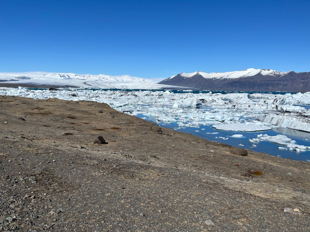
Looking east from the above location, we could see how all the icebergs that had calved off of the glacier had drifted across the lagoon where the larger of them were stranded.
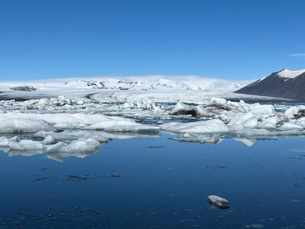
Supposedly, most of the icebergs drift around in the lagoon for about five years before finally breaking up enough to drift downstream into the ocean.
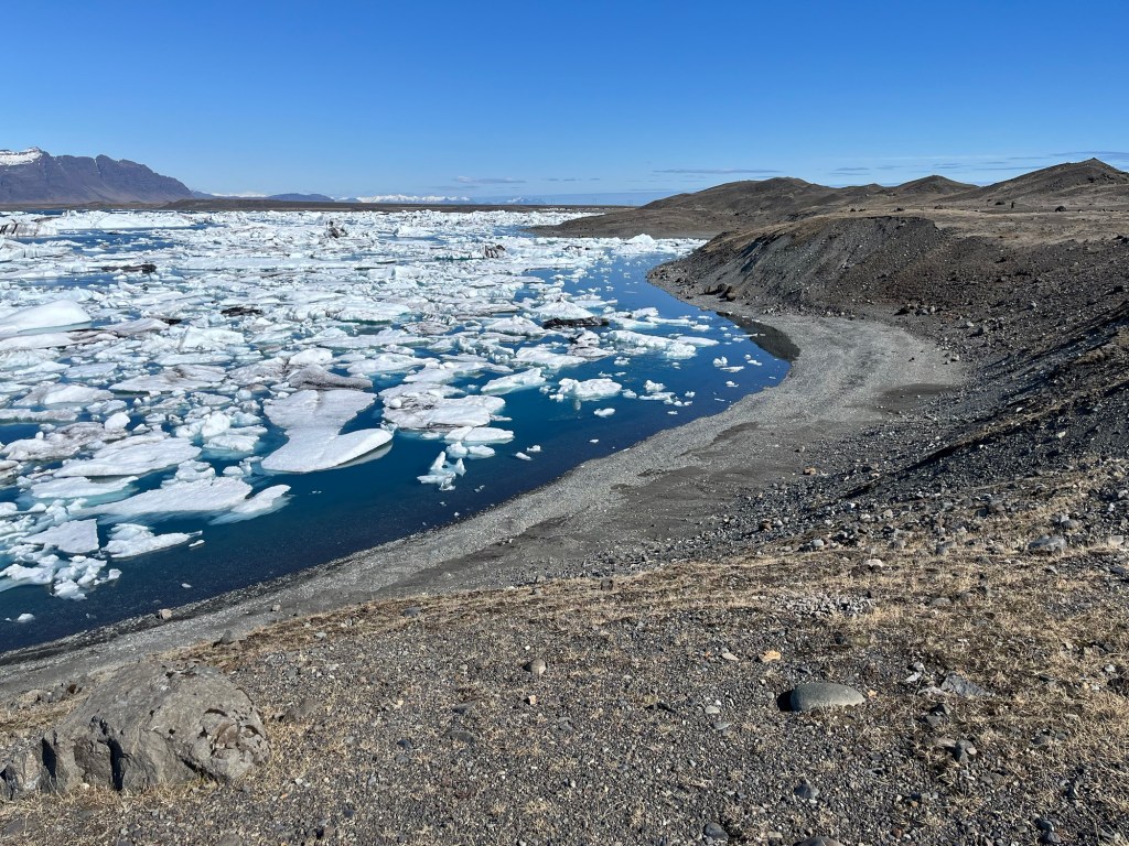
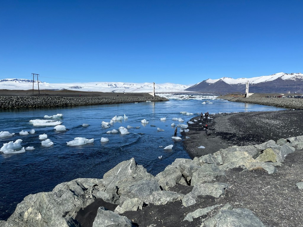
We drove further east, crossing the one-lane bridge that spans the lagoon’s outfall into the North Atlantic, parked, and then walked along the edge of the lagoon. Near the bridge, the water was mostly free of ice, the smaller bergs having already drifted out to sea.
But as we walked further along the lagoon, ice fragments became more common…
… as you can see in this progression of photos taken as we walked along the shoreline.

Standing on the water’s edge, I picked up this piece of ice, my own private iceberg.

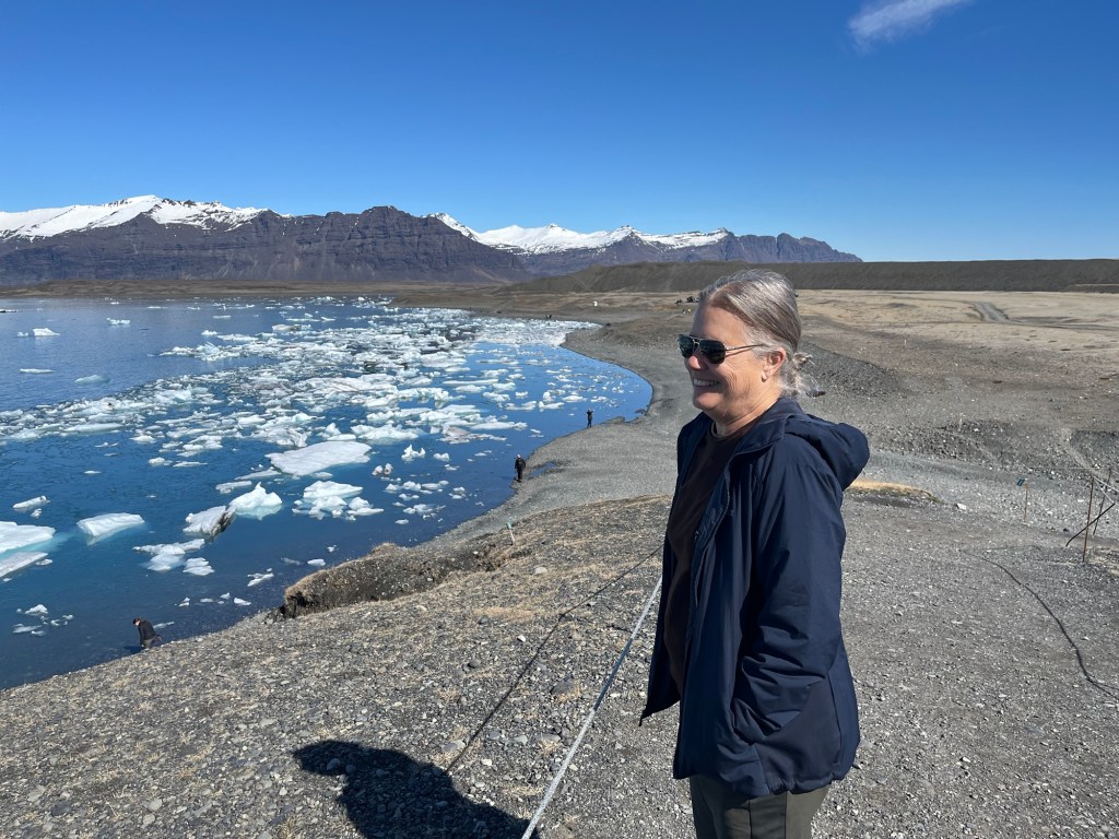
We decided to hike up to the top of the moraine to get a better view.
Turning back east, we had a great view of the bridge and the outfall into the ocean.

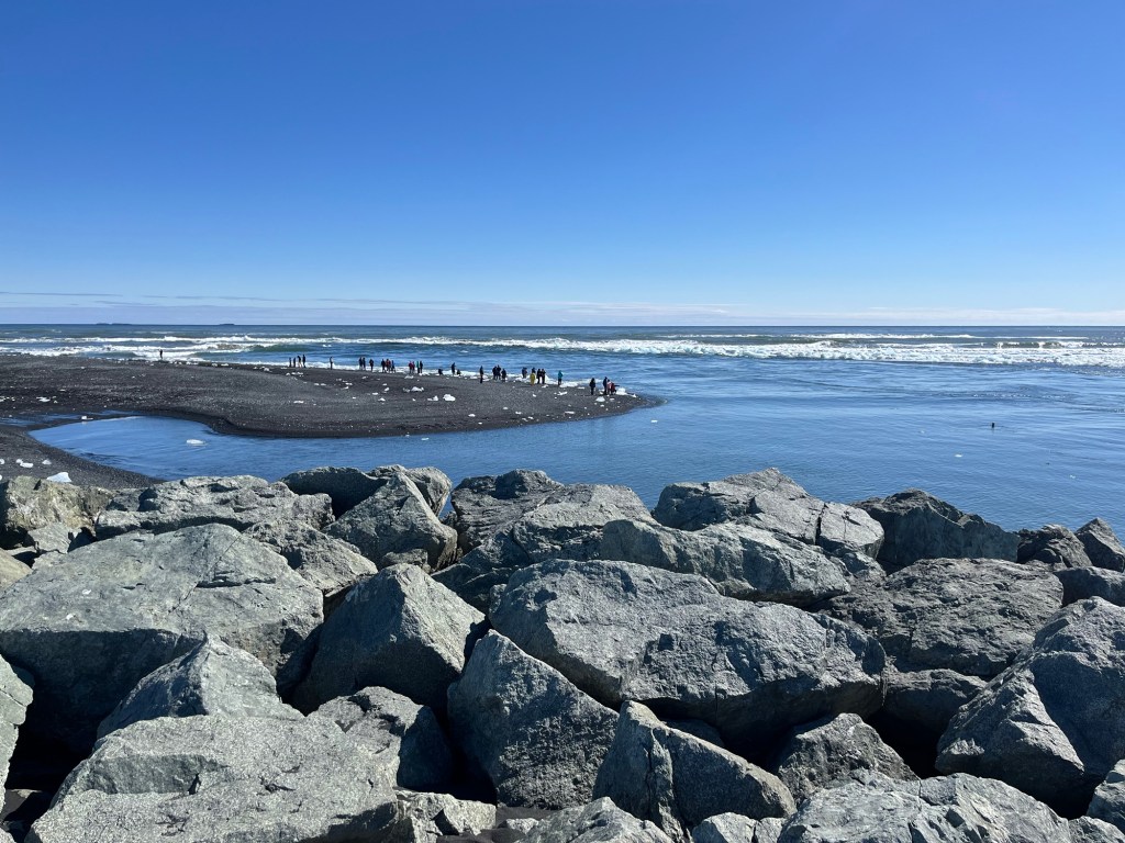
We headed down hill, grabbed lunch at one of the food trucks, then walked out to the end of the natural jetty to watch the little bergs float by on their way out to sea.
This is where all the ice eventually ends up: the North Atlantic Ocean:
Except for my private little iceberg. It’s chilling my evening cocktail.

so how does thousand-year-old ice taste in your cocktail?
Like ice.
unglaublich. Ihr macht aber auch alles mit, ob im Flugzeug, auf den Fahrrad, Schiff, Pferd, Kayak, zu Fuß … toll!