The Karakum Desert covers about 70% of Turkmenistan. Nearly all of the cities and towns are situated along the country’s periphery. Very few people live in the barren interior.
There are only two highways crossing the desert and only one connecting Ashgabat to the north. Today’s post is about our drive north across Turkmenistan with an overnight stop at Darvaza, smack dab in the middle of the Karakum Desert.

Since the road is rough and traipses off on sandy detours, our travel group was divided into three 4-wheel vehicles for the journey.
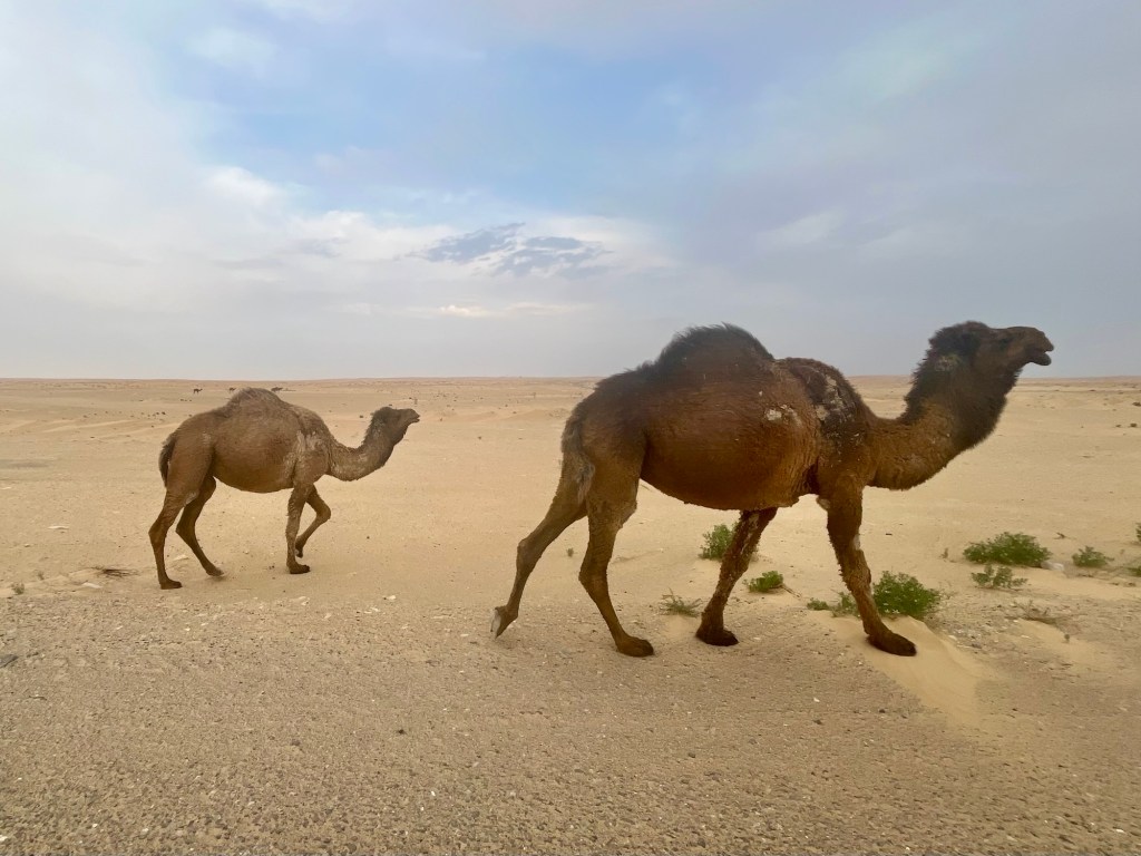
We were told we would see camels, and we did. Early on, they were scattered along the road individually or in pairs.
I had read that the Silk Road caravans of old were made up of Bactrian camels because these two-hump camels could store more water. More humps, more storage. But we saw exclusively Dromedary camels – one-humpers – on our drive across the desert. Perhaps the Bactrian camels are all in service somewhere.
The camel, generally, is uniquely evolved for the desert environment. The camel’s skin and coat, eyes, lips, nostrils, height, body size, foot pads and hump(s), are all adapted to deal with the temperature extremes and aridity of the desert. The Dromedary camel can go 8 to 10 days without water.

Our drivers seemed to make a game out of the drive, weaving back and forth between one another, trading places and lead car, playing chicken with oncoming trucks, and generally speeding along at 80-90 mph!
After about four hours of these shenanigans, we arrived at two of the three craters on our itinerary. To me, they looked like typical Florida sinkholes, except for the fire in the second one, of course.
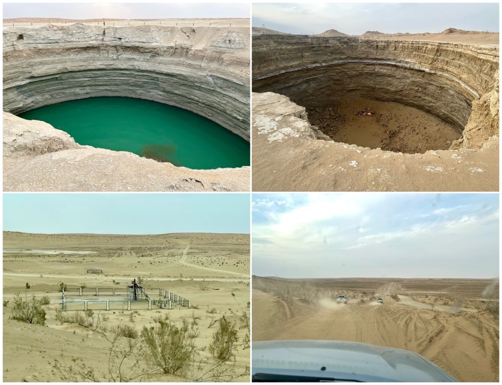
We also passed the occasional gas well, pictured above in the bottom left quadrant. Turkmenistan is rich in natural gas, currently ranking 13th in world production. I guess that’s how they paid for all those marble buildings in Ashgabat.
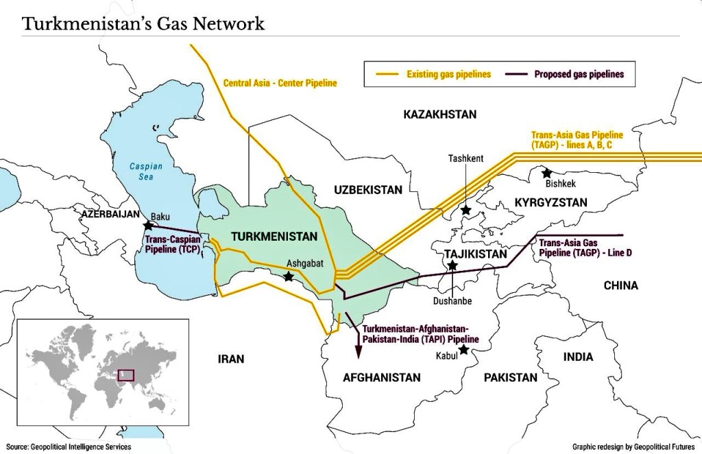
Most of Turkmenistan’s natural gas is exported to China via the pipelines shown below. The main gas fields are in the southeast part of the country where the pipelines start.
On our way to the third crater, the Darvaza gas crater, referred to as the “Gates of Hell” in the travel guides for dramatic effect, we passed a small camel herd.

If reincarnation is real. I do not want to return as one of these guys. Please let me come back as a dog or pelican.
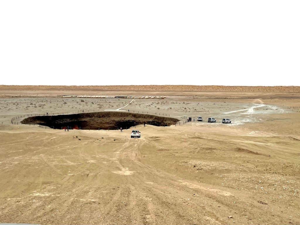
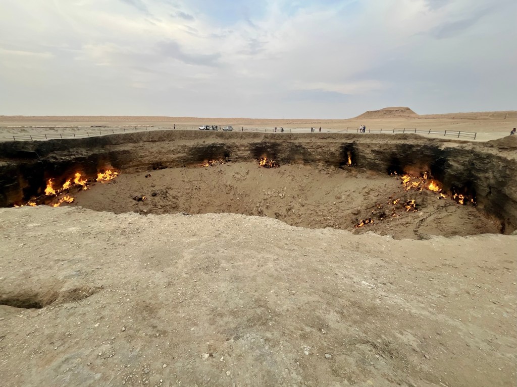
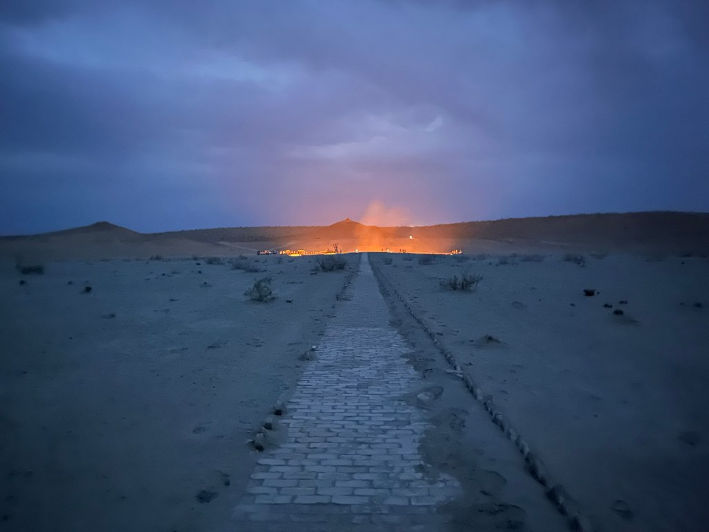
Here’s the view as we arrived at the Darvaza crater, our camp for the night in the background, a village of yurts.
This crater is purportedly a collapsed gas field. It came into existence during the Soviet era and there seems to be a bit of controversy about what caused it. I’ll let Wikipedia explain:
The early years of the crater’s history are still being determined. Relevant records are either absent from the archives, classified, or inaccessible. Some local geologists have claimed that the collapse of a crater happened in the 1960s; it was set on fire in the 1980s to prevent the emission of poisonous gases. Others assert that the site was drilled by Soviet engineers in 1971 as an oil field but collapsed within days, forming the crater, with the engineers choosing to flare the crater to prevent the emission of poisonous gases but underestimating the volume of the gas.
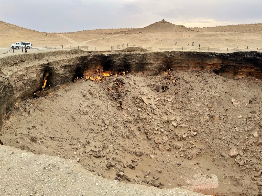
At any rate, the escaping natural gas has been burning constantly for over 40 years with no end in site and no plan to stop it any time soon.
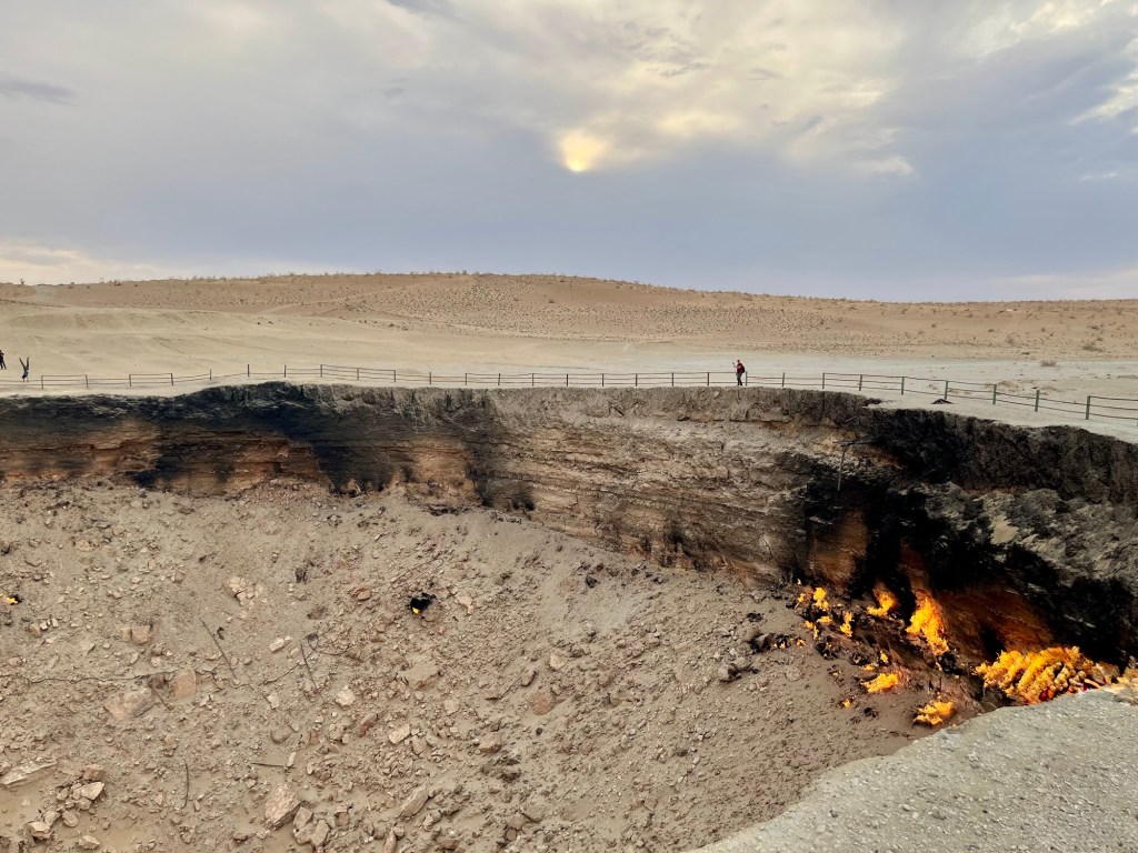
The two photos above are taken from the east side of the crater; the one below is from the west side, looking east.
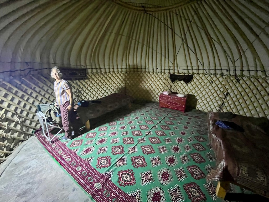
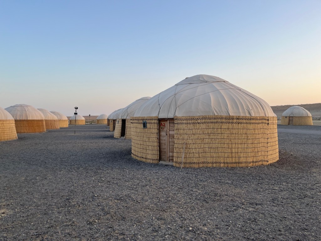
After a short look-see, we drove on down to our camp and checked into our yurt. It proved to be quite comfortable, with the exception of communal toilets outside, about 100 feet away.
After dinner, we walked back up to see the crater burning at night.
Here’s our yurt at sunrise the following morning.
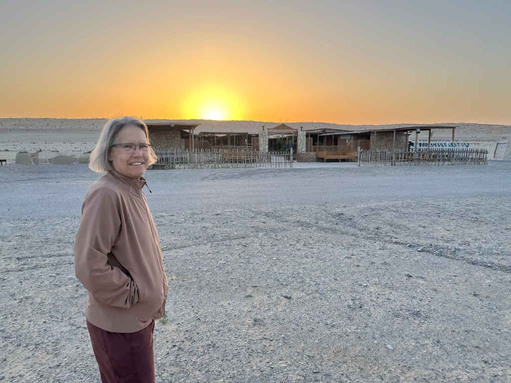
And this is the communal mess hall with the sun peaking above the dunes beyond.
Back on the road for another four hour drive to the Uzbekistan border, we passed several more herds of camels, undeterred by the trucks rumbling past.

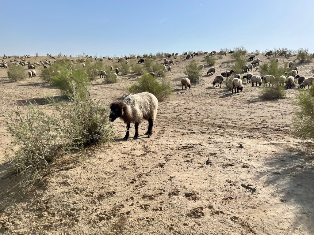
We went off-road for a while, interrupting a shepherd and his flock.
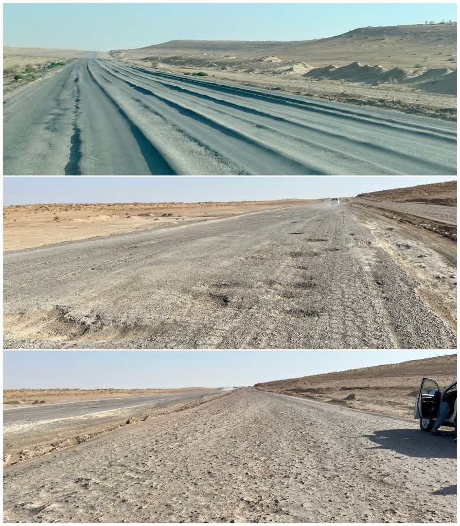
The road across the Karakum is unlike anything I’ve ever driven. In places, the pavement has become ridged as the summer heat melted the asphalt (the pavement can exceed 150° F) and trucks sank into the surface (top photo, below). Elsewhere, potholes were deep enough to destroy a car’s suspension (middle). The best roads were the graded rock ones lacking pavement (bottom). Our guide said most of the pavement, where it existed, is less than eight years old. The elements simply destroy anything built out here.
Imagine doing 80-90 mph on these roads!
We arrived at the Dashoguz-Shavat border crossing in the afternoon and transitted into Uzbekistan for our final stop, the ancient city-state of Khiva.

interesting about Darvaza. If it is like west texas where they burn off the gas a fairly strong Sulphur odor is in the air. Is that the same there? -Allen
Oddly, there was no smell. Perhaps because it’s such an open and windy area.