Early Sunday morning, April 27, we flew over the Caspian Sea from Tashkent, Uzbekistan, to Azerbaijan, arriving in its capital city, Baku, a little before noon. With a population of over 2,000,000, Baku is the biggest city in the Caucuses.
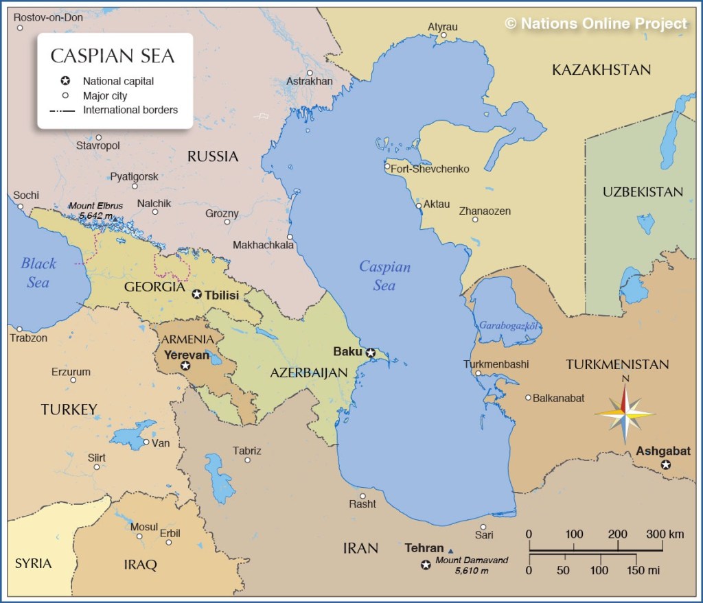
The Caspian Sea today is physically landlocked, although it was once connected to the Black Sea, and through it, to the Mediterranean and Atlantic Ocean beyond.
The Caspian’s legal status as a “sea” or a “lake” has yet to be determined. Resolving that issue is not a trivial matter as it will require agreement of the five countries along its periphery.
And its resolution is significant for the leaders of Turkmenistan and Azerbaijan who hope to construct a pipeline across the Caspian in order to sell Turkmen gas and oil in Europe. They can only do so if they have legal rights to the “seabed.” As a lake, the littoral countries legal rights extend 25 nautical miles from shore; everything else is held in common.

But Russia and Iran, both oil producing countries themselves, have resisted settling the matter, thus undermining the competition, their weaker gas- and oil-producing neighbors.
Below is a broader map of the area. You can see that Azerbaijan and Georgia both share a border with Russia, while Armenia and Azerbaijan share one with Iran.
Azerbaijan and Iran also have a common religion, both being predominantly Shiite Muslim, as compared with the -stans of Central Asia which are Sunni. Georgia and Armenia, on the other hand, are predominantly Christian.
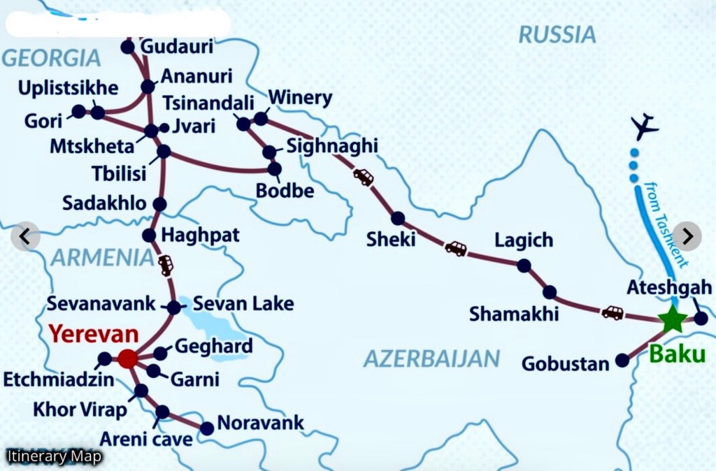
Our tour organizer, Advantour, mixes and matches its various country and city tours to create multi-destination itineraries like the one we’re doing, the Silk Road Essentials tour, the second half of which is 14 days traveling through the South Caucuses countries: Azerbaijan, Georgia and Armenia, in that order.
Here’s our itinerary:
As I implied above, Azerbaijan, like Turkmenistan across the Caspian, is a petro-state, that is, its economy is based on extracting and processing petrochemicals.
In Azerbaijan’s case, that means oil. Commercial oil production here began in 1847, twelve years ahead of the first oil well being drilled in the United States, making Baku home of the first oil producer in the world. By 1900, Azerbaijan was producing more than half the world’s oil.
Today, about 2/3 of Azerbaijan’s oil comes from wells in the adjacent Caspian Sea, most of which is exported by the state oil company, SOCAR, to Europe via a pipeline that transits Georgia and Turkey to the west.
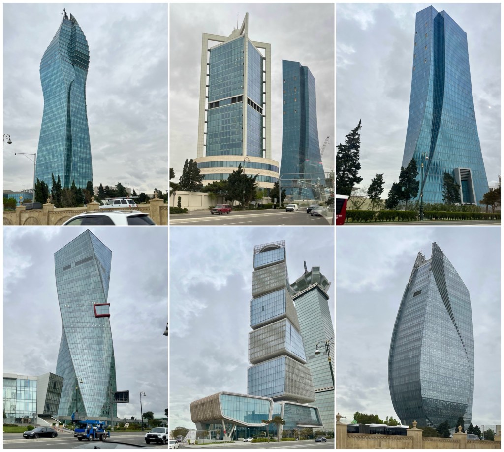
On the drive in from the Baku airport, we passed a number of unusual high-rise buildings on Heydar Aliyev Avenue, most likely funded by oil revenue. At least one of them was, anyway, the SOCAR Tower, owned by the State Oil Company of the Azerbaijan Repubic (top left) and completed in 2016.
We were in Azerbaijan for five days, staying three nights in Baku and one night in Sheki, 2/3 the way across the country on our route to Georgia.
A cold front rolled in the day of our arrival in Baku and as a result the weather was unseasonably cold and rainy, limiting our time outdoors and my ability to take good photographs. Consequently, I’ve combined our entire time in Azerbaijan into this one post.
We started our tour of modern Baku from in front of the Azerbaijan Parliament Building, at the base of the Fairmont Hotel complex, known as the Flame Towers.
From there, we walked down Martyrs’ Lane, a memorial to the civilians killed in Black January, 1990, when Soviet troops put down an independence movement during the waning days of the Soviet Union. Many of those killed were non-protesting, ordinary citizens, victims of circumstance.
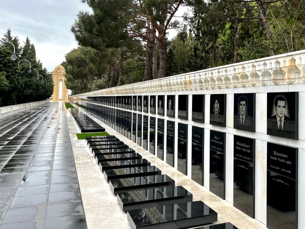
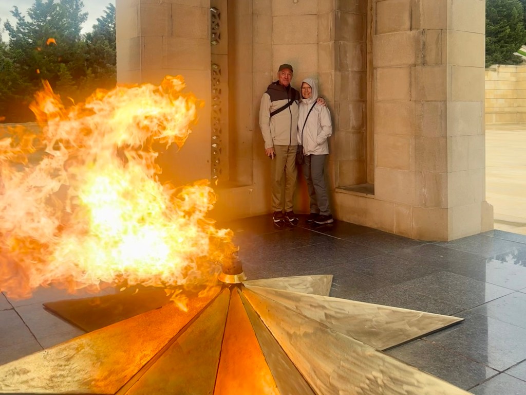
At the end of Martyrs’ Lane is the Shahidlar Monument, also known as the Eternal Flame Memorial. We lingered inside, enjoying the warmth.
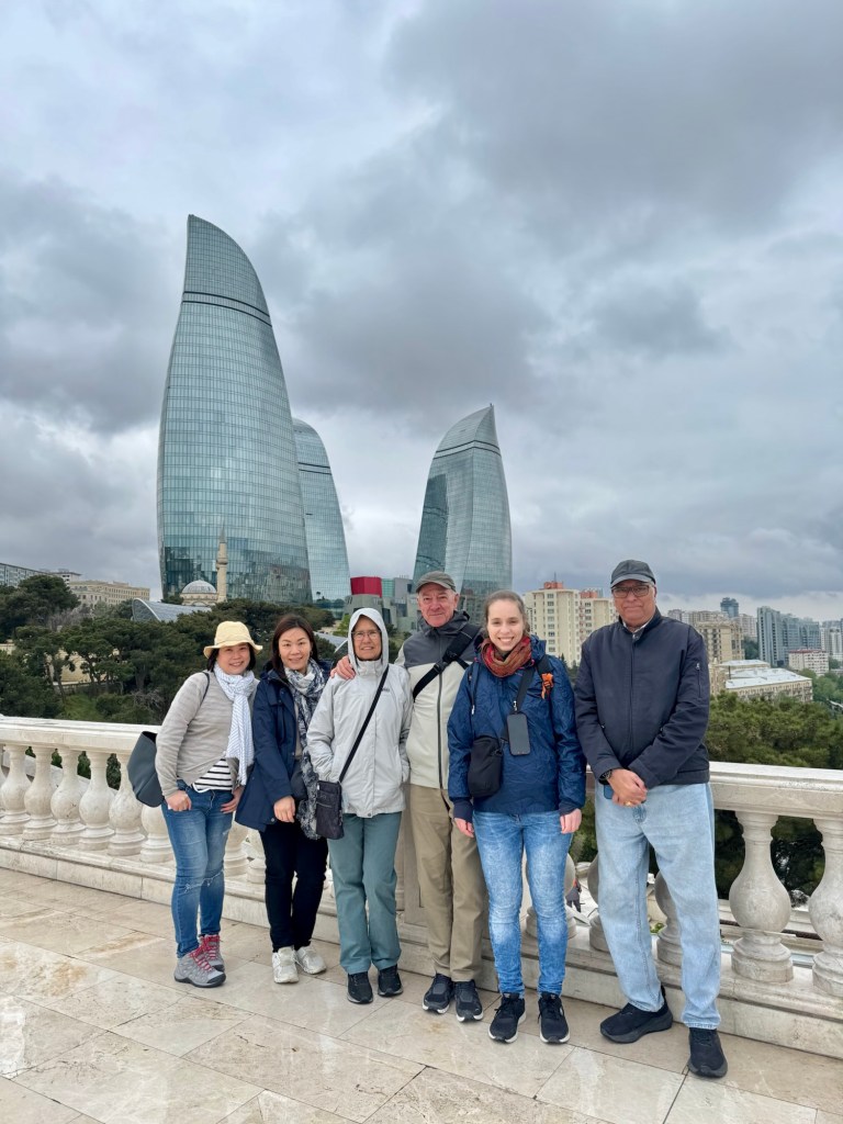
Below is a photo of our traveling companions for the Azerbaijan leg of our travels with the Flame Towers in the background: Karen and Clara, high school friends from Singapore (one now living in Hong Kong); Serena, from Italy; and, Behram, an Indian now living in New Zealand. Like in the -stans, we were the oldest of the bunch.
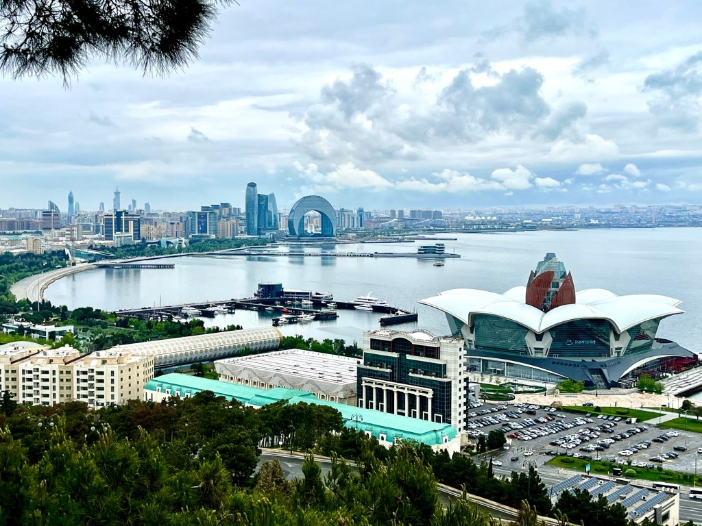
Looking to the northeast from the same place, the Baku Panoramic Viewpoint, is the city skyline, including the upside-down crescent moon hotel still under construction. We are staying at the Radisson Baku, a little to the left of it.
The building in the foreground, right, is the Baku Crystal Hall, built to host the 2012 Eurovision Song Contest. It houses up to 25,000 spectators and is now a concert and sports facility.
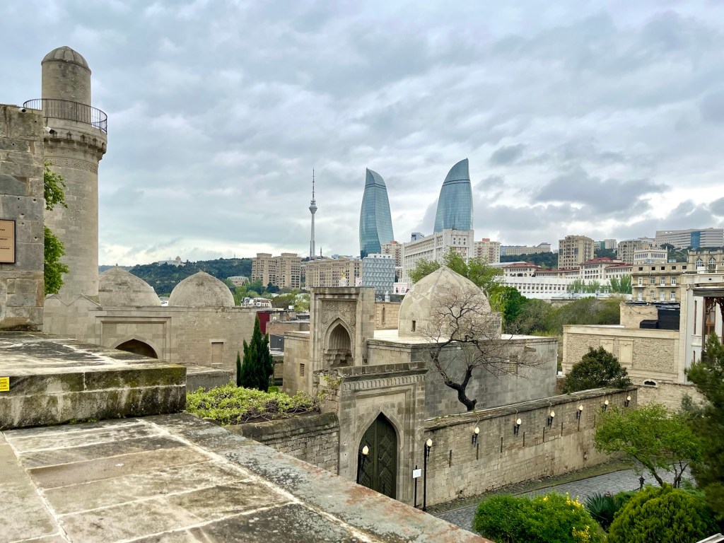
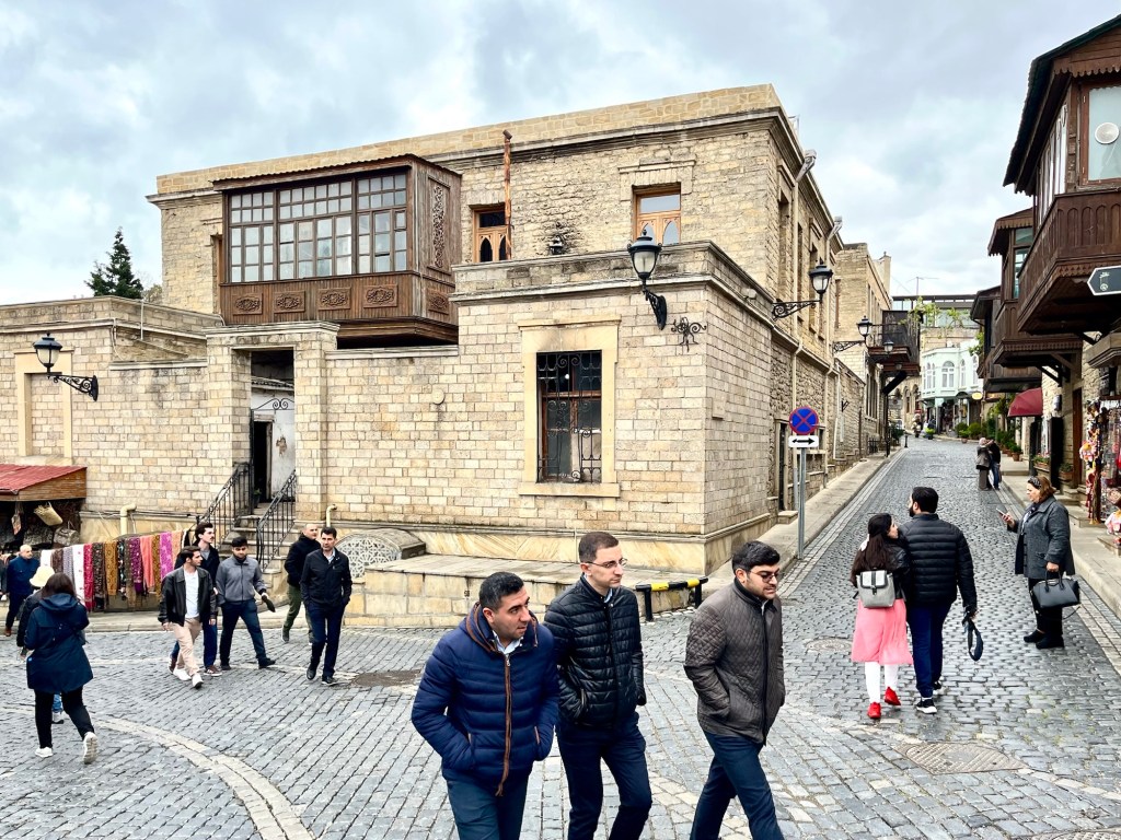
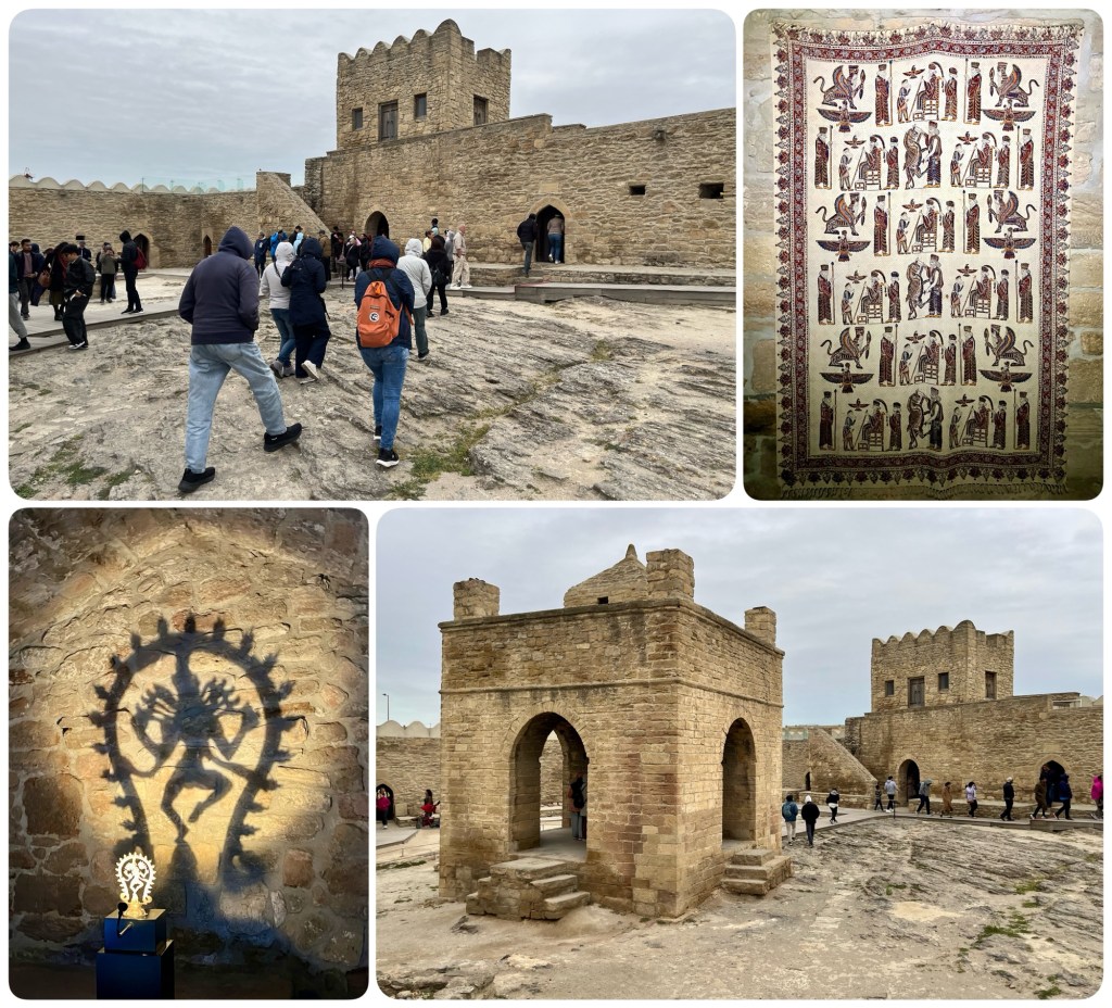
From the viewpoint, we drove to the Old City of Baku, about two miles away. Once there, we spent time wandering around the Shirvanshah Palace.
The Shirvanshahs ruled what is now Azerbaijan for almost 700 years. For most of their reign, which began in 861 AD, the shahs made their capital in the interior at Shamakhi. But between 1382 and 1500 AD, they lived here in Shirvanshah Palace behind the defensive fortress walls they built around the city.
We wandered the streets, looking for a place to get coffee and tea. This is what a typical street in the Old City of Baku looks like:
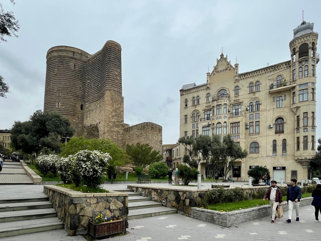
Growing a little weary, Dale and I decided to leave the group and walk back to the hotel while our fellow travelers drove off to visit the Heydar Alyev Cultural Center. As we walked down to the promenade along the waterfront, we passed by the Gyz Galasy, also known as the Maiden Tower, pictured below.
The Maiden Tower is an icon of Baku, built sometime around 1,000 years ago. It is 92 feet tall and encloses a well that is 69 feet deep. Its base is level with the Caspian Sea, some 600 feet away. Since the Caspian is currently 92 feet below sea level, the top of the tower is…. Well, you do the math.
Archaeologists have not been able to determine the main purpose intended to be served by the Maiden Tower, but it is known to have been used as both a stronghold and a lighthouse. Today it’s a museum. Together with the rest of the Old City of Baku, it was added to the UNESCO World Heritage list in 2000.
It was a pleasant mile-long stroll back to the hotel.
One afternoon we drove out to the Abseron Peninsula to visit the Atashgah Fire Temple, about 10 miles to the northeast of downtown Baku.
This Zoroastrian temple was built in the late 1600s at the location of a natural gas vent in the ground by Hindu traders on the Silk Road so that they had a place at which to worship according to the traditions of their ancient faith. The Hindu connection was apparent from the artifacts here, as Behram, our Indian/Kiwi companion, a Zoroastrian himself, helpfully explained.
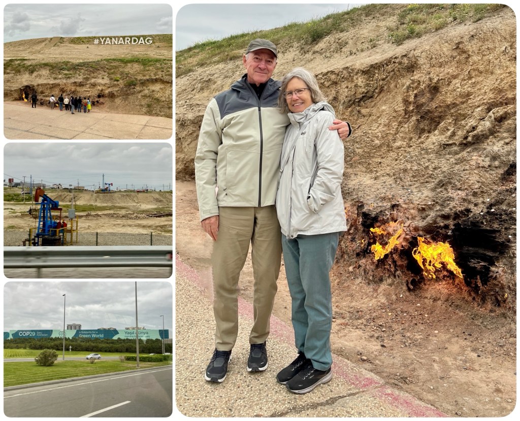
After visiting the Fire Temple, we drove to Yanardag, another natural gas vent, similar to what we saw in Turkmenistan at Darvaza, but on a much smaller scale. Natural gas vents like this are often associated with petroleum, and we did see active oil wells in Baku as we drove around, like those in the photo below (left, center).
I found it quite ironic that the most recent annual UNFCCC climate conference, known as COP29, was held here in Baku, the capital of a country that relies on the production of fossil fuels to fund its government and economy (photo below, bottom left).
It’s hard to believe that this charade of jetting bureaucrats and politicians around the world every year to jawbone about “saving the planet” has been going on for 29 years. Cui bono.
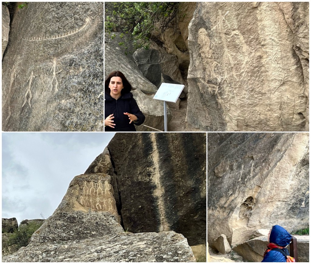
Earlier that afternoon, we drove about 25 miles out of town to the southwest to see the petroglyphs at Gobustan State Historical and Cultural Reserve (that’s our guide in Azerbaijan, Elnara, top right in the photo, below).
This rock art dates back to the Mesolithic era, the middle part of the Stone Age, around 8000 BC. It’s a curious thing that Stone Age people all over the world made these things. We’ve seen them now on several continents and they generally resemble one another. Baffling. I guess people gonna people wherever and whenever they are.
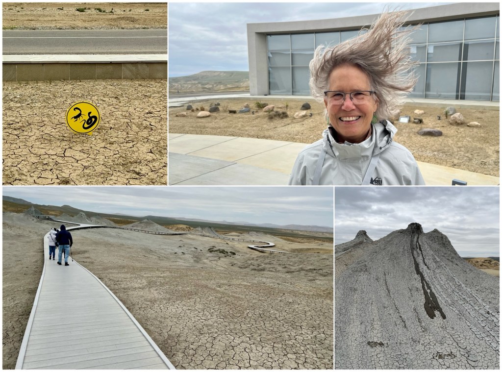
From Gobustan, we drove inland to see the mud volcanos. Baku is known as the “City of Wind.” It became apparent on the day of our visit why it’s called that. The wind was blowing so hard it was difficult to stay on the boardwalk.
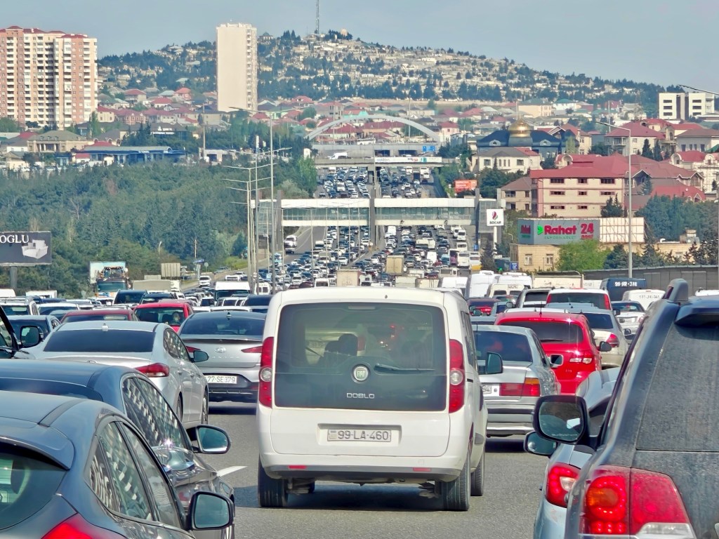
The morning we left Baku, Wednesday, April 30, the congestion was awful. Five lanes in each direction, bumper-to-bumper both ways. A typical weekday morning, said our driver.
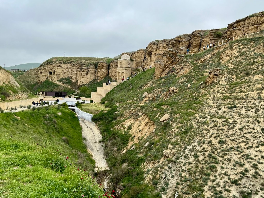
On the drive to Sheki, where we would be spending the night, we stopped briefly at the Diri Baba Mausoleum near Maraza, built into a cliff face in the 1400s AD.
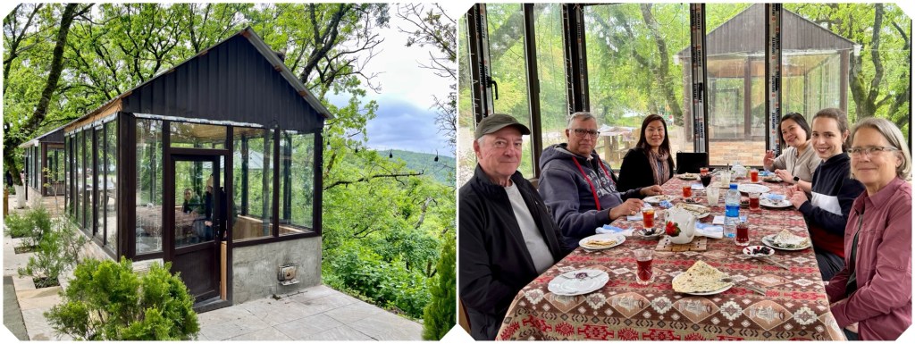
Our next stop was near Akhsu (Agsu) for lunch at this roadside cafe, heated by a wood fire and quite toasty inside.
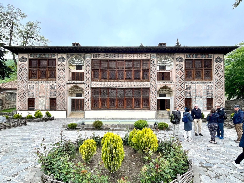
In Sheki, we visited the Palace of Sheki Khans, built in the late 1700s AD and designated a UNESCO World Heritage Site in 2019. It was quite impressive inside, but no photography was allowed.
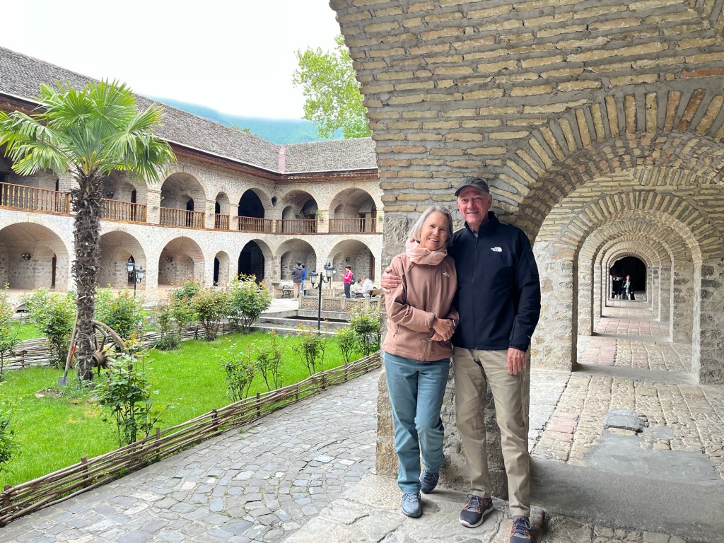
We walked down the hill to visit the restored caravanserai in Sheki, now a hotel. We spent the night at the Sheki Palace hotel, leaving our Italian companion, Serena, there. Her trip was over.
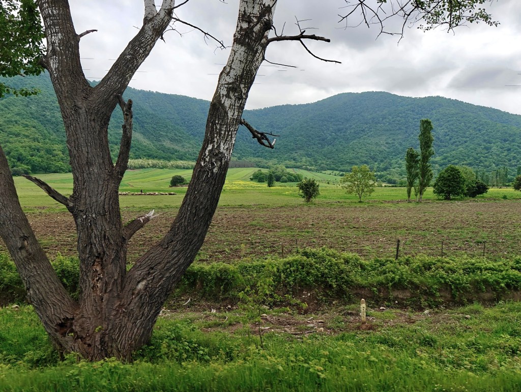
The next morning, after a visit to the local bazaar, the rest of us continued our drive to the Georgian border through a beautiful countryside.
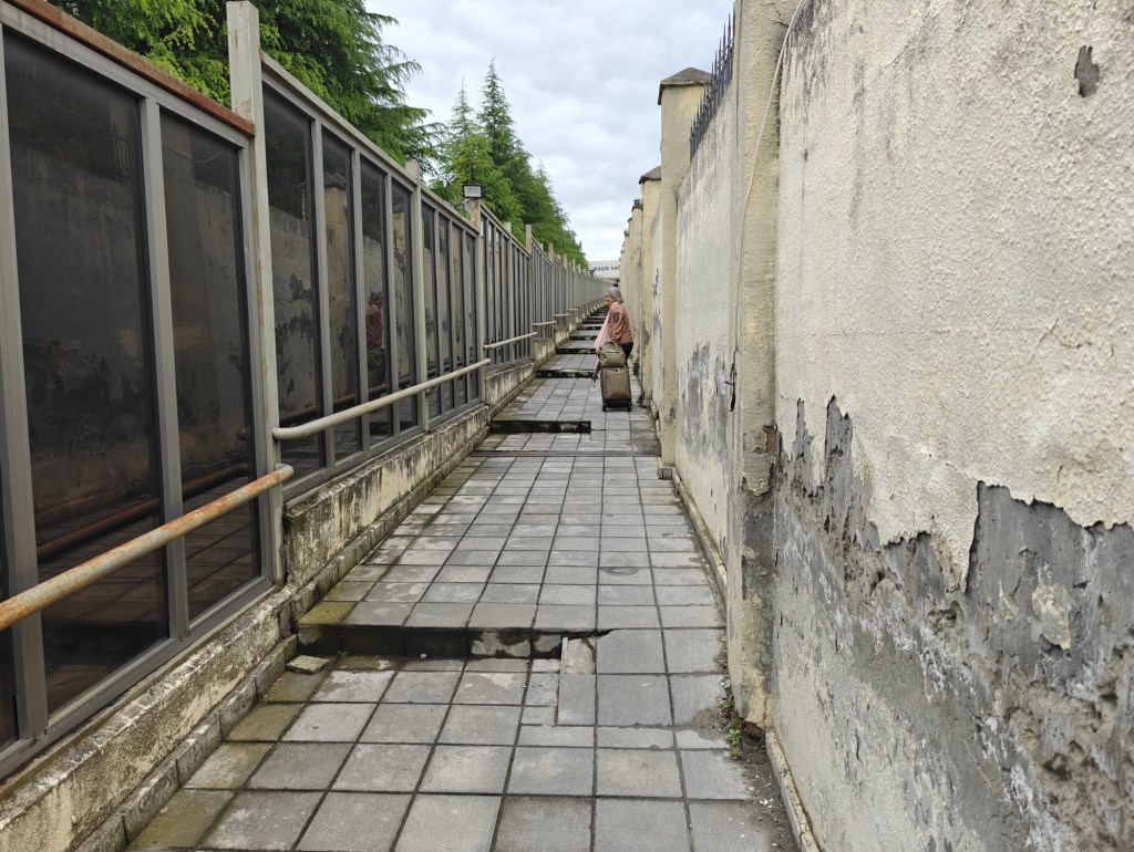
We reached the Mazymchay-Lagodekhi border crossing from Azerbaijan into Georgia a little after noon on Thursday, May 1, and lugged our bags about half a mile across No-Man’s-Land and into Georgia where we were met by our next guide, Irakli.
The weather was finally beginning to improve.
