The forecast for this Memorial Day weekend on Vancouver Island is warm and sunny, in the high 70s. Of course, Memorial Day finds its origins in the American Civil War, so it’s not an observed holiday here in Canada; lucky for us, since that means it won’t be a busy holiday weekend. With temperatures expected to rise throughout the day, we got a relatively early start on our hike around Elk Falls Provincial Park.
The Campbell River runs from the mountains through Elk Falls Park, but the water is held back on the way by three dams, the last of which, at John Hart Lake, is – you guessed it – the John Hart Dam and Spillway. The hydropower station that is fed from this system was built in 1947. It generates 126 megawatts of electricity, enough to power 80,000 homes, which is more than what exists in the nearby city of Campbell River. Due to safety concerns, the whole system is in the process of being rebuilt and replaced at a cost of approximately $1.35 Billion (CAD). All of this was unknown to us before we arrived at the trailhead this morning.
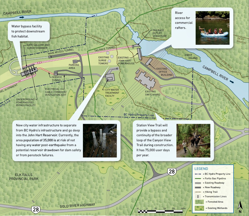
Here’s an excerpt of the project map that also shows the location of Elk Falls and some of the trail we hiked:

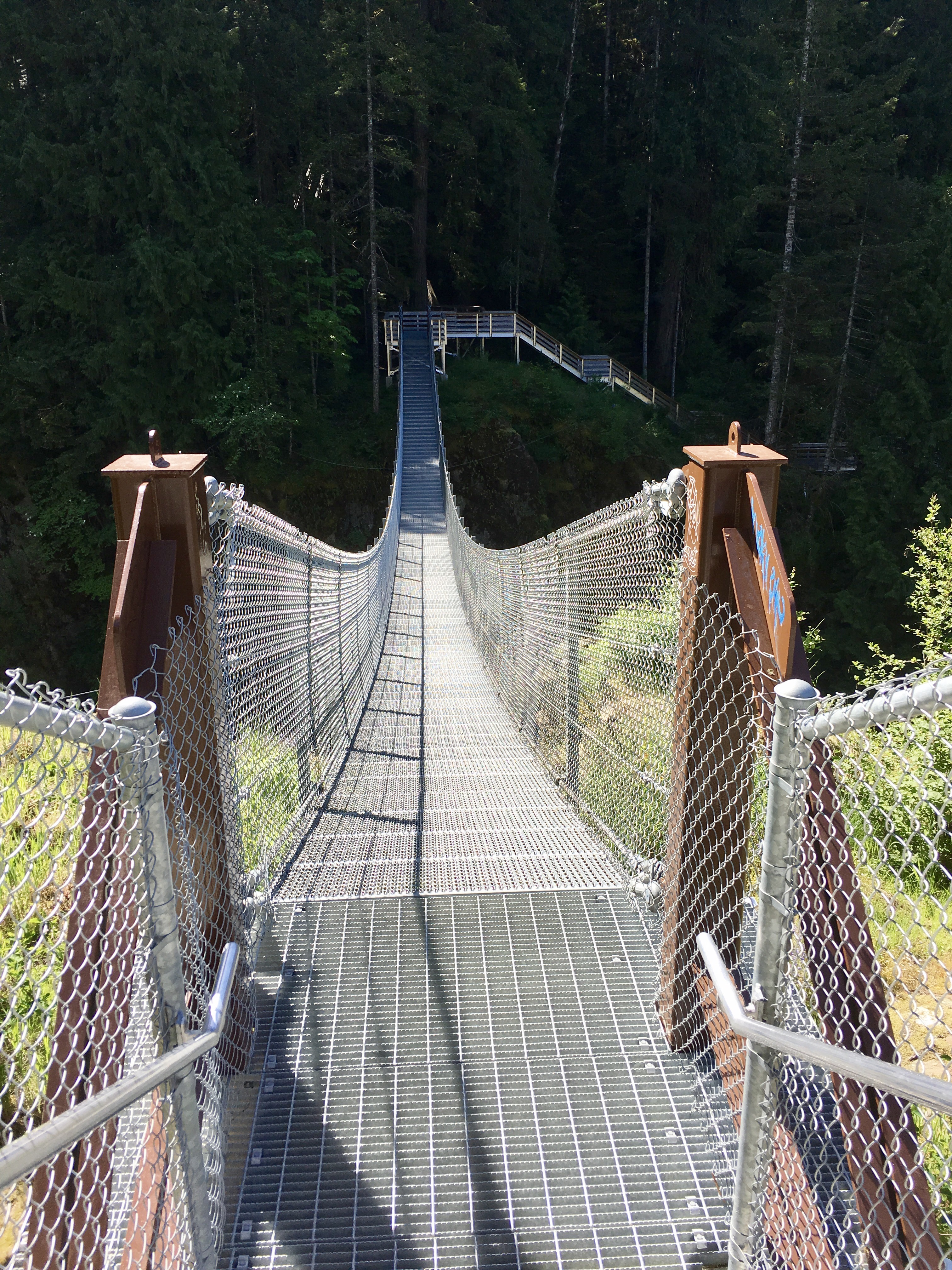
The original, existing hydroelectric generators are fed by three 10-foot diameter, above-ground pipes, located in the “Existing Penstock Corridor” on the map, above. We had to cross over them from the parking lot to get to the new pedestrian suspension bridge and its Elk Falls viewpoint.
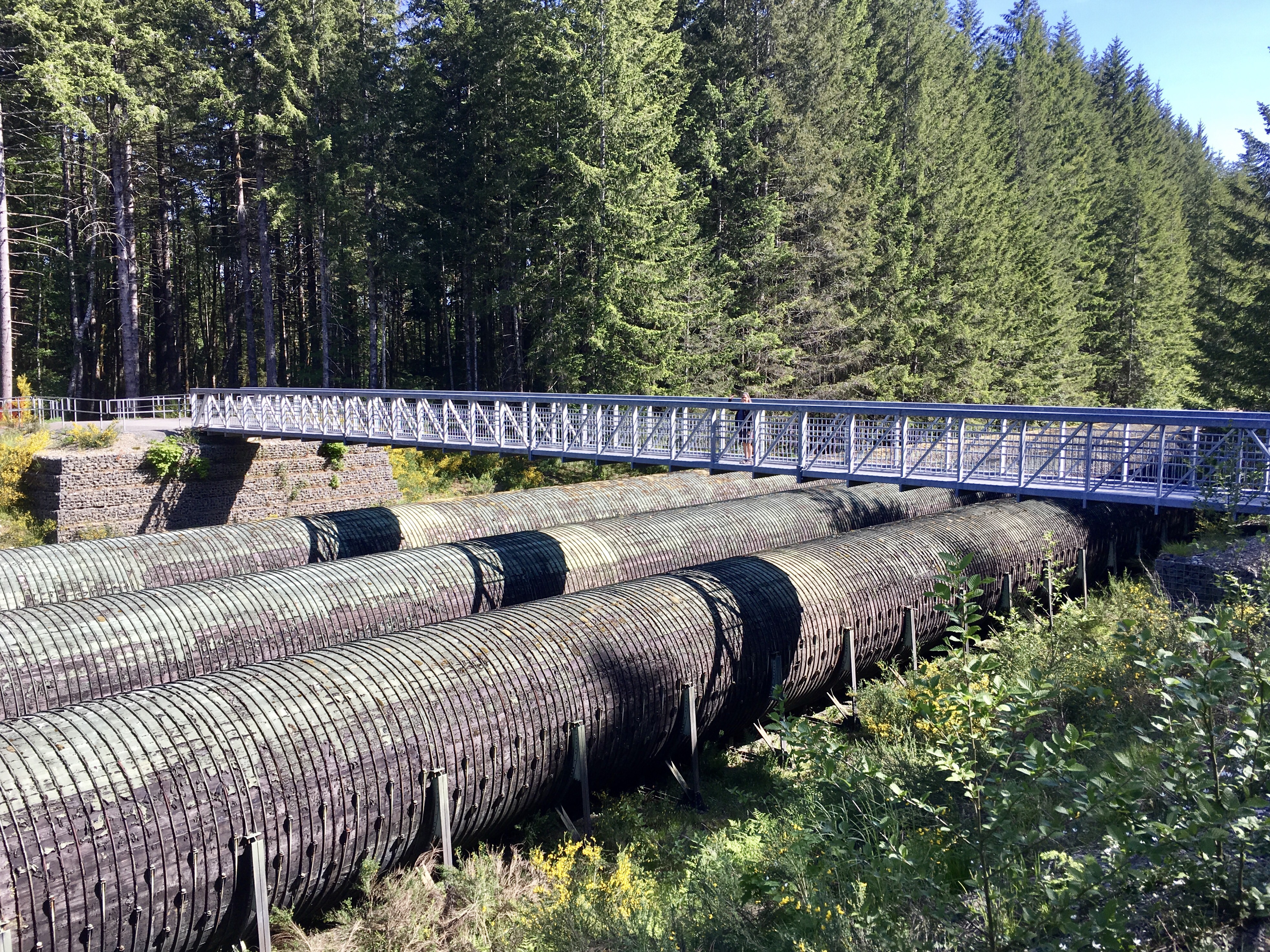
Take a look at those pipes for a minute. They go on for about a mile. And, they are built out of wood! WOOD! Can you believe that! And they are constantly full of flowing water that feeds the turbines downstream and have been since 1947!
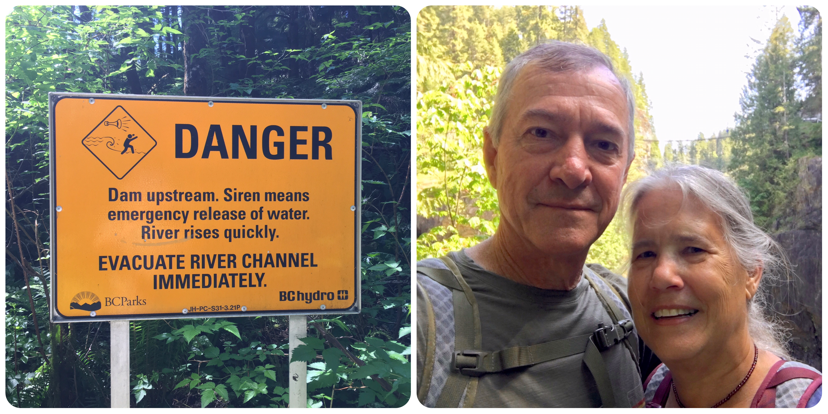
They are also the reason for the current replacement project. The concern is earthquake damage. In 1946, there was an earthquake that measured 7.3 on the Richter Scale, the strongest in Canada’s recorded history. The epicenter was about 30 miles away. Even a lesser quake would have the potential to damage the above-ground pipes in their current condition, thus potentially turning off the lights to all of the northern half of Vancouver Island! So, the pipes are being replaced with a 25-foot diameter underground tunnel that will feed a new turbine generator. The tunnel, which is currently being drilled, is shown in pink in the above project map.
But the existing dam and spillway will be retained and the Campbell River will still flow over Elk Falls. I suspect that as a public relations gesture, BC Hydro, the public utility undertaking the project, funded the new suspension bridge, parking lot and trail improvements. At any rate, today we were the beneficiaries of BC Hydro’s largesse.
Here’s the view from the Elk Falls viewpoint looking back at the suspension bridge (after we had crossed it)…
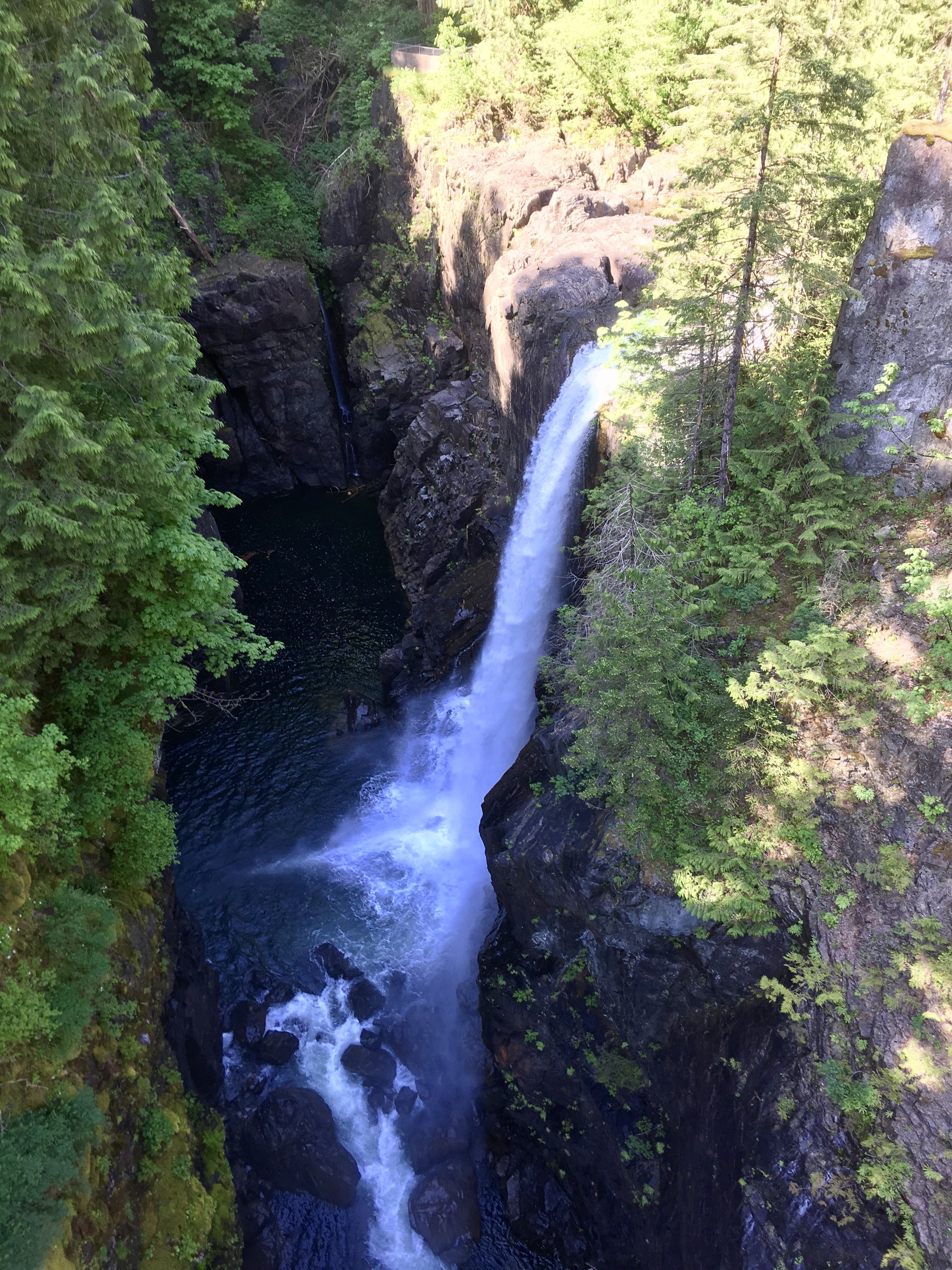
… and down at Elk Falls, with its 75-foot drop:
We hiked about three miles; first, through old growth forest:
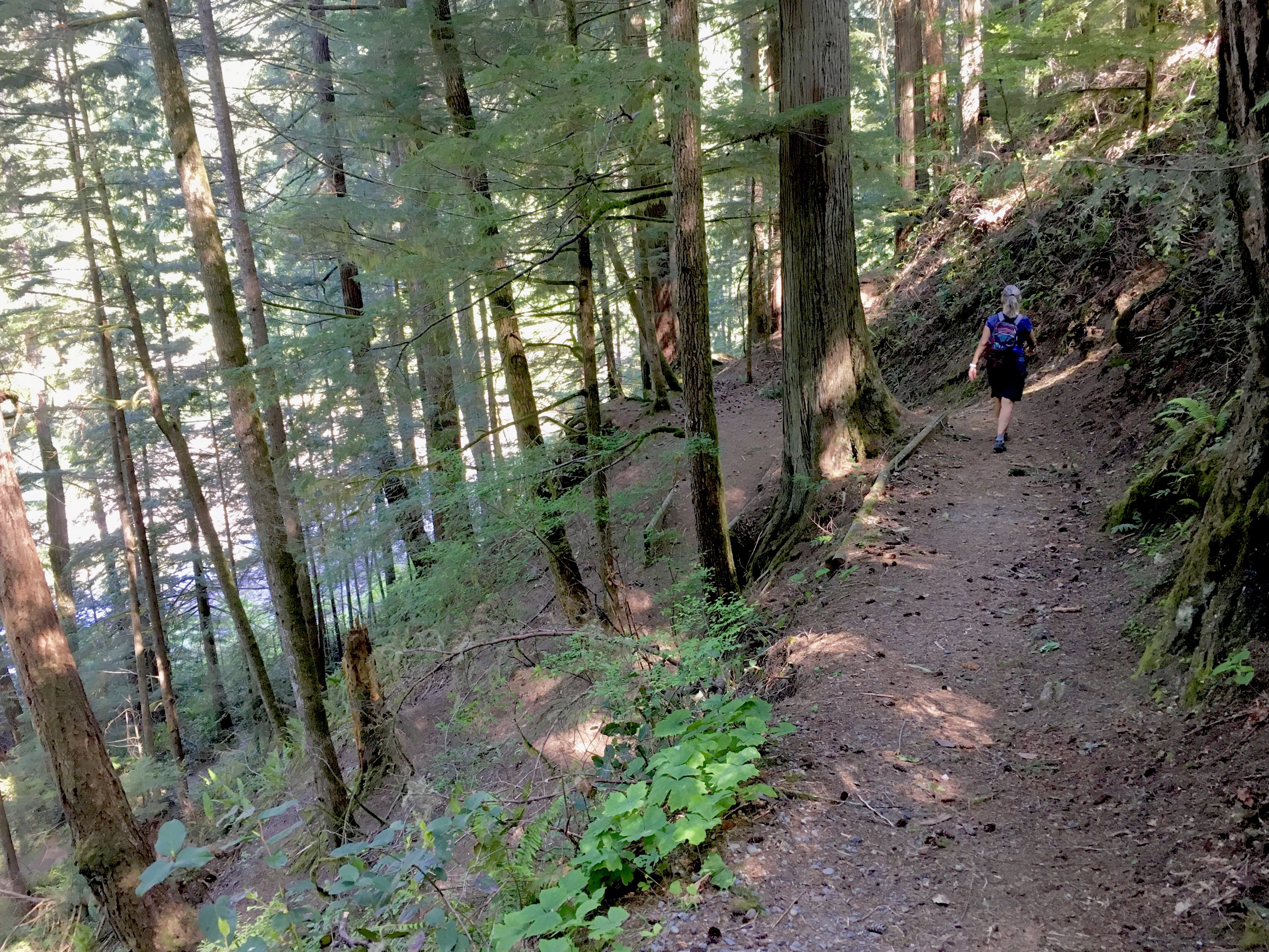
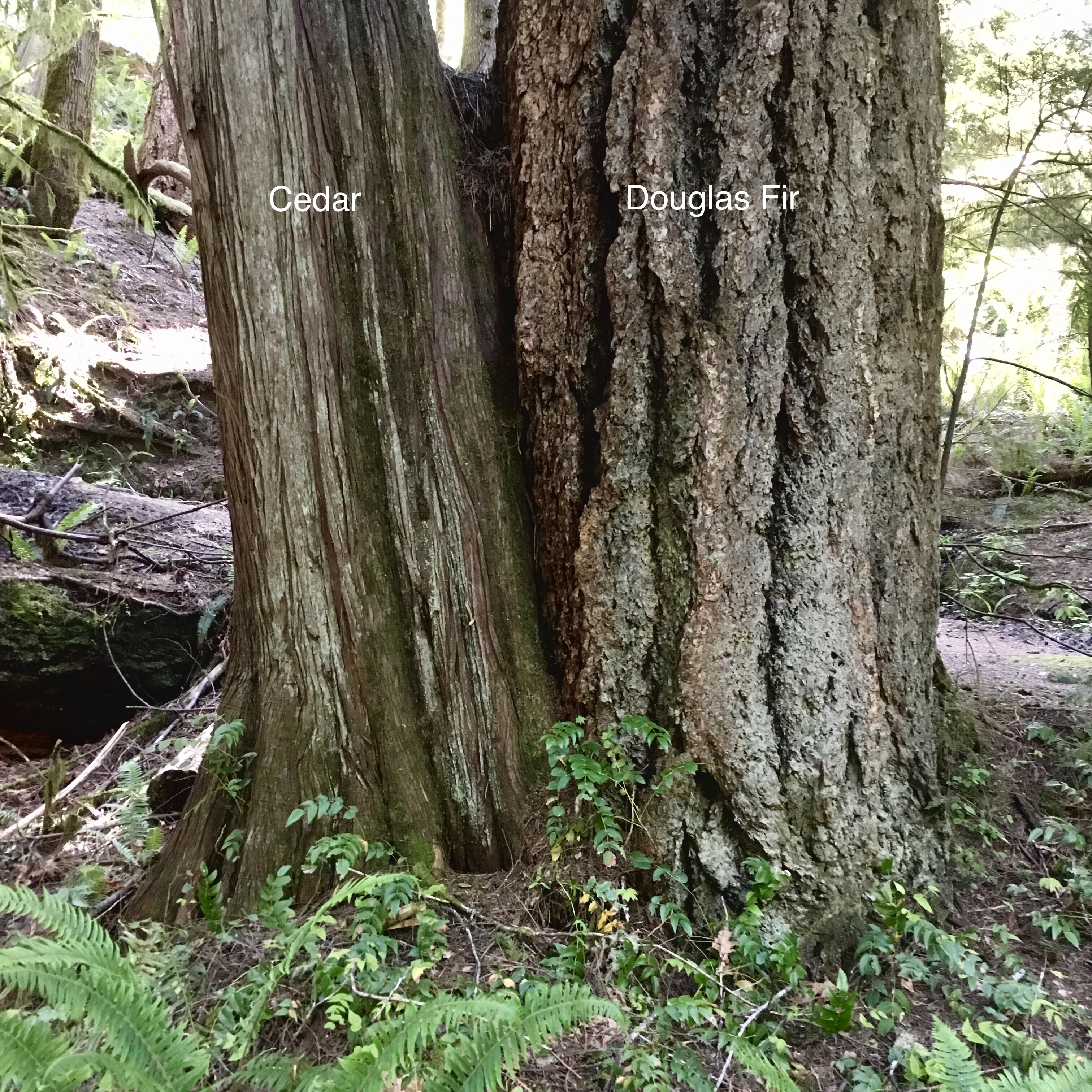
The forest is a mixture of fir and cedar, struggling for domination.
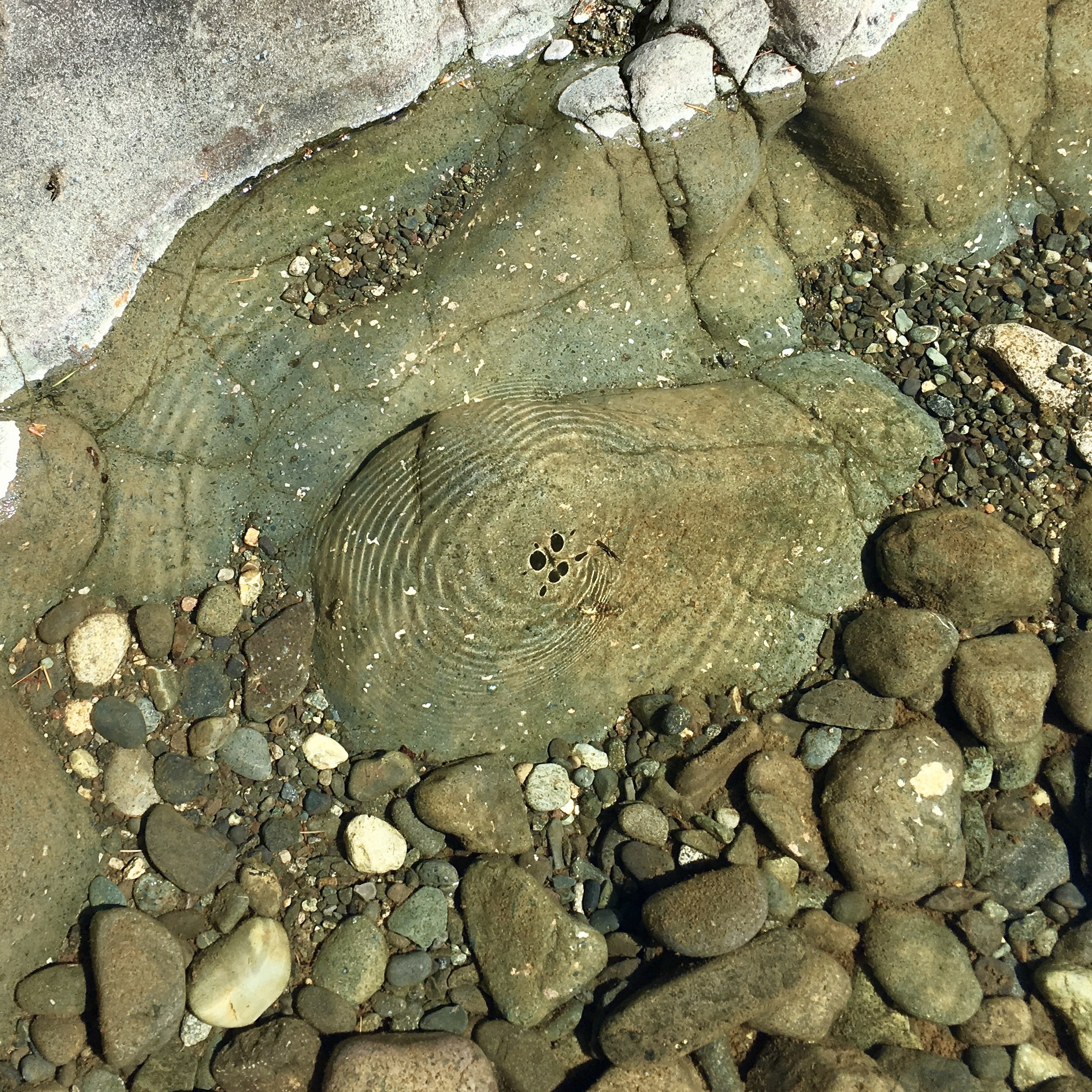
We descended to the river. It was amazingly clear:

We were amused by the waterbugs dancing on the river’s surface, making alien shadows on the rocks, below.
We looked up at the suspension bridge and were surprised at how high it was above the river.
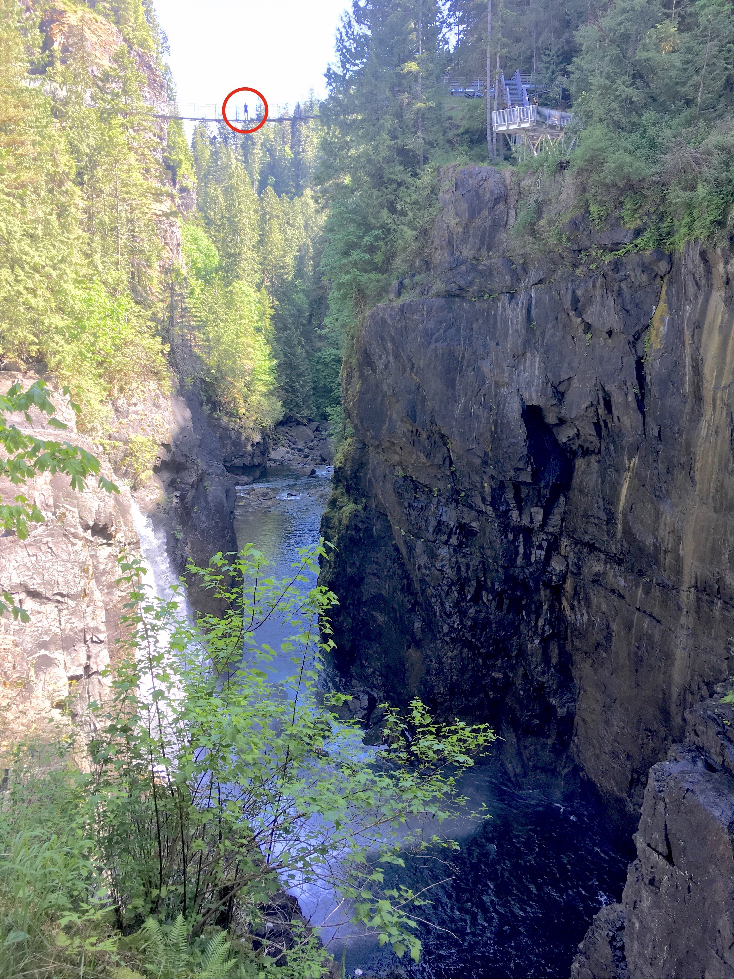
But we decided not to linger in harm’s way at the bottom.
We ultimately made our way downstream to see the hydroelectric generator and the terminus of the existing pipes that feed it (you can see them at the lower right-hand side).
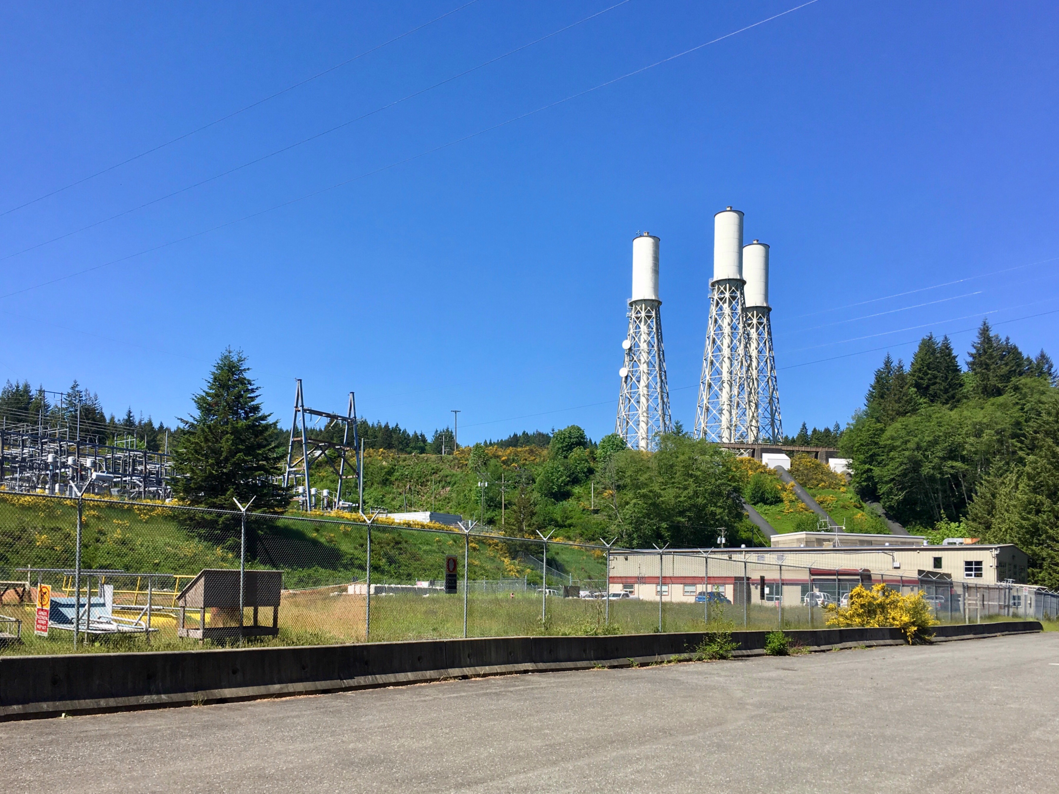
Here’s that end of the project drawing. The whole operation is designed to keep the existing system in operation until the new one becomes operational. Pretty amazing.

very impressive especially the wooden pipes.
Jörg
LikeLiked by 1 person