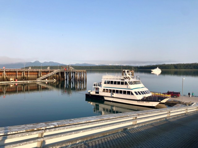
Our 3-night reservation at Glacier Bay Lodge included an all-day, 150-mile boat ride from the dock at Bartlett Cove, north to the far end of Glacier Bay. We walked down to the dock early Monday morning, arriving about 6:30 a.m., the sun had already been up for 2 hours. This time of year at such high latitude the days are 17 hours long with the sun rising around 4:30 a.m. and setting at 9:30 p.m. But accounting for twilight, true darkness lasts for only 3 hours, 11:30 p.m. to 2:30 a.m.
In 1794, when Vancouver passed through here, all of Glacier Bay was covered by glacier and a solid wall of ice faced the intrepid explorer here from where I took the photo, above, covering and hiding all of what is now known as the Beardslee Islands, Bartlett Cove and Glacier Bay Lodge. I have posted a map of Glacier Bay at the bottom of this post so you can follow our route. The map shows the chronology of the advance and retreat of the glaciers in the bay.
The first stop on our cruise was South Marble Island to see the wildlife: sea lions lounging on the rocks, gulls nested on the adjacent cliff, and puffins and murre lazily floating and fishing in the calm waters. It was an idyllic and serene place,…

… but we soon left it in our wake.
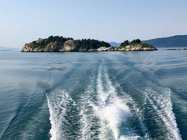
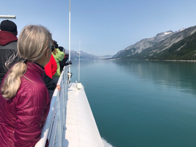
We continued north at 25 mph, detouring briefly into Tidal Inlet, from which I took this photo looking back to the south:

We continued north to Gloomy Knob, just beyond the glacial line of retreat in the 1860s. Our fellow passengers scoured the rock face of Gloomy Knob looking for mountain goats.

It took a while, but one was finally spotted about halfway up the 1,330′ face. You can just make him out (that little white thing) on the enlargement to the right, below:

We watched our mountain goat for about 15 minutes as he edged along the rocks foraging. How these animals are able to so easily range this terrain is beyond my comprehension. We edged along to the north, continuing to look, spotting only one more goat and a nearby eagle. The Park Ranger on board said that eagles will attack younger mountain goats in an effort to dislodge them from the cliff face, in order to feed on the carrion.
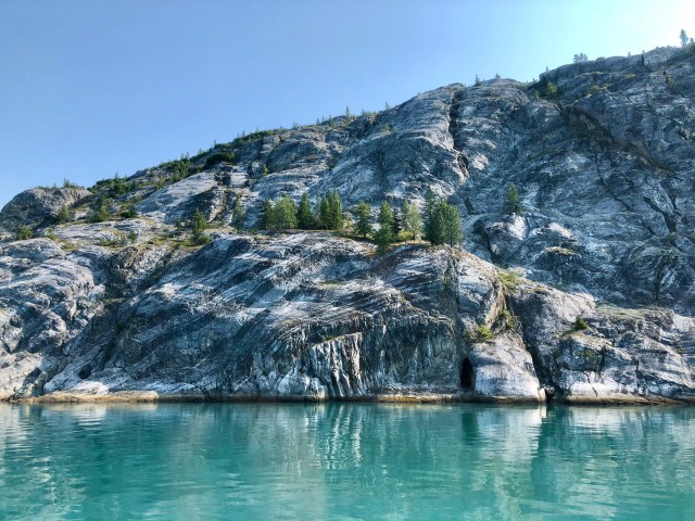
I was just as interested in the rock face itself. In the next picture you can see diagonal striations in the rock running from the bottom left to the top right. But if you look closely, you’ll also see that the rock has grooves ground into it running from the top left to the bottom right – these are the scars left by the glacier’s passage.
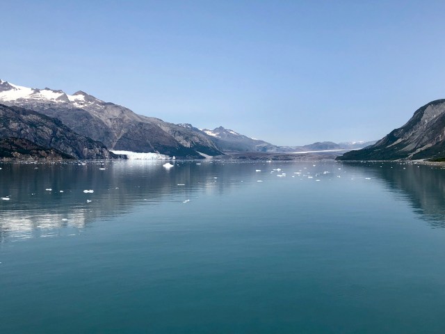
Another 10 miles north, we reached Composite Island, beyond which we could look up Tendu Inlet on the left and Queen Inlet on the right.
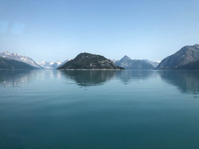
We continued north another yet another 10 miles or so, passing to starboard of Russell Island to enter Tarr Inlet.
After Vancouver’s visit in 1794, only one other known non-native visited this area prior to 1879 when John Muir (1838-1914), the famous naturalist, writer and conservation activist, came exploring with an American missionary friend and four Indian guides in a red cedar, dugout canoe. Russell Island was as far north as Muir and his companions were able to travel, the glacier forming a solid line here then across Glacier Bay.
Muir’s account of his explorations and reminiscences in Letters from Alaska, a compilation of columns he wrote for a San Francisco newspaper, documenting his journeys of 1879 and 1880, is a joy to read. I am particularly fond of his poetic description of southeastern Alaska as he headed up the Inside Passage:
I never before had scenery before me so hopelessly, over-abundantly beautiful of description. This enchanted land of lake and fiord, forest and waterfall, mountain and island, begins to appear in full force just below the Bay, and ends far north if it ends at all. It seems as if surely, following this shining way, we should finally reach heaven. What can the heart of man conceive more divine? (Id. at 9)
We continued up Tarr Inlet to its terminus at the face of the Grand Pacific Glacier which currently sits just south of the Canadian border. In 1925, the face of the Grand Pacific Glacier was several miles further north in Canada. It is obvious that this glacier, like many others in Glacier Bay N.P., has since advanced, proof – to me anyway – that there are forces at work in nature since time immemorial that counteract and may even override any effect of anthropogenic increase in greenhouse gases.
Take a good look at the photo, below. To the left is Margerie Glacier and just to its right, focus on the white spot – that’s a cruise ship!
As we approached, the cruise ship departed.

We had traveled 70 miles to get to see Margerie Glacier, her face one mile across as she tumbles 21 miles down the Fairweather Mountains to tidewater. We had seen several glaciers on our trip to this part of Alaska, but this was the first that had reached all the way down from the mountains to tidal saltwater.

As we watched in wonder, the glacier calved, tons of ice crashing into the bay as the crack of the break reverberated across the water. Too slow, I was only able to photograph the lingering mist above the drop.
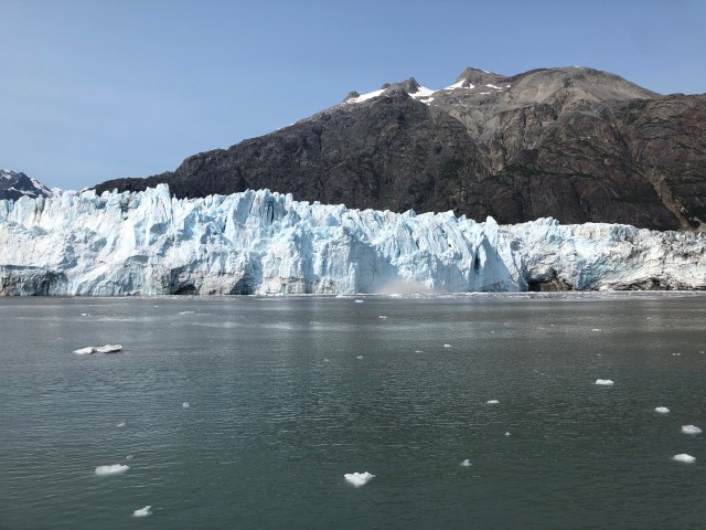
The rebounding wake from the splash did little to disturb the harbor seal napping on the growler ice in front of us.

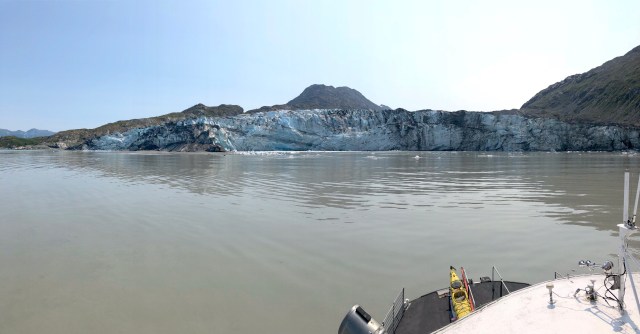
After spending about half an hour admiring Margerie Glacier, we then began our journey south back to Bartlett Cove, first detouring up John Hopkins Inlet to its glacier, then retracing our steps to stop in front of Lamplugh Glacier, the calving of which drops growlers and bergs into the shallow sediment before it, stirring up silt and giving the water a muddy appearance. [Note the kayak carried on our bow; more on that in a moment.]
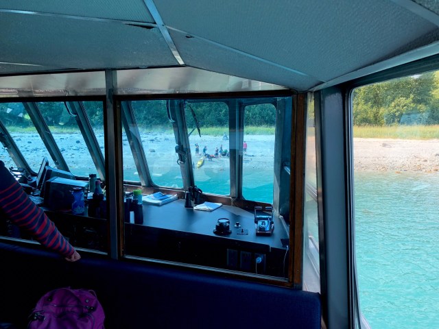
We continued south past Reid Inlet, then stopped to peer through our binoculars at the shore where a group of kayakers had set up camp. To the left – and apparently unbeknownst to them – was a Grizzly Bear, feeding in a nearby berry patch!
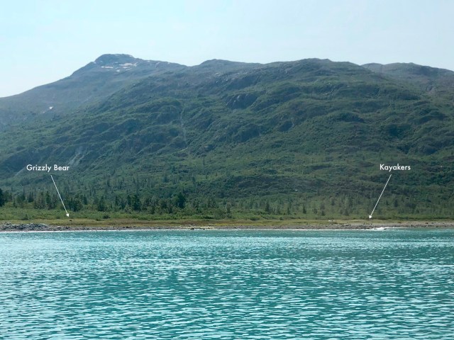
Seated in front of us in the boat was the young couple whose kayak sat on our bow. They made a verbal note to avoid this campground. Twenty minutes later, just past Gilbert Peninsula, the bow of our boat bumped against shore near Hugh Miller Inlet to drop these folks and others off for an overnight adventure.
We continued to Bartlett Cove, passing to starboard of Drake and Willoughby Islands, and arriving back at dock at 3:30 p.m.

Tomorrow we’ll be kayaking in Bartlett Cove. We couldn’t have asked for better weather!

Enjoyed your photos & comments…My wife & I sailed on a cruise to the Margerie Glacier – amazing to watch. Also, having visited Elfin Cove on 2 occasions, seeing the Fairweather Mountains peaks from the water is an unforgettable & beautiful sight. Safe travels.
LikeLiked by 1 person
Thank you, ands thanks for reading and commenting.
LikeLike