The house we’re staying in is about 2 miles from the Kīlauea Caldera in the Volcano National Park. The volcano has erupted as recently as 1982!
Here’s an aerial photograph to give you a little perspective on how close we are (the blue dot is us):

The Hawaiian Islands are volcanic islands. As fissures have opened under the Pacific Ocean, lava has spilled out and up, forming the islands. As they have formed, the islands have appeared to move to the northwest.
The Big Island of Hawaii, where we are now, being the southeastern-most island, is the youngest of the Hawaiian islands. This island was actually formed from five volcanoes that have merged into each other. The oldest of the six volcanoes is in the northwest part of the island: Kohala, which last erupted 60,000 years ago. Moving to the southeast, the next volcano is Mauna Kea, which erupted 4,600 years in the past. The other three have all erupted in the last 250 years: Hualālai (1801); Mauna Loa (1984); and, where we are, Kīlauea (1983). There is a sixth volcano under the ocean, to the southeast, that is actively enlarging the island in that direction.
We drove into Volcano N.P. from the north and first stopped on the north rim of the outer crater:
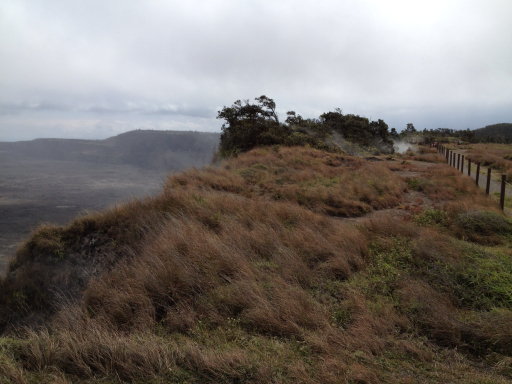
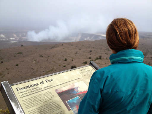
That’s the active part of the volcano out there in the distance, but everything you see in the photo, below, is part of the Kīlauea Caldera.
A caldera is formed when the liquid magma reservoir below the surface suddenly evacuates, leaving a void in the earth so that the surface collapses. Sometimes the cause of the magma disappearing from below the surface is a volcanic eruption, like Mount St. Helen in Washington, or in the movie, Dante’s Peak (that we watched last night); other times, such as in the case of Kīlauea, the magma flows out through “lava tubes” below the surface, running downhill in tremendous lava flows.
The Kīlauea Caldera was formed only 500 years ago with the surface collapsing 2,000 feet from an original elevation of 4,000 feet above sea level!

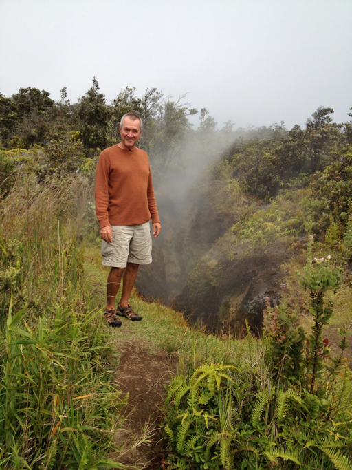
At any rate, up here on the outer rim of the Kīlauea Caldera, it’s an eerie world as rainwater seeps down through cracks in the rock and is instantly turned into steam, which you can see behind Dale in this picture:

We decided to explore the rim, walking along the crater rim trail to look at the steam vents. The Park Service warned us to be careful.
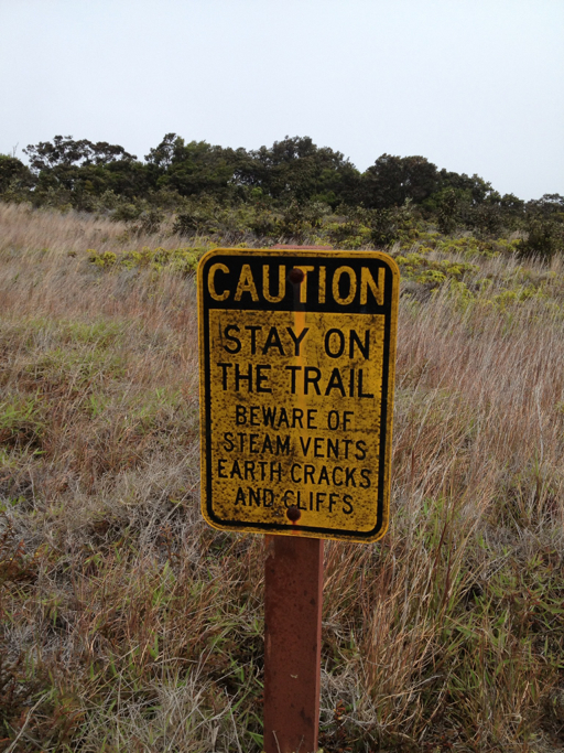
EARTH CRACKS!?!
CLIFFS!!!
VOLCANIC FUMES!?!
Undeterred, we forged ahead.

I was holding my breath.
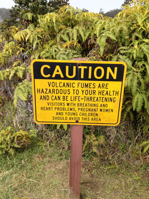
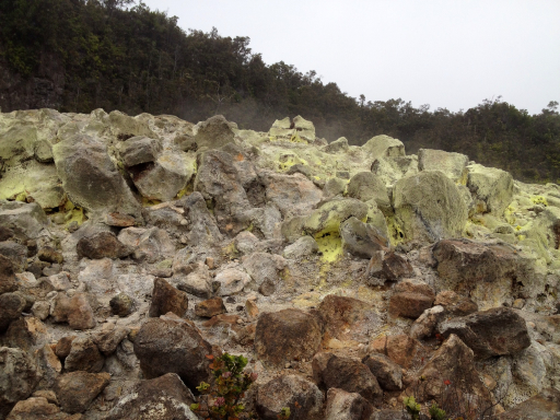
A little further away from the rim, we came to an area where sulfur dioxide and hydrogen sulfide fumes were rising from below the earth. As these volcanic gases escape into the atmosphere, they mix, releasing steam and creating pure sulphur which condenses on the upper rocks in a yellowish crust.
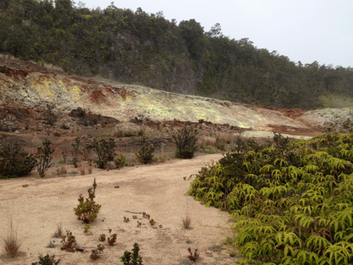
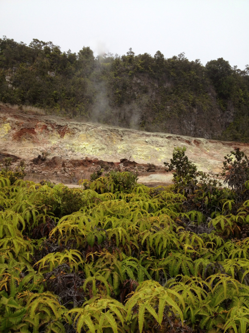

The native Hawaiians call this kūkaepele, the waste of Pele (Pele is the volcano god; I have a pretty good idea what “kūkae” is). It smells like rotten eggs.
After the sulphur banks and the steam vents, we walked back to the car (the “You Are Here” in the map, below), then drove further along the crater rim road to the west to the Halema’uma’u Crater overlook. By the way, the map is upside down: north is at the bottom.
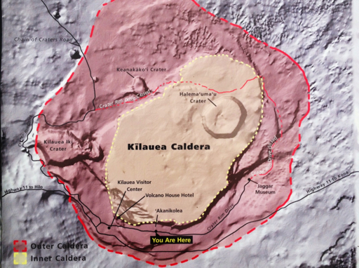
Halema’uma’a, which means “house of eternal fire,” is still active, as you can tell from the steam rising from it.
Something that we hadn’t expected, but should have, is that we were constantly seeing rainbows around the caldera because of all the moisture in the air.

We took one last look at Halema’um’a Crater before heading back to the car for the 18 mile drive down the lava flow to the ocean.


Pingback: Yellowstone | The Road Less Traveled