The drive north from Hyder runs along the easternmost edge of the Tongass National Forest. The Tongass, established in 1907, is the largest National Forest in the United States with 16.7 million designated acres, most of it temperate rain forest. The Tongass encompasses most of the Southeast Alaska “Panhandle,” an archipelago that includes, in addition to Hyder, the Alaskan cities of Juneau, Ketchikan and Sitka. We visited the islands on a small boat cruise with our kids in 2000. It was beautiful then and it’s beautiful now mainly because, with the exception of Hyder, it is inaccessible by car.
The main attraction on the Granduc Road north out of Hyder is the Forest Service’s Fish Creek Wildlife Viewing Area, an extensive boardwalk along Fish Creek where tourists come from far and wide to watch Gizzly and Black Bears feed on salmon, just yards away. Unfortunately, we arrived before the salmon run, so no bears were around. Beyond the Wildlife Viewing Area, the Forest Service recommends that motorhomes and trailers turn back. We were in our Jeep Wrangler, so on we went.
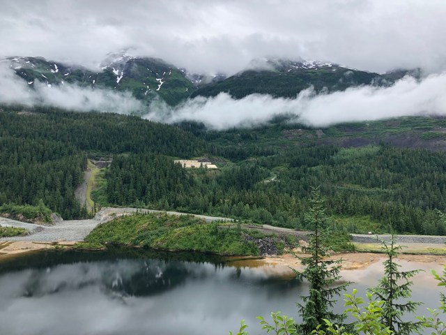
At 13 miles out of Hyder, the road leaves the U.S.A. and crosses into British Columbia at the location of the former Premier mine, opened in 1910. At its peak in 1927, more than 800 men worked over 17 miles of tunnels here and Premier was then known as one of the greatest gold mines in the world. It closed due to low commodity prices in the 1950s, sporadically opened and closed again over the years, ultimately completely shutting down in 1996.
Here’s a view of the water body below the mine and I suspect, given the color of the water, that this is where the mine discharged its waste product:

In the early 1900s, the road ended here, although mining entrepreneurs did venture further north and west, including two miners who were digging for copper in 1928 another 17 miles further north on the other side of Salmon Glacier in an area known as Tide Lake. Their claim turned out to be a huge copper lode and a joint venture was put together in the 1960s to commercially mine the area which was named the Granduc Mine. The venture first built a road to continue access beyond the Premier mine to Granduc Mine.
We continued driving, rounding the end of the glacial lake in the photograph above. From the other side, we could see the abandoned Premier Mine:
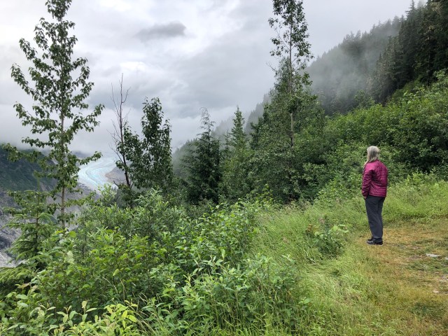
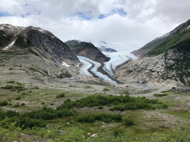
The Granduc Road climbs steadily up the valley that has been created by the withdrawal and runoff of the Salmon Glacier, the 5th largest glacier in Canada. Here’s a photo looking downstream toward Hyder:

And here’s another from the same spot, looking north – you can see the toe, or terminus, of Salmon Glacier off in the distance through the low-settling clouds:
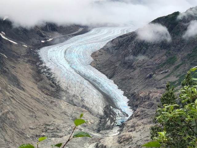
We continued driving up the valley to a better vista. Here’s the toe of Salmon Glacier:
Although Granduc Road is pretty well maintained all the way up to the Salmon Glacier Summit Viewpoint at mile 23, there are occasional rock slides along the drive.

The glacier seemed to go on forever.

By now, we had driven alongside Salmon Glacier for 5 miles and it seemed like it would never end!

Rounding the curve, above, we started seeing peculiar, hand-written signs saying things like “DVDs FOR SALE – BEARS FIGHTING” and “WILDLIFE POSTCARDS FOR SALE – 3 FOR $2.” We thought, surely there can’t be a tourist shop up here?
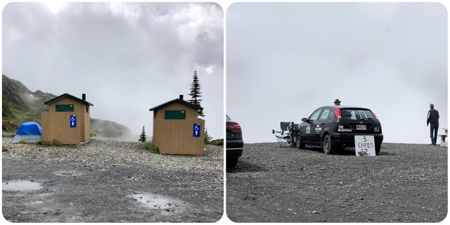
Well, in a way, there was. Here at the end of the Salmon Glacier Drive, a guy from Nova Scotia annually drives across Canada, sets up his tent next to the port-a-potty at the summit viewpoint, and camps here for the summer selling nature DVDs and postcards. That’s him, the head popping up on the other side of the car, below. Different strokes for different folks is all I can say.
At any rate, this is the literal “end of the road” for tourists. The guide recommends turning around here, warning that the road beyond this point is not maintained. Of course, we ventured on. Topping the summit, we discovered that the Salmon Glacier flows north as well as south,…

… though not for such a long way. At the toe of the glacier on the north end, the ice is more broken up and a small lake has formed. This is Summit Lake and also the beginning of what the Granduc miners called Tide Lake because it rose and fell with the volume and flow of the meltwater.

During Granduc Mine’s heyday in the 1970s, workers were transported daily by bus from Stewart up the Granduc Road, but in winter the heavy snows at this point made the road unsafe, so the mining company built a mile-long tunnel through the mountain.
Here’s the tunnel’s southern entrance (left) and northern exit (right). I ventured in just a short distance. The tunnel was 15 feet in diameter. I could actually see the “light at the end of the tunnel” from where I stood.

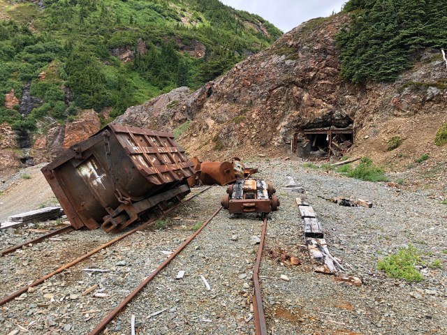
The area that the tunnel bypassed was the location of another old mine, since closed. You can see the tailings of the old mine in the center of the photo, below.

We found a side road down into this old mine where one of the old ore cars had been abandoned in front of the shaft it had serviced.
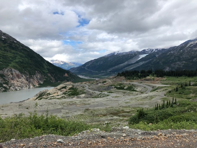
Continuing north on the Granduc Road, we passed through low clouds and a couple more rock falls, then the northern valley vista opened up to us. This is the site of the now closed Granduc Mine, one of the largest and most productive copper mines ever operating in North America. My odometer read 32 miles from Hyder.
Continuing around the bend to the right, we looked back to where I had taken the photo, above, to see the mining camp and the Berendon Glacier beyond. A blog written by one of the mine workers says that in the 1970s and 80s, there was housing here for 500 men.
We drove as far down into the camp as we could. Entry into the mine tunnels and the “concentrator” – the facility that turns the copper ore mined here into a condensed, shippable commodity – is to the left. It was closed in 1984 due to low commodity prices. The camp buildings to the right are more recent, perhaps from an exploratory crew that was here in 2014, but these buildings, too, are now abandoned.

The Granduc Mine was an amazing engineering achievement. The actual excavation of the ore takes place 11 miles to the west of the Tide Lake entrance at the foot of the Laduc Glacier, but that area is inaccessible from the surface due to intervening glaciers and mountains. So, in order to extract the copper ore that had been discovered there, the mining company had to design and build an 11-mile tunnel from here at Tide Lake to Laduc Glacier. Originally, in 1964, the plan had been to bore the tunnel from both ends, but an avalanche occurred at Laduc Glacier when the tunnel from that end had been dug a mere 28 feet, killing 26 miners.
Ultimately, the tunnel was completed from the Tide Lake side and a railway was laid in it to take the workers to Laduc and to return the ore from there to the concentrator at Tide Lake. At Laduc, the ore was extracted as much as a mile below the surface and partially crushed there and loaded into railcars. The railcars could carry 50 tons of ore each and 15 to 20 cars were transported back to Tide Lake with every trip by electric-powered locomotives traveling at 40 mph! And all of this was taking place a mile below the surface! Mind-boggling.
Back at Tide Lake, the ore was processed at the concentrator and the processed ore was then taken by truck back to Stewart where it was loaded on tankers and shipped abroad, the first delivery being made to Japan in 1971. Waste materials from the concentrator were discharged into the valley to the north, shown in the photo, below.
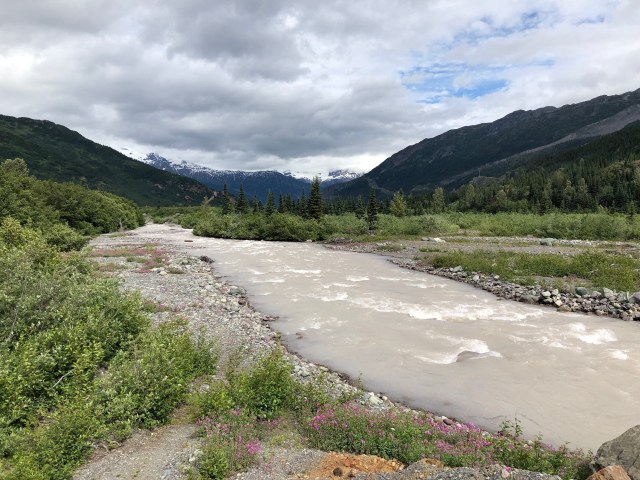
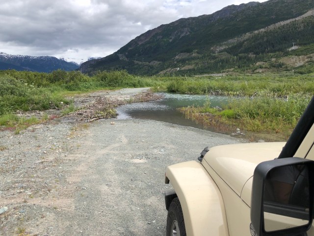
We crossed the meltwater stream flowing from Berendon Glacier and Tide Lake and then came to an impassible flooded area where we turned around, 35 miles from Hyder. It was a beautiful and fascinating ride.
Tomorrow and the day after are driving days. Our goal is to make it to the Yukon Territory by Friday.
