Our passage from Whittier to Yakutat across Prince William Sound and the Gulf of Alaska was a scheduled distance of 346 statute miles; from Yakutat to Juneau is another 269 miles. Of the ten ships currently in the Alaska Marine Highway fleet, only the Kennicott is certified to operate in open water; consequently, only its routes include the cross-gulf link between the south central ports-of-call around the Kenai Peninsula and those of the Inside Passage to the southeast.
We had just rounded Cape Spencer and entered the Inside Passage from the north at Icy Strait when I awoke Wednesday morning. Looking out the window of our cabin, I realized that we were approaching Glacier Bay, so I went up on deck to take a photo looking north up the Bay…
 
… then, turning to the right, another of Bartlett Cove and Lester Island where we had kayaked and had our encounter with a sea lion when we visited Glacier Bay NP six weeks ago.
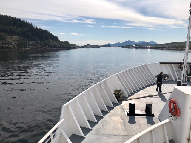
Four hours later, we docked in Juneau. Well, not really. Although the published route for our voyage listed “Juneau” as a port of call, the ferry dock is actually in Auke Bay, 4 miles to the northwest of the Juneau airport and 12 miles northwest of downtown. We wanted to visit the city, but our 3-hour stop at Auke Bay only gave us time to walk the mile or so around the bay to the nearest restaurant for lunch, and not much else. Here’s Auke Bay:
From Juneau/Auke Bay it’s another 338 miles to our next stop, Ketchikan, at the southern end of the Alaskan Inside Passage, another overnight voyage.
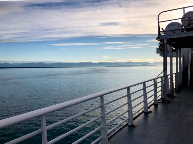
Our ferry, the M/V Kennicott, is 382 feet long, 85 feet wide and draws 17.5 feet. While it is not a cruise ship – nor does it rival the gigantic ferries of Europe – it is a big vessel with a gross deadweight of nearly 10,000 tons and a cruising speed of 16 knots (19 mph). Consequently, in the protected waters of the Inside Passage, it is extremely stable and quiet … for the most part (more on that later).
The Kennicott cost $80 million to build in 1998 and 80% of its funding came from the United States government as part of Alaska’s federal highway funds allocation because the Alaska Marine Highway is considered to be part of the National Highway System. The balance of the money came from the State of Alaska, mainly from the settlement fund resulting from the litigation over the Exxon Valdez oil spill in 1989. A condition of using the Exxon Valdez money was that the Kennicott had to be designed so that it could be transformed into a command center for emergency teams responding to any future oil spill. It thus has a helicopter landing pad, decontamination showers, a floating dock that’s stored below deck and an elevator system capable of launching that floating dock.
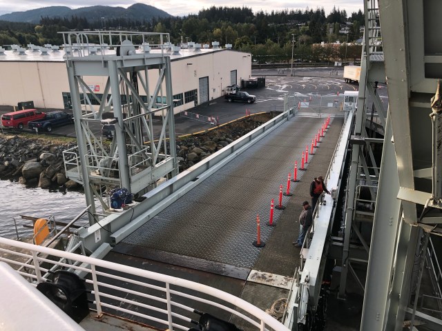
That elevator system is also used for loading vehicles at docks that have no ramp, like the dock at Yakutat. You can see it in operation in the bottom grouping of photos in my last post. The elevator is located immediately above the cabin we were assigned, 91-A. Apparently, the crew didn’t properly secure the system when we departed Yakutat Tuesday evening and as a result it made a continual racket into the night. Fortunately, the purser was able to move us into a cabin further toward the bow, 45-A, for the remainder of the journey and a sound sleep.
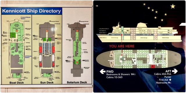
The Kennicott has a vehicle capacity of 1,560 linear feet which is the equivalent of 78 vehicles, allowing 20 feet per vehicle. It is also designed to carry 499 passengers; accordingly, there are 51 four-berth and 58 two-berth cabins and “roomettes,” mostly on the deck above the vehicle hold.
Wikipedia says:
The Alaska Marine Highway System is a rare example in the U.S. of a shipping line offering regularly scheduled service for the primary purpose of transportation rather than [for] leisure or entertainment. Voyages can last many days, but, in contrast to the luxury of a typical cruise line, cabins cost extra, and most food is served cafeteria-style.
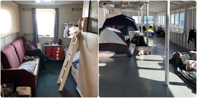
We opted to pay for a cabin (photo below, left), although it’s not required as a condition of passage. Our cabin was actually quite comfortable and included an ensuite bathroom with shower, bunk beds and a sofa. It wasn’t much different than being in our RV. Those who didn’t take a cabin were allowed to set up camp, literally, in the solarium on the top deck (photo below, right). It was like Woodstock up there.
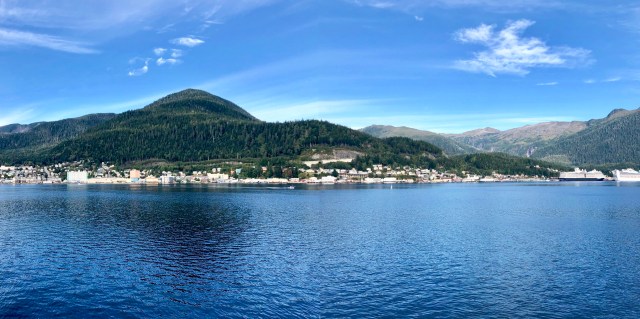
We arrived at Ketchikan around 11:00 a.m. on Thursday morning.
I was busy watching all the seaplane activity when Dale pointed out a whale surfacing in the middle of the seaplane terminal; you can see it in the center of the photo, below:
With the swarm of seaplanes constantly landing and taking off around us in the channel, the Tongass Narrows, not to mention the commercial jet traffic taxiing into position on the adjacent runway, Ketchikan is one of the noisiest ports I’ve ever visited.
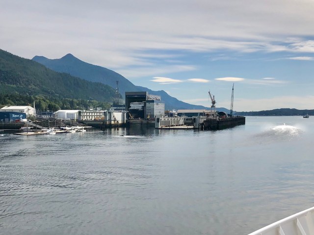
Ketchikan is also the headquarters of the Alaska Marine Highway System which has its administrative offices and a maintenance facility here. The State’s newest ferry, the M/V Hubbard, was in dry dock being fitted out for her inaugural launch when we arrived (photos above and below). At the maintenance dock around the corner was the M/V Matanuska. The Kennicott, the Matanuska and the M/V Columbia are the three ships that make the run through the Inside Passage to Bellingham, but only the Kennicott goes further north.
 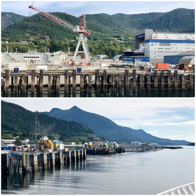
As you can see, Ketchikan is a busy port, lined with containers and docking facilities for ferries, freighters and cruise ships, two of which were in port near downtown when we arrived – you can just make them out in the distance in the photo, above.
Again having only 3 hours in port, it was not possible to walk to the downtown area and back, so we satisfied ourselves with a stroll along the commercial waterfront and a quick lunch ashore, approximately the left half of the photo, below:
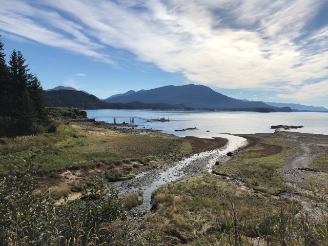
Not long after leaving Ketchikan, we entered Canadian waters, had cellular internet for an hour as we passed Prince Rupert, then continued south through Grenville and Princess Royal Channels on our way toward Vancouver Island as we slept Thursday night.
The Inside Passage through Canadian Waters is mostly down relatively narrow channels winding between the many passing islands and islets, forested with fir trees so common in the Pacific Northwest. Around 8:00 a.m. Friday morning we passed Dryad Point light (photo, below) on the north end of Campbell Island. Just south of the light is the largest settlement along Canada’s central coast, New Bella Bella, a First Nation Indian village of around 1,400 people.
 
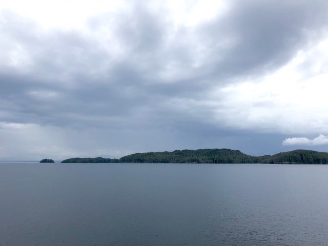
As Friday, our final day at sea, wore on, the weather began to deteriorate. We had been lucky: bad weather at the beginning of the voyage during our crossing of the Gulf of Alaska could have been rough, but the Inside Passage is protected from the oceanic swells and waves associated with low pressure systems like the one now approaching offshore. By the time we reached the north end of Vancouver Island (photo, below) as night approached it was raining.
There were no scheduled landfalls after Ketchikan for the remaining 676 miles of our voyage until our disembarkation at Bellingham, Washington, the end of a 1,629 mile journey.
The forerunner to the publicly-owned Alaska Marine Highway was a private ferry line, founded in 1948, that ran weekly between Juneau, Haines and Skagway and was acquired by the Alaska territorial government in 1957. When Alaska became the 49th state in 1959, Alaskans approved a bond issue to expand the ferry system throughout south central and southeastern Alaska, terminating at Prince Rupert in British Columbia. Passage further south was to be by way of other ferry lines until 1967 when the Alaska Marine Highway extended service to Seattle until it was pulled back north to Bellingham in 1989 where it has remained since.
As we passed through Johnstone Strait near sunset Friday night, a pod of dolphin joined us, veering off as we approached orca to both port and starboard. Continuing south past Campbell River in the dark, we were back in familiar territory and nearly home (we spent 2 weeks on Vancouver Island in 2017 which you can read about here).
We arrived in Bellingham at sunrise on Saturday morning, home again after 10 weeks of travel.

This is Sehome Hill. Western Washington University is on the top, off to the left.

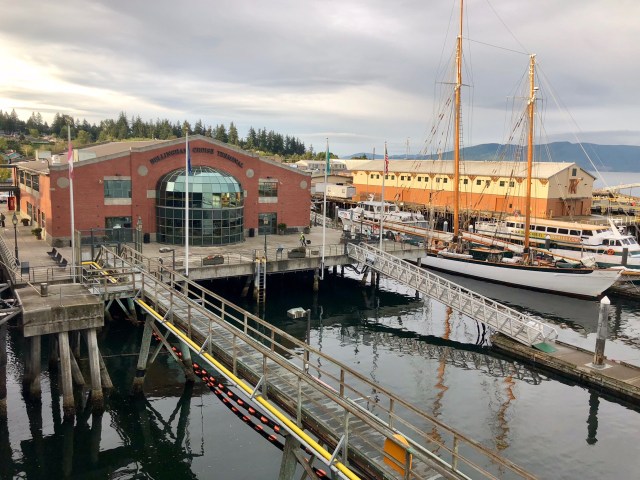
Bellingham Cruise Terminal, next to the AmTrack train station and within walking distance of downtown Fairhaven.
Just 8 more driving miles to go! But who’s counting?
Well, I guess I am. In addition to the dolphin and orca seen from the ferry, we saw lots of other wildlife during our trip – black and grizzly bear, moose, caribou, Dall sheep, mountain goat, coyote, porcupine, snow hare, sea otter, sea lion, harbor seal, harbor porpoise and humpback whale – quite a menagerie.
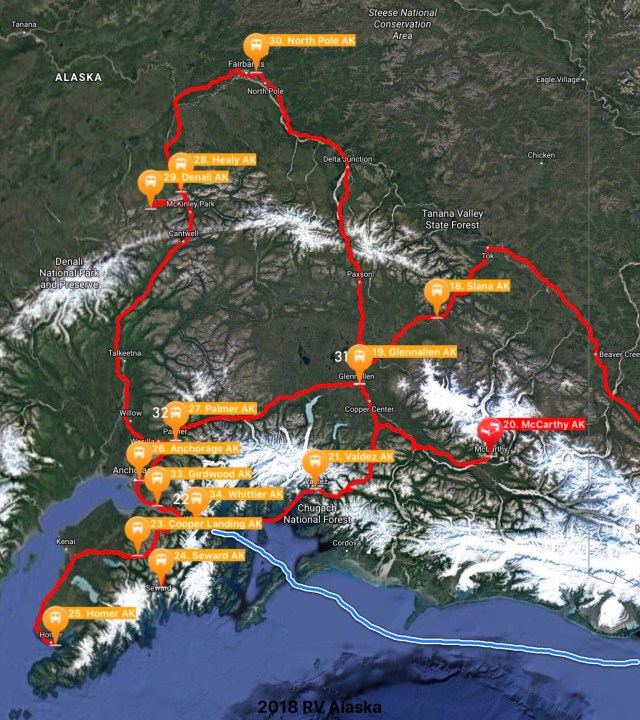
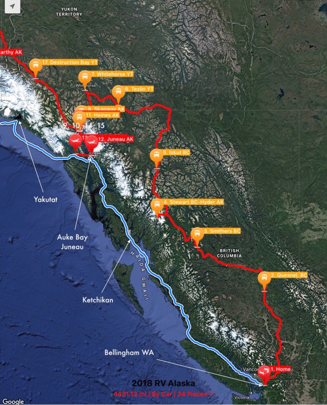
And while I’m counting, our motorhome odometer says we drove 3,855 miles, not including another 600 miles, give or take, in the Jeep. Here’s our route, broken into two maps so the locations are legible (the bottom map is at a smaller scale than the upper map):
It was a terrific adventure. If you ever have the opportunity to visit the Far North, make sure you go.

Welcome back home
LikeLiked by 1 person
Thank you!
LikeLike
Welcome home and thank you for your detailed blog of the adventure. I learned so much. I admire and appreciate those willing to blog and share with the rest of us. I normally read and never comment but I felt your hard work needs to be acknowledged.
I can’t wait to see where you go next.
LikeLiked by 1 person
Thank you for your nice comments.
LikeLike