It took less than two hours to drive from Palmer to Bird Creek Campground in Chugach State Park on Turnagain Arm, our final campsite before boarding the Alaska Marine Highway ferry at Whittier Monday evening, September 10th. It was a nice drive, starting with a scenic view of the Chugach Mountains on the left and Knik Arm on the right as we headed southwest into the Anchorage suburbs. The road, AK-1, turns south through downtown Anchorage, then continues southeast along Turnagain Arm, winding along that inlet at the base of the Chugach Mountains, adjacent to the Alaska Railroad.
According to Wikipedia,
Turnagain Arm was named by William Bligh of HMS Bounty fame. Bligh served as [Capt. James] Cook’s Sailing Master on his third and final voyage, the aim of which was discovery of the Northwest Passage. Upon reaching the head of Cook Inlet in 1778, Bligh was of the opinion that both Knik Arm and Turnagain Arm were the mouths of rivers and not the opening to the Northwest Passage. Under Cook’s orders Bligh organized a party to travel up Knik Arm, which quickly returned to report Knik Arm indeed led only to a river. Afterwards a second party was dispatched up Turnagain Arm and it too returned to report only a river lay ahead. As a result of this frustration the second body of water was given the disingenuous name “Turn Again.”
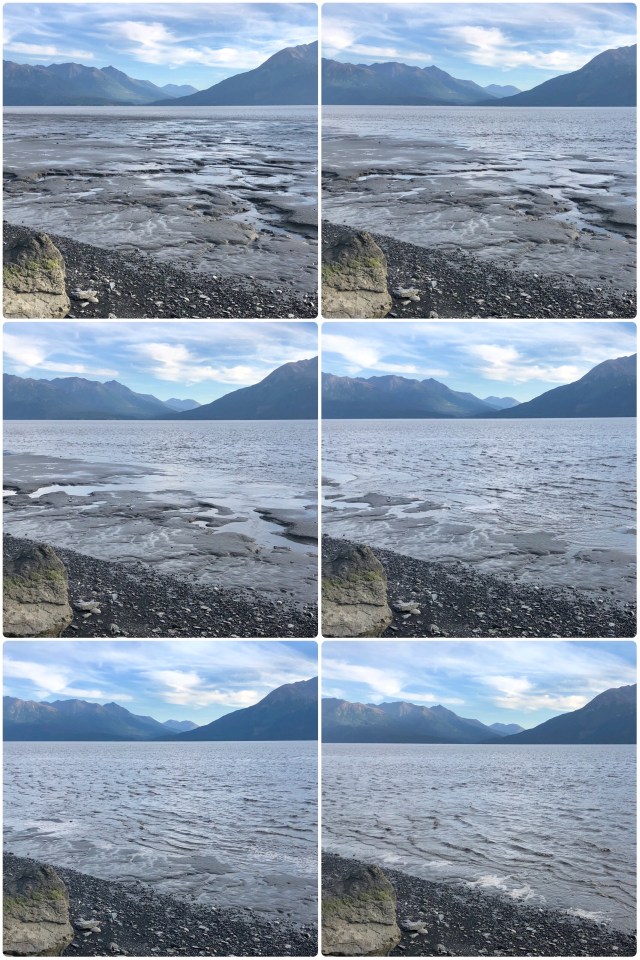
Could be. It’s as convincing as any story I could come up with. At any rate, it’s a good thing Cook kept his ships, Resolution and Discovery, anchored back in Cook Inlet rather than trying to bring them up Turnagain Arm for they would surely have run aground. Here’s a view of Turnagain Arm at low tide near our campsite at Bird Creek:

Again, according to Wikipedia:
Turnagain is characterized by remarkably large tides of up to 40 feet which are the largest tides in the United States. The flood tide often begins with a tidal bore … which has a height of 6 feet at times and runs in from the west at a speed of 5–6 miles an hour.
A “tidal bore” or “bore tide” is essentially a wall of water caused by extreme sea tides rushing up adjacent coastal rivers having a large tidal range where the incoming tide in confined to a narrow channel – exactly the conditions that exist along Turnagain Arm. The best time to see a bore tide is during a new or full moon and we had made a point of getting to Bird Creek on such a day a couple hours before the bore tide was to arrive.
Through binoculars we could see the front-running bore tide wave approaching from our vantage point along the shoreline, but the wave faltered as the water raced across the vast mud flats before us, turning into a rapidly moving flood in the shallows at our feet. The entire sequence of photos, below, took place over a span of 5 minutes:
After boon-docking for the night at Bird Creek, we drove through the nearby village of Girdwood – where Anchoragites go in the winter to ski – on our way to the Whittier Tunnel.
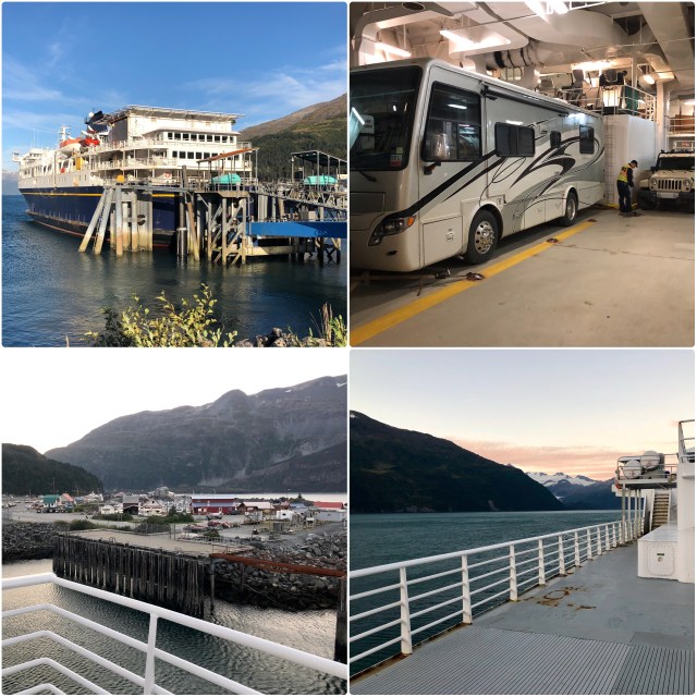
In Whittier, we had time to see the town, which took all of 15 minutes. I’ve written about Whittier before. It was built by the U. S. Army during WWII and abandoned by it after the Cold War. Nearly the entire population of Whittier resides in a single building, Begich Towers Condominium, originally built by the Army as officer and family housing. Most of the activity in Whittier is along the waterfront where the railroad depot sits next to the ferry and cruise ship docks.
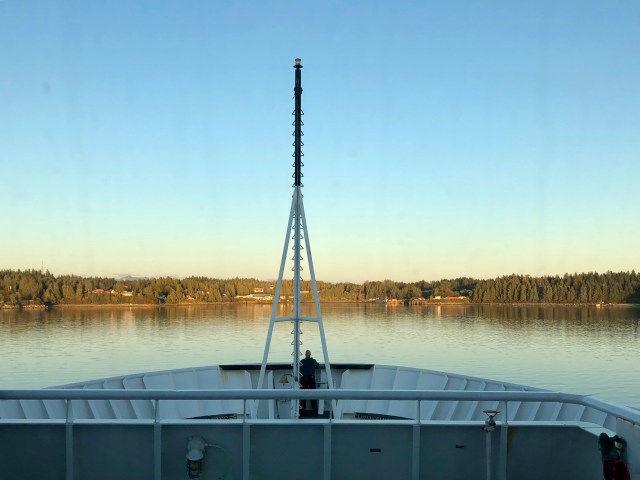
We had booked passage on the M/V Kennicott, the newest ship in the State of Alaska’s fleet, launched in 1998. Because we are ticketed all the way to our hometown of Bellingham, Washington, the southern terminus of the Alaska Highway, we were loaded at the back of the boat.
Here’s a map of the Alaska Marine Highway routes. We will be stopping in three ports before departing in Bellingham: Yakutat; Juneau; and Ketchikan; all accessible only by water and air.

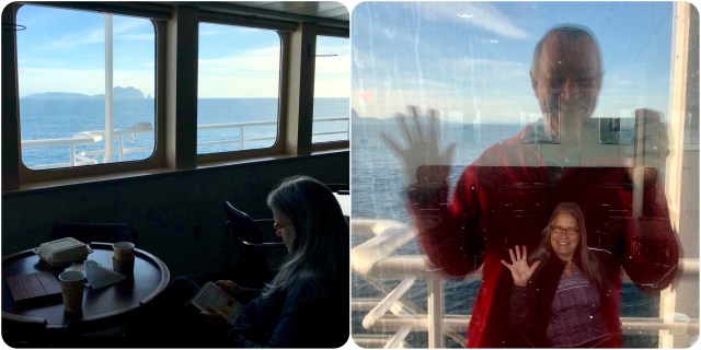
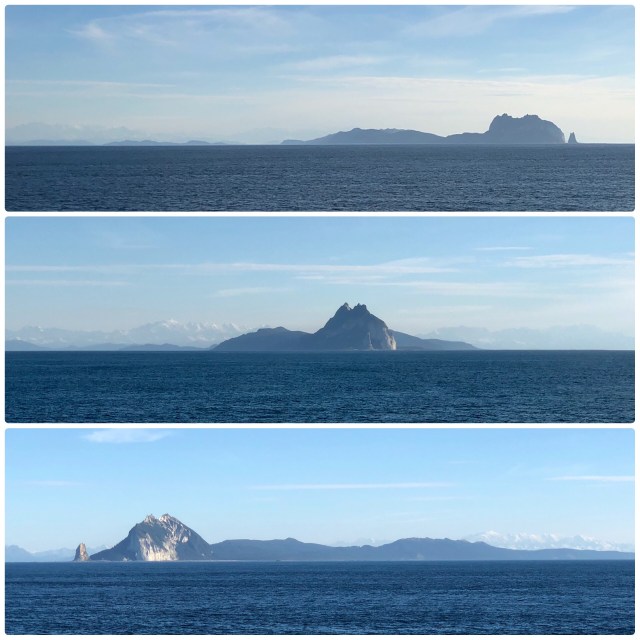
Having booked a cabin for the voyage, we were already asleep in our bunks when the ship cast off from Whittier just before midnight. The next morning, we went topside after breakfast, just in time to see Kayak Island coming up off the port bow.
Kayak Island was where the naturalist, Georg Stellar, landed during Vitus Bering’s second Russian Alaska voyage in 1741. The island is now a National Historic Landmark, although being so remote, it is hardly ever visited (Dean Littlepage, author of Stellar’s Island: Adventures of a Pioneer Naturalist in Alaska (2006), did travel here). I photographed Kayak Island from different vantage points as we made our way past it.
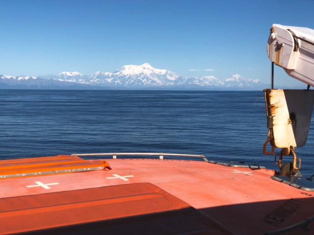
As we approached Yakutat that afternoon, Mt. St. Elias (elev. 18,008 feet), the second tallest mountain in the United States (after Denali), came into view to port.
Unless you are traveling Alaska by ferry, chances are you will never visit the village of Yakutat. To say it is remote and out-of-the-way is a great understatement – it is in the middle of nowhere, surrounded by miles of ice and mountains and ocean. Yet, 605 people (about half of whom are Tlingit Indians) live in this town whose city-borough limits cover 7,649 square miles – six times the size of the state of Rhode Island – that works out to just over 8,000 acres of land per resident!
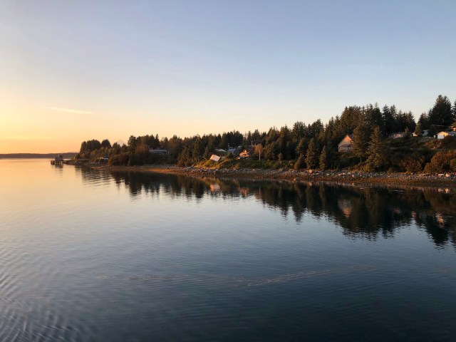
It was around 8:00 p.m. when we arrived in Yakutat, beautiful and serene in the setting sun.
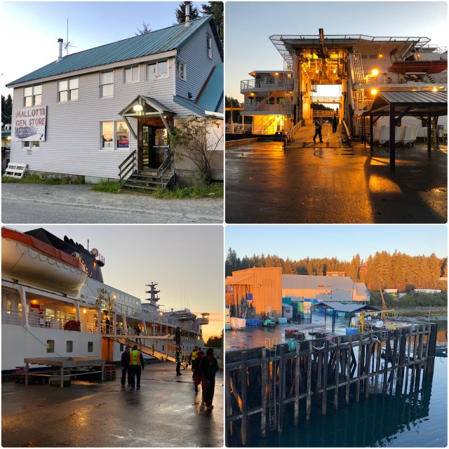
We went ashore for the hour we were in port, just to stretch our legs.
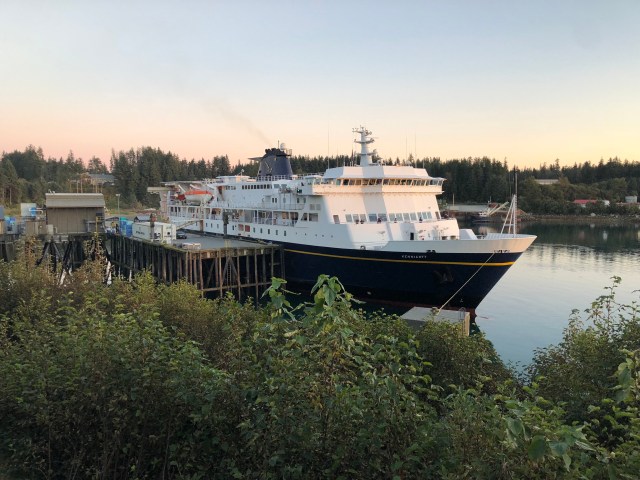
There’s not much here and nearly all of the residents’ needs are met by the single general store, Mallott’s. We went in and bought ice cream before returning to the ship. Rumor has it, though, that there’s also a surf shop further down the road, “Icy Waves,” and a great surf break in the bay with up to 20-foot swells; consequently, Yakutat bills itself as The Far North Shore (Hawaiians will understand the reference).
Another night at sea. Tomorrow we’ll be in Juneau, the state capital.

Another brilliant post Mark, thank you. The photo of Turnagain really makes us feel small. it’s a big world out there. stay safe and keep enjoying your adventure.
LikeLike
Vince, EVERYTHING about Alaska makes me feel small!
LikeLike
So true just wish I could oneday experience it for myself. I love reading your posts about it .
LikeLike
Pingback: Inside Passage to Bellingham | The Road Less Traveled