Kayaking Day 6, November 3, 2018
Unlike Mario, Lino did not celebrate Día de Muertos. Lino resides fully in the present. He appears uninterested in lore and legend, perhaps because he lives the life of those stories today. He is too busy providing for himself and his family – and on tours, for turistas like us – to spend time romanticizing about the past. And, today, Lino would introduce us to that world, his world: life on and along the waters of the Sea of Cortez.
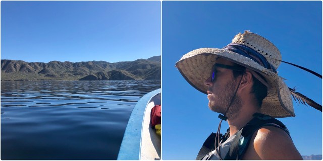
Following morning coffee and an omelette breakfast, we climbed aboard the panga for a quick ride across the channel to Isla San José.

Dale awoke with a puffy face, the apparent result of a minor case of sun poisoning or, possibly, an allergic reaction (the biting gnats?). At any rate, she took it in stride without complaint, as she does most things, one of her many lovable qualities.
Leaving our campsite at Nopoló in the rearview mirror, Lino pushed the panga up onto a plane, then rigged a pole for fishing, as we sped eastward.

There were a few ripples on the water in the middle of the channel, but it was dead calm on the other side in the lee of Isla San José. Mario stood lookout for marine life as we crossed.
According to the Baja Naturalist Guide website:
There are approximately 900 islands in the Gulf of California, each with varying degrees of area. The islands boast high cliffs, white sand beaches, and turquoise waters. The four Mexican states of Baja California, Baja California Sur, Sinaloa, and Sonora work together to protect the islands as well as the Gulf of California. First protected by a decree, written in 1978, the islands were safeguarded as a reserve and refuge for migratory birds and wildlife. In 2000, the reserve was renamed to its current name, [Islands of the Gulf of California Flora and Fauna Reserve,] and in 2005 the area of the Gulf of California, including 244 islands, islets, and coastal areas, was named a UNESCO World Heritage Site.
Isla San José is one of those protectorates, a semi-arid, 70-square-mile island, the 3rd biggest in the Sea of Cortez and 6th largest in Mexico:
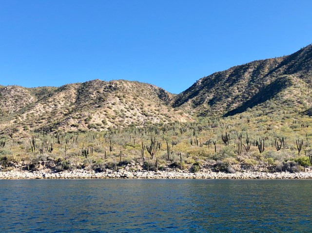
Fewer than 25 people live on Isla San José, all of them on the northeastern shore in a small shoreline settlement of fishermen called La Palma Sola, Spanish for “the lone palm” (we were not going to be visiting that side of the island).
We trolled along western shore, Dale as angler. No luck. After a half hour, we decided to motor on and Lino throttled up, taking us to the southern end of the island.
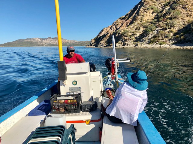
Rounding the southern point of Isla san José and heading east into Bahía la Amortajada, we could see the only other settlement around, El Pardito, another village of fishermen, this one located on a tiny rock outcropping north of Isla San Francisco to the south. El Pardito has only 15 residents, 13 of whom are men – all fishermen.
We continued east, intending to turn inland to run a channel through the mangroves, but the channel was silted-in, the result of recent Hurricane Sergio, down-graded to tropical storm status at the time it made landfall on October 12 near Loreto, just two weeks before we had arrived (prior to reaching land, Sergio had been rated a category 4 hurricane).

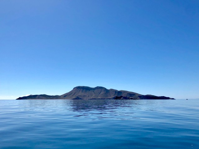
The plan frustrated, Lino took us back to the beach near the southern point we had rounded on our entry into Bahía la Amortajada (photo above, beach on the right).
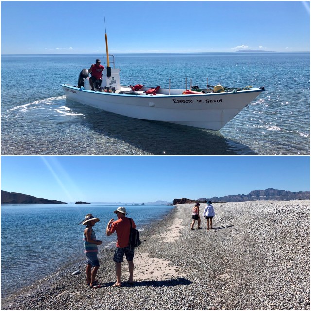
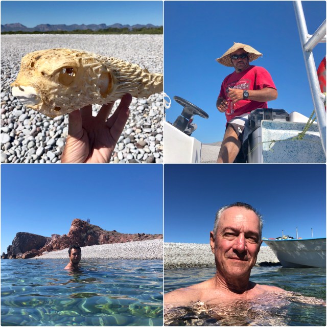
After a little beach-combing, we cooled off in the water.

Portrait time! Clockwise from top right: Lino, me, Mario, random blowfish.
Refreshed, we motored back north for lunch on shore near Punta San Isidro, opposite the village of San Evaristo on the peninsula, then walked east along the beach to the salt ponds.

The operators of the salt ponds trap brine in a shallow bay marked off in rectangular grids, letting the sun do the work of removing the water by evaporation so the remaining salt can be scraped off, processed and sold.
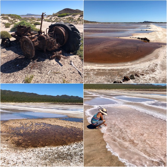
Salt is very caustic in this form and wreaks havoc on the mechanical equipment. I know from prior experience that it will also eat the soles off your shoes if you don’t remove it immediately after contact. We could smell the heavy concentration of salt in the air and taste it in our mouths and sinuses. The area appeared lifeless.
We returned along the beach to the rocky point where we had left Lino and the panga.

As you can see from these last two photos, the wind freshened as the afternoon wore on. To the south of here, this is a daily occurrence, as it is in South Florida. As the sun rises in the sky it heats the peninsula, causing the air over the land to rise. Cool air from the Pacific rushes in to fill the void, thus creating the afternoon Coromuel winds of the La Paz region. Here, north of La Paz, the mountains interfere with the process, but the mechanics are the same.

Somewhere along the way, Lino caught a rooster fish which he filleted and used to stuff tacos for dinner.

Spending the day on the water caused me to reflect on our time living in Islamorada in the Florida Keys. So many similarities: the water; the weather; the birds; the fish; the sun- and wind-burn; traveling by boat – I could go on. Island life repeats itself around the world. There’s a different pace to life than on the mainland.
Though we are now at Longitude 110° W – 1,800 miles west of Islamorada (at 80° W) – our camp at Nopoló is at the exact same latitude – to the second! – as our house in Islamorada: 1″ south of Latitude 25° North.
No wonder I felt so at home.
