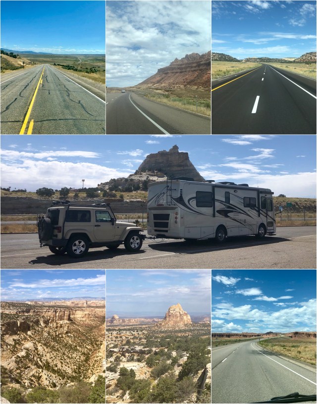
Leaving Fort Collins on Labor Day, we avoided the high passes of I-70 and the holiday traffic in and out of Denver, driving north on US Highway 287 to Laramie, Wyoming, then west on I-80 around the northern peaks of the Rocky Mountains.
We left I-80 and Wyoming on WY-789, which soon became CO-13 (photo top left, below), heading south to Rifle, Colorado. There, we took I-70 west to Grand Junction where we spent the night, the day’s drive clocking in at 435 miles.
The next morning, we continued west on I-70 into Utah (photos, below continue clockwise as we traveled west through Utah). We turned south on US Highway 89 which we took to its junction with Utah’s Scenic Byway 12, taking that road to Cannonville, Utah, where we again checked into a KOA, 15 minutes past the entrance to Bryce Canyon National Park. A short day’s drive this time, just 330 miles.
The next morning, we were up early to beat the crowds and heat, driving back into Bryce Canyon NP for a hike in the canyon, but stopping first at the Visitor’s Center on the way to the trailhead. According to the very helpful book I bought at the Visitor’s Center, Geology Unfolded: An Illustrated Guide to the Geology of Utah’s National Parks, p. 3 (2012):
The national parks of Utah are particularly “geologic” in nature. They are all located within the Colorado Plateau, an elevated, relatively dry geologic province of the North America continent. As such, vegetative cover is minimal and the sedimentary rocks that dominate the plateau are strikingly exposed. The variety of landscapes observed in the parks result from three broad geologic processes: 1) the deposition of sediment in diverse environments which created the rock strata; 2) the uplift and deformation of the strata by cotinental-scale tectonic forces; and, 3) on-going weathering and erosion of the strata exposed at Earth’s surface.
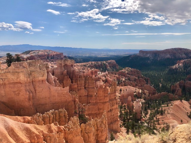
Bryce Canyon is the top “step” on the Grand Staircase of the Colorado Plateau, the bottom step being the Grand Canyon, approximately 100 miles due south (see, below, left).
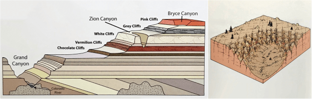
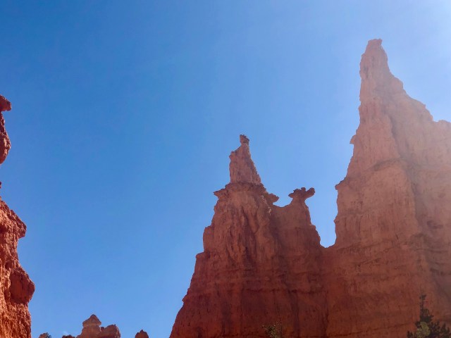
Bryce Canyon NP, established in 1928, is known for its “hoo doos” – rock chimneys formed by multiple geologic processes. As depicted in the sketch above (right) from Geology Unfolded, the uplifting of the Colorado Plateau about 35 million years ago caused multiple fractures, one set running NE/SW, the other running NW/SE. Over the years, water filled the cracks in the ground, freezing and thawing and, consequently, breaking the rock and washing away the debris, leaving the odd, rock chimneys that exist here today (photo, below).
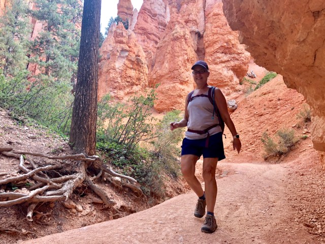
We parked at Sunset Point and walked to the rim of the canyon to look out over the “amphitheater” at the hoo doos. Ebenezer Bryce, the early settler for whom the canyon is named, summed it up well, saying it’s a “hell of a place to lose a cow.”
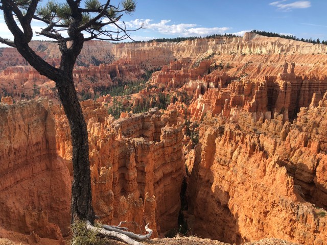
It would be impossible to take a bad photograph here.
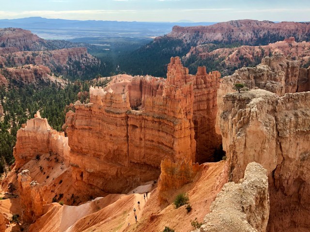
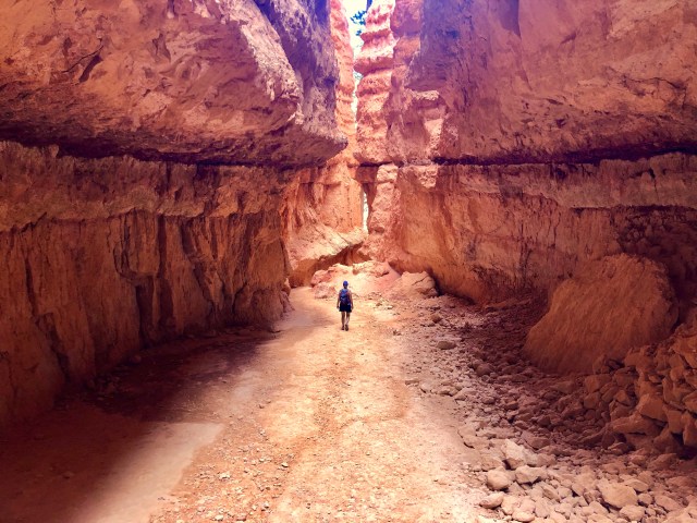
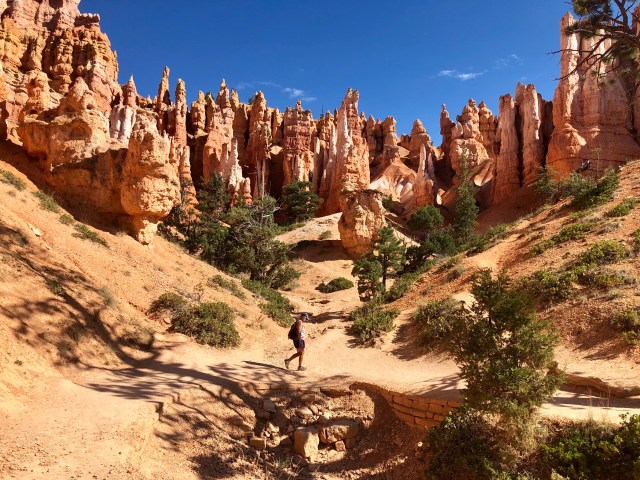
Our intent had been to hike down into the canyon on the Navajo Loop Trail, but we opted, instead, for the Wall Street Trail which winds its way down steeply to the bottom of the canyon via a series of switchbacks (in the photo, below, you can see hikers ahead of us down in the shadows):

Here’s what it looked like at the bottom:
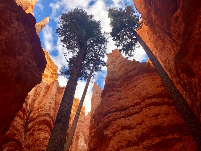
Surprisingly, there were huge trees growing down here!
They were nearly as tall as the the canyon walls were high.
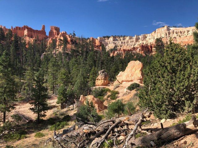
Exiting the hoo doos about 1/2 mile down the trail, we walked through different terrain, lined with Ponderosa Pine:
Eventually, our trail merged into the Queen’s Garden Trail, leading us, ultimately, to Queen Victoria, herself, perched high atop a hoo doo. Can you see her in the photo, below? (Dale says she’s riding a camel backwards.)
We continued for a mile on the Queen’s Garden Trail,…
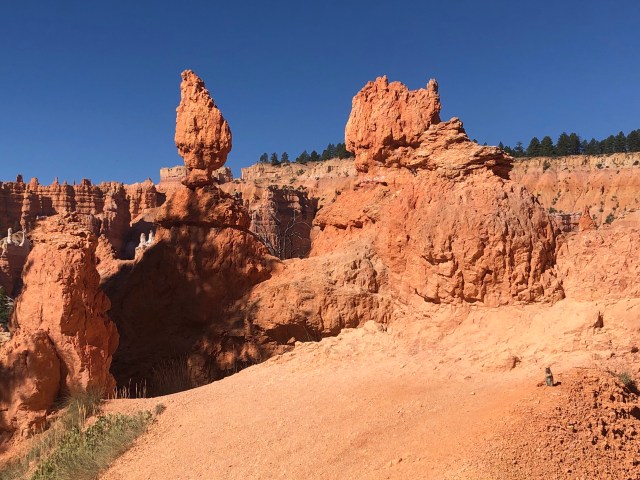
… then veered off the main trail after stopping to admire these interesting formations and the squirrel (bottom, right, in the photo, below), posing for a portrait.
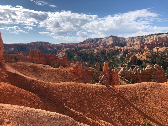
It was beautiful in every direction, so we decided to get off the main trail to take a less-traveled branch labeled the “Horse Trail” on the map.
We tried to identify the various trees as we hiked along. I think this is a Juniper:
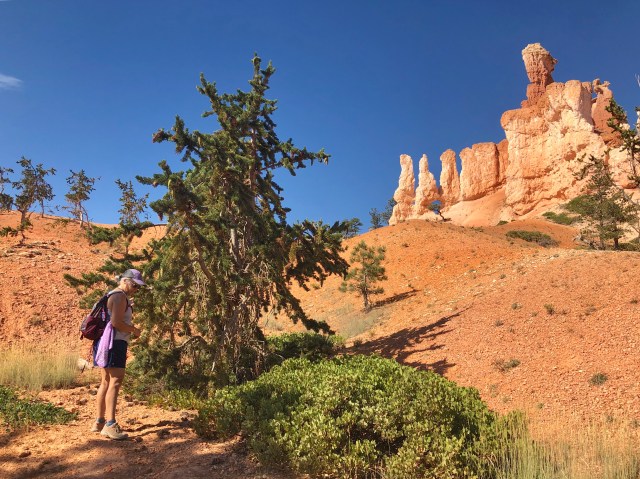
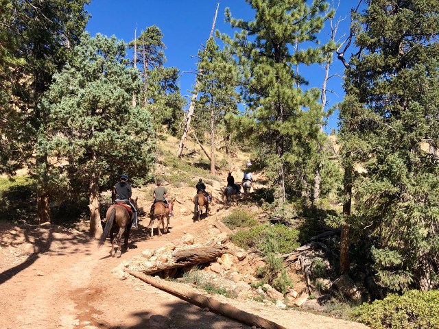
We soon discovered that “Horse Trail” was a description, not a name, as evidenced by the ever-increasing droppings and horseshoe tracks on the trail. Soon, a group of riders caught up to and passed us, leaving fresh droppings on the trail for us to work our way around. Lesson learned.
Eventually, we climbed back out of the canyon, surfacing at Sunrise Point:
We walked from Sunrise to Sunset, in total, a 4 mile loop with a 650 foot descent/ascent. A wonderful introduction to the Colorado Plateau.

Great place to hike Did you check out Escalante National Monument, North of Bryce. Spectacular in a different way Safe travels
LikeLike
Escalante NM is on the agenda for our return to Washington in a week. Loved the photos of your National Park road trip on FB. Glad your treatments are behind you!
LikeLike
Love it. Beyond beautiful. “Hellava place to loose a cow” lol
LikeLike