Leaving Bryce Saturday morning, we drove west on UT-12 to US Highway 89, taking that road south to Kanab, Utah. Jim and Von opted to continue south from Kanab into Arizona on US-89A through the scenic Vermilion Cliffs Wilderness area. Dale and I stayed on US-89, heading east to Page, Arizona, which lies just beyond the Glen Canyon Dam over the Colorado River (Dale and I will be returning to Page for a few days after visiting our son and daughter-in-law in Phoenix next week).
US Highways 89 and 89A reconnect about 25 miles south of Page and 30 miles farther south is the beginning of the 45-mile-long entrance road to the east gate of Grand Canyon National Park (South Rim), AZ-64 West.
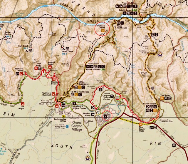
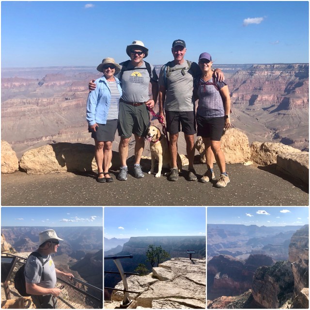
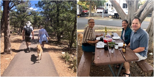
At the Grand Canyon, we checked into Trailer Village RV Park (red circle at “Mather” on the map, below). Lucky for us, our site turned out to be just a short walk from where Jim and Von were staying. After getting settled, we all met up at the local bar & grill for dinner to plan our two day stay on the South Rim.
This was a homecoming of sorts for Jim and me. In 1976, we spent 4 months driving around the country in a converted International Harvester bakery truck and one of our stops was here at the South Rim of the Grand Canyon. Hard to imagine that was 43 years ago!
Anyway, back in the present, we decided to hike the Rim Trail in two sections: the west half on Sunday (with Daisy) from Grand Canyon Village to Mohave Point; and, the east half on Monday from our lodgings to the Kaibib trailhead with stops at the Yavapai Geology Museum and the Visitor’s Center (our hikes are highlighted in red on the map, below). Each of these hikes would be 5 miles walking distance along the canyon’s rim at elevation 7,100 feet.
Jim and I were much more energetic back in 1976 – back then, we hiked down 3,100 feet on the Bright Angel Trail to Plateau Point to see the Colorado River, then back up to the top of the South Rim, 12 miles round-trip, all in one day (Plateau Point is circled in red, below).
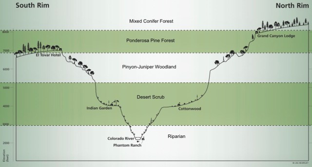
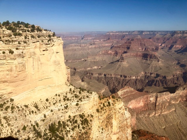
It is generally believed that the Grand Canyon was carved out of the Colorado Plateau by the Colorado River about 6 million years ago. As I mentioned, above, the elevation of the South Rim of the Grand Canyon is 7,100 feet above sea level. The Colorado River is currently at an elevation of about 2,000 feet, nearly a mile below the canyon’s rim.
In between the South Rim and the Colorado River there are four distinct biotic communities: Ponderosa Pine Forest at the top (where we would be hiking); Pinyon-Juniper Woodland, a transition zone; Desert Scrub down at Indian Garden/Plateau Point; and a Riparian habitat down at the Colorado River. The North Rim, being 1,000 feet higher – and, therefor, cooler – has a fifth community, a Mixed Conifer Forest.
Our first day’s hike started directly above the beginning of the Bright Angel Trail. Down in the valley, at the end of that flat plateau, we could just make out the trail to Plateau Point off in the distance.
At Maricopa Point overlook we looked down at the Bright Angel trail again and marveled that we had hiked down to Plateau Point in a single day.
We continued on to Powell Point for a group photo. While there, I noticed a sign out on the ledge beyond the railing (photo, below, center, bottom). Squinting, I could just make out that it was a warning sign: “Danger! Steep Cliffs!” I wondered how many people had inadvertently risked their lives walking out to read that sign.
While we’re on that topic, we saw a number of tourists posing for photos and selfies while dangling their legs over 2,000-foot precipices or pretending to climb up (or down) from the rim. I am completely baffled by people willing to risk certain death for a photograph.
Later, in the geology museum bookstore, I flipped through a 586-page book, Over the Edge: Death in Grand Canyon, that details all the known accidental deaths resulting from such idiotic acts. In case you’re wondering, 64 people have fallen to their deaths from the rim; another 61 from further down the canyon. So far in 2019, two selfie-takers have plummeted to the bottom; same in 2018. The worst year was 1993, when 7 people fell to their deaths.
We stayed well away from the edge for our group photo.
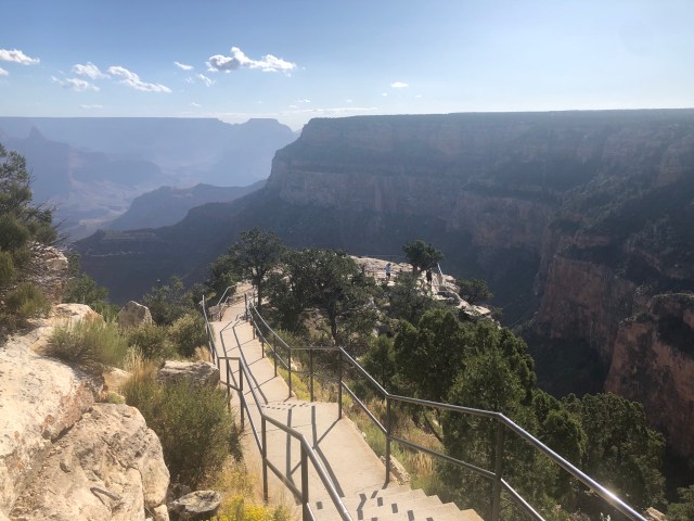
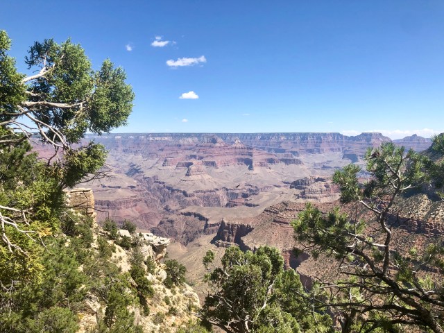
I prefer taking photos of the scenery, rather than becoming part of it. Here’s the view from Powell Point:
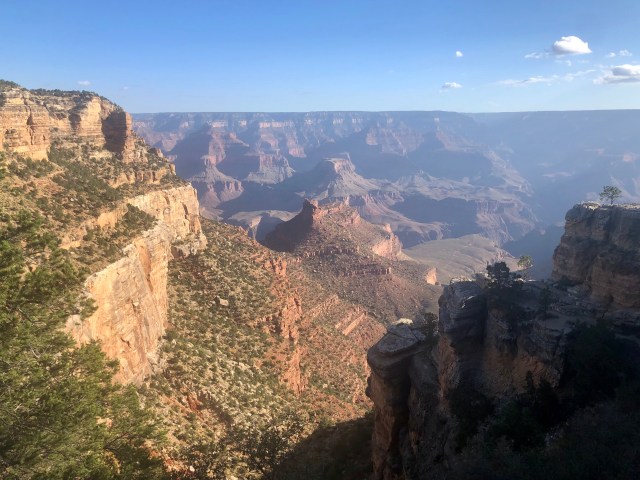
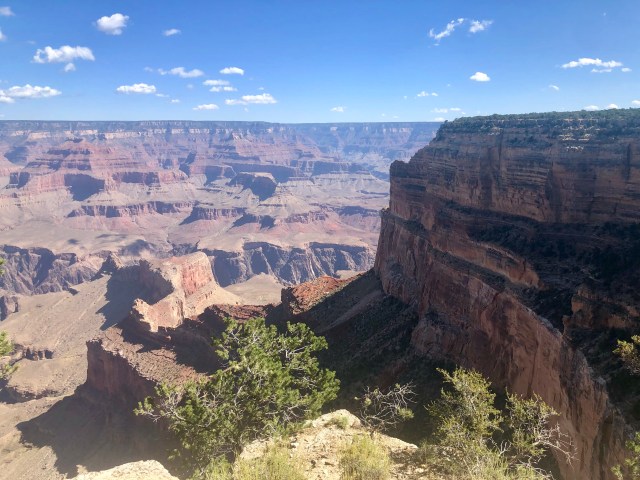
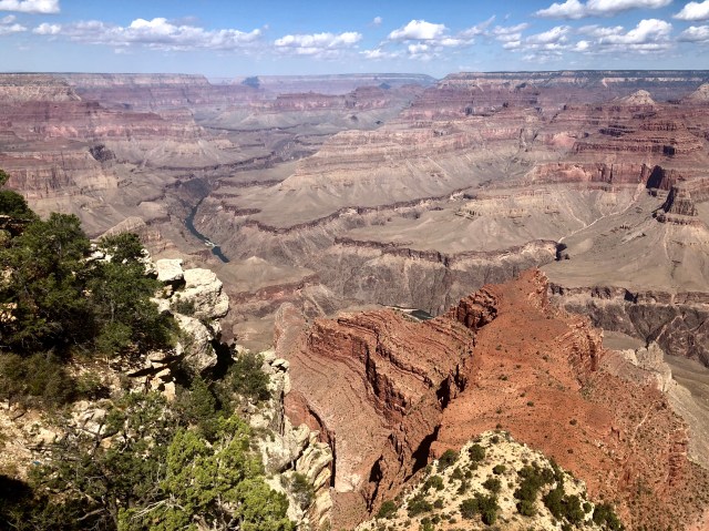
Further along, Hopi Point, where we could just make out the Colorado River down below:

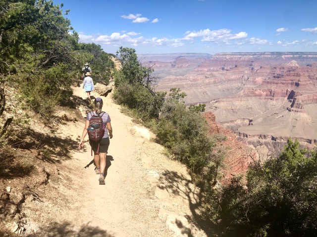
The hike was a little tense at times, given that the edge of the trail was a sheer drop-off (notice that we hugged the uphill side of the trail as we walked). On the way to Mohave Point:
End of the line for us. We turned around at Mohave Point and started back.
A really beautiful place, especially if you like earth tones.
Back at Maricopa Point:
And, finally, back near the trailhead and pavement. Dinner at our RV.

Pingback: Little Missouri | The Road Less Traveled