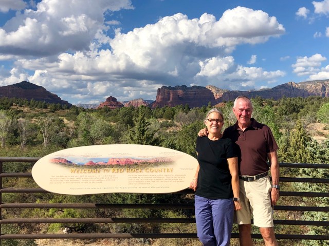
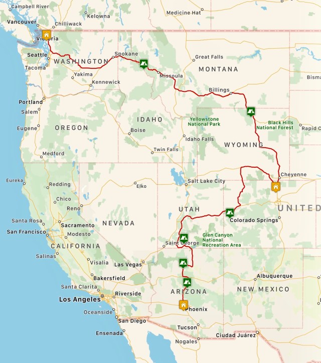
One of the reasons that the Grand Canyon is so popular is its location in the northwestern corner of Arizona, just a 4-hour drive from Las Vegas Airport. Leaving Grand Canyon, many tourists head north to Zion or Bryce Canyon National Parks, but we were headed the other direction, south, taking AZ-64 South to I-40 East into Flagstaff, then I-17 South, turning off at US Highway 89A to Sedona where we checked in to one of America’s nicest RV Campgrounds, Rancho Sedona RV Park, for two nights.
Sedona is a special place – America’s Stonehenge – renown for its Vortexes, the “mysterious cosmic forces that are said to emanate from the red rocks” there, if you believe in that sort of thing.
After getting set up at Rancho Sedona, we stopped by the Red Rock Visitor Center in the Coconino National Forest to talk to a ranger about hiking trails in the area. We’ll be back in Sedona for Thanksgiving, to be joined by Trevor and Alicia and Kelly and Dakota, and we want to have some idea about what to do then, other than eat turkey and cranberry sauce.
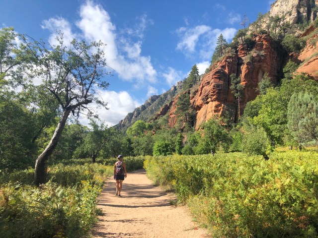
One of the hikes that the ranger recommended was West Fork Trail #108, about 15 miles north of town on scenic US Highway 89A. We decided to do that one ourselves on this trip, saving the more typical mesa and Red Rock trails closer to town to hike with family in November.
The West Fork Trail is atypical of hikes in the Sedona area because it follows a wooded creek bed up a canyon, rather than being out in the open on a mesa. Here’s how Dennis Andres describes the hike in his trail guide, Sedona’s Top 10 Hikes (p.33):
The canyon Zane Grey loved enough to memorialize in 1924, in his The Call of the Canyon novel, has been enjoyed by presidents, royalty, and hikers ever since. *** Walk West Fork with someone who matters to you. Invite someone with whom you are, or would like to be, in love. It is Sedona’s most romantic trail.
Leaving the parking area, the trail first meanders through an apple orchard planted by early settlers,…
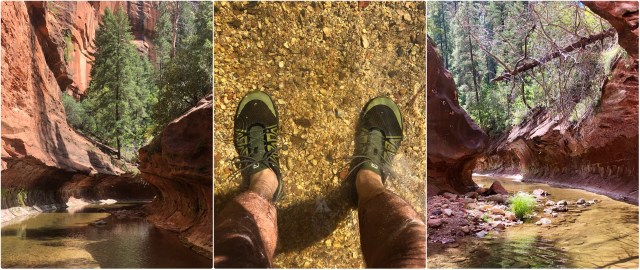
… then over an iron bridge, before passing the ruins of the Mayhew Lodge where “presidents, royalty and hikers” of old were entertained (Andres also says it served as a getaway for “movie stars and diplomats” – was there anyone that didn’t come here?).
The Mayhew Lodge ruins (photo, below, top right) is where the trail starts, proceeding from there upstream with at least 15 creek crossings. It’s a nice, leisurely hike, trafficked by few, but there’s poison ivy along the trail (middle, left), so you can’t just blithely walk along.

About 4 miles in, the trail climbs a slight rise, then descends and ends at a very pretty little canyon and pool. There were several people already here, relaxing on the rocks, cooling their feet in the water. I had on waterproof hiking shoes, so I forged ahead, to the surprise of the other hikers who remained seated, watching.
The creek was not very deep, but it was a little cold. I continued upstream about 0.1 mile. The scenery kept getting better and better. I wished Dale had joined me, but she decided to wait back with the others.

After a while, I found myself in an area the locals call the “Subway.” And then I heard splashing behind me (sound travels quite well here). Dale had decided to join me, after all!
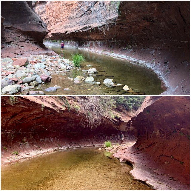
We walked about 1/4 mile in the water before turning around. It was beautiful, 8.5 miles total distance, roundtrip.

The next morning, we continued south on 89A to I-17 which we took all the way to Phoenix where we stayed for several days at the Covered Wagon RV Park, the only game in town if you need to be in the big city.
Trevor’s and Alicia’s apartment is only 15 minutes from Covered Wagon, so we were able to easily get together with them after they got off work. We thought we might go for a hike or undertake some other outdoor activity, but it’s a little on the warm side in Phoenix this time of year (it hit 113°F while we were there), so we looked for something to do together indoors.
On Saturday, we drove around Paradise Valley and Scottsdale house-hunting (their apartment is way too small), then stopped in Scottsdale to do a James Bond themed “Escape Room” together. Along with another family, we were able to solve all the puzzles and escape the room with just a minute remaining. It was a lot of fun.
As we were walking back to the car, we noticed Amery Bohling’s studio right across the street (remember her: we bought her painting at the Grand Canyon)!

It was great seeing Trevor and Alicia. We helped them move to Phoenix in April right after their wedding and the place suits them well. These newlyweds are very happy with their move and we’re happy for them.
We left Phoenix on a Sunday, avoiding rush hour traffic, heading back up I-17 on our way to Page and Lake Powell. You can tell from the scenery we’re in the desert:

Phoenix was our southernmost destination on this trip, a mere 115 miles north of the Mexico/USA border and 2,700 miles from our starting point just south of the Canada/USA border. We’re looking forward to heading back North.
On to Page and Lake Powell.

Just catching up on some emails and saw this one. We took the kids to Sedona at Christmas a few years ago and loved it.
When will you be in Gainesville? When do you leave Gainesville for Christmas? There are a few more football games and Bill still has some doctor appointments
Emily
Sent from my iPhone
LikeLike
I’ll email you
LikeLike