It was a 265 mile drive north from Phoenix to Page, Arizona, near the Utah border, up I-17 to Flagstaff, then continuing north on US Highway 89 and, finally, UT-20 to the Page Lake Powell Campground.
I am older than the town of Page (pop. 7,500), founded in 1957 as a community for housing the workers laboring away to construct the nearby massive Glen Canyon Dam that holds back the Colorado River, forming Lake Powell.
We had returned to Page to kayak in the slot canyons that feed into Lake Powell, but those plans fell through due to weather concerns (even storms 20 miles away can cause dangerous flash floods in the slot canyons). So, we had to content ourselves with a brief visit to Lake Powell from water’s edge.
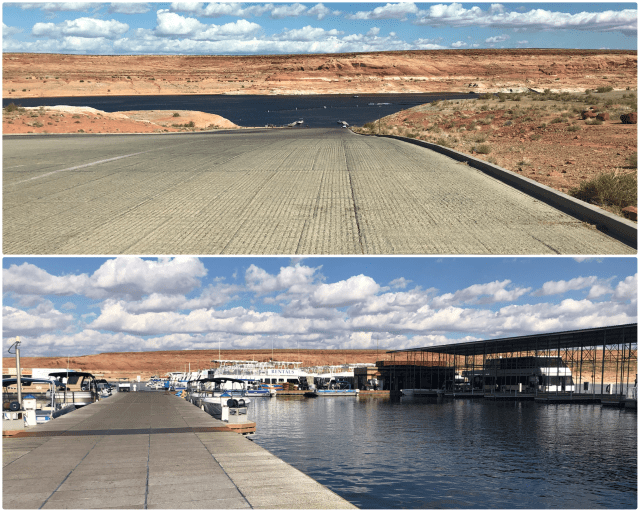
Lake Powell is a boater’s paradise. It has what could possibly be the world’s longest boat ramp (photo, below, top). For those without their own watercraft, there are a number of outboard motorboats and houseboats available for rent in the marina.
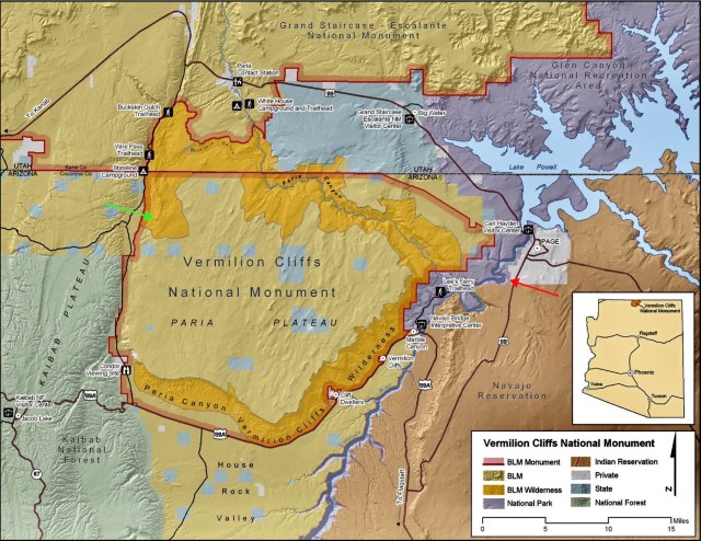
The land upon which the town of Page was built (in grey on map below) was acquired through an exchange with the Navajo Indian tribe whose reservation encompasses all the lands east of the Colorado River in this region (in brown). On the west side of the Colorado River is the Vermilion Cliffs National Monument and Wilderness. And sandwiched between those two (in purple) is a sliver of the Glen Canyon National Recreation Area which incorporates Lake Powell.
Unable to be on the water, we decided to circumnavigate the Vermilion Cliffs in our Jeep, starting at Horseshoe Bend (red arrow), a meander of the Colorado River, five miles downstream of the Glen Canyon Dam (the dam is labeled the “Carl Hayden Visitor Center” on the map, below).
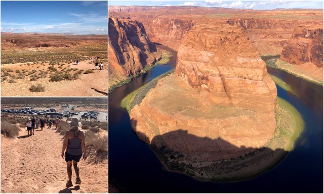
Until recently, Horseshoe Bend overlook was relatively unknown, but photos of this scenic and dramatic bend in the river went viral on social media and the place is now swarming with tourists and tour buses. Although there weren’t too many visitors when we arrived (photo, below, top left), the place was inundated with tourists when we left (bottom left).
[There’s a $10/car fee to enter and park at Horseshoe Bend and the Navajo are busy adding more parking and toll/ticket booths to increase revenue. Nearby, Navajo guides charge $50+ per person to hike in popular Antelope Canyon and in other nearby slot canyons on Reservation lands. I estimated that there were 200 cars parked at Antelope, so they’re making about $10,000 profit daily just from Antelope. Beats building a casino! In a fashion, the Navajo are still living off the land here.]
Leaving Horseshoe Bend, we headed north on US Highway 89, crossing over the Colorado River, then continued northeast into Utah. Just past the Paria Ranger Station, we turned south onto a graded county road known as House Rock Valley Road. Just south of the Utah/Arizona state line, we pulled off (green arrow on map, above) for a hike to see the Maze Rock petroglyphs, etched into sandstone up in Cayote Butte:
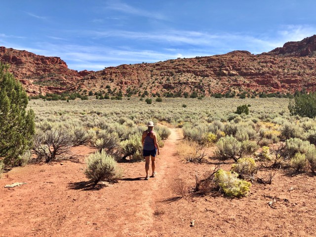
The hike across the arid desert floor was interesting, lined with sage and odd cacti. As we hiked, we kept lookout for rattlesnakes and scorpions, known to inhabit these environs, then ascended the butte.
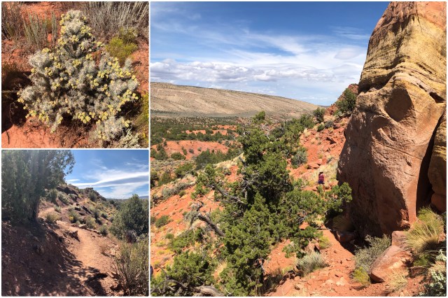
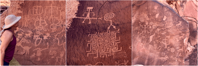
The rock art, about 100 feet above the desert floor, is estimated to have been created by Native Americans here between 850-1300 A.D., based on the subject matter depicted,…
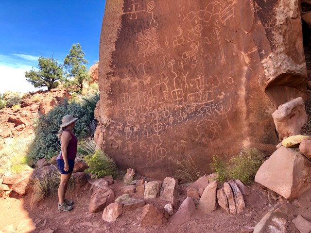
… that is, human-like images and animal forms, such as bighorn sheep, deer and mountain lions, and geometric patterns. The name for the site, “Maze Rock Art,” comes from the prominent maze pattern shown up high on the rock (must have been a tall Indian).
Just before reaching the petroglyphs, we caught up to an older couple (in street shoes) also making their way out to the site. They were having trouble, but were so close that we helped them finish the trail and get back down to lower ground before we left them and crossed back across the flat land to our Jeep.
From Maze Rock, we continued south, bumping along House Rock Valley Road, then turned east on an even less improved dirt road toward the White Pocket trailhead. When it began to appear that there wouldn’t be time to make the drive and do the hike, we turned around at the “Cowboy House” at Pine Tree Pocket. Iconic, eh?

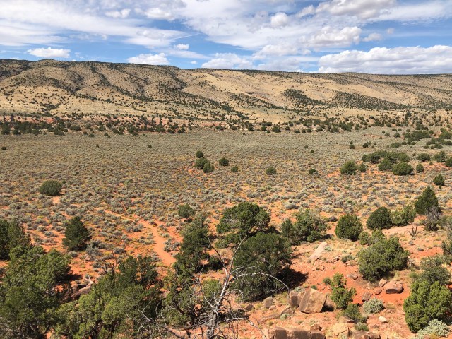
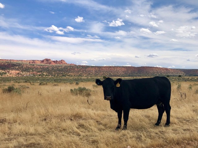
Back out on the “main” road, we continued south through open range land, passing several tagged cows wandering along the road.
At the junction of the graded road and US Highway 89A, we caught up with the couple we had helped on the trail at Maze Rock (they apparently passed us while we were on our detour to White Pocket). We were happy to know that they made it all the way back to their car without issue.
We continued east on 89A, following the edge of the Vermilion Cliffs on our way back to Page.
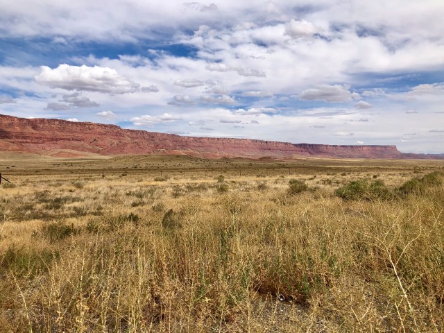
This is what The West is supposed to look like, isn’t it?
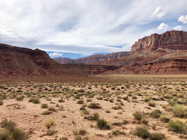
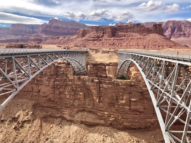
Highway 89A follows the track of the old wagon road used by the early Mormon settlers. It crosses the Colorado River at Marble Canyon…

… over the Navajo Bridge, a pair of steel spans completed in 1929. At 470 feet above the Colorado River, these are 9th highest bridges in the United States (the first span, to the right, is now open only to pedestrian traffic).
Back at the campground, we got a call that our kayak trip in Lake Powell was canceled for the second day in a row, so we decided to check out early and head for our next destination: Zion National Park.

Stunning photos – we were in Arizona/Utah during the summer – I love it there. Looks like you had a great trip
LikeLiked by 1 person
I saw your post from Antelope Canyon. We’re still traveling in Utah. Loving it.
LikeLike
Raining here in Dublin – wish I was in Utah!!! Enjoy the rest of your trip – M
LikeLike