Capitol Reef, established as a National Park on December 18, 1971, is the most recently designated and second largest National Park in the State of Utah (Arches NP became a National Park just 36 days earlier; Canyonlands NP is 40% bigger). But Capitol Reef NP is not the capital of anything, nor was it ever a reef, alhough it was, at one time, underwater (the early settlers supposedly called it a “reef” because it stopped them from proceeding, like a reef stops a ship; “Capitol” comes from the dome-like appearance of a nearby butte resembling the U.S. Capitol building).
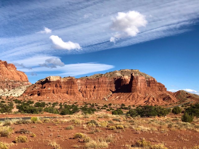
At any rate, one of the most stunning features you see in Capitol Reef NP as you approach from the west is Chimney Rock (elev. 6,360 ft.) and the mesa behind and above it (elev. 6,608 ft.). In the photo, below, Chimney Rock stands in dark relief in front of the mesa, casting a shadow on the mesa’s face, the Mummy Cliffs.
Chimney Rock was originally part of the mesa, but the peculiarities of erosion wore away the connection and it now stands adjacent and alone, pointing skyward.
There’s a 3.5 mile loop trail that proceeds from a parking area and trailhead near the road, UT-24, with a 600-foot ascent to the top of the mesa: the Chimney Rock Trail. We were in need of a hike, so off we went.
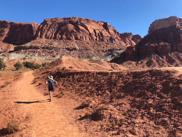
The hike up is relatively gradual and the views are spectacular. We soon found ourselves above Chimney Rock, looking down on it from the top of the mesa.
[The difference between a mesa and a butte, by the way, is that a mesa’s width is greater than its height, while a butte’s height is greater than its width.]
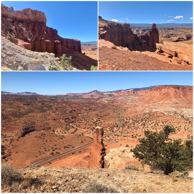
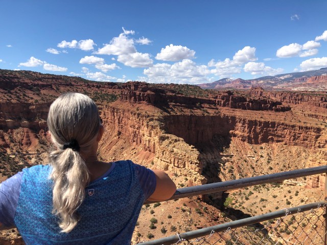
From the top of the mesa, looking south, we could see the road to Panorama Point and its overlook of Goosenecks canyon.
The trail continued from the flat top of the mesa into the interior toward Chimney Rock Canyon (bottom right)

As we started to descend, there was another overlook from which we could see the cliffs of the Navajo Knobs, looming above Whiskey Flat. This is the northern part of Waterpocket Fold.
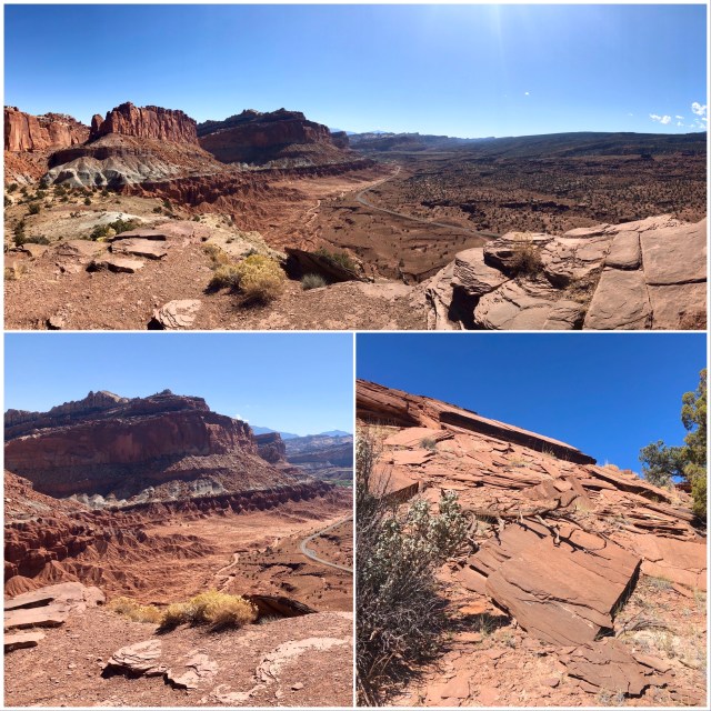
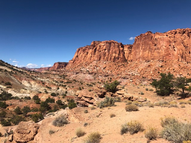
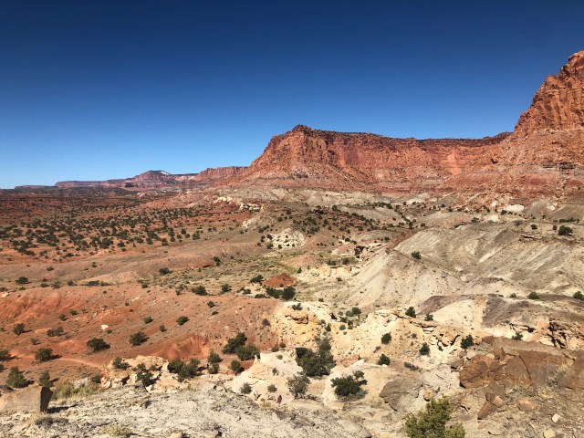
The trail continued down across shale (photo, above, bottom right). As we approached the opening of the canyon (photos, below), we stopped to admire the hard quartz sandstone cliffs rising around us in contrast to the soft, colorful, clay-rich mudstone mounds below.

The color variation in these sedimentary rocks is the result of the state of oxidation of the iron within them. The red rocks formed in the open air where the iron has oxidized, or, in common parlance, rusted. The grey and green rocks formed underwater and therefor did not oxidize or “rust.” White rocks, as I mentioned in my last post, contain little or no iron, most likely the result of a leaching by water (or oil) moving through the rock.

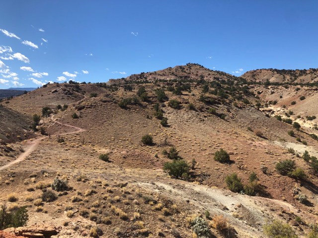
At this point, we opted to finish the loop, rather than proceed into the canyon, stopping for a snack before pushing on, returning west through the arid, interior.
The topography here in the interior was completely different from the top of the mesa.
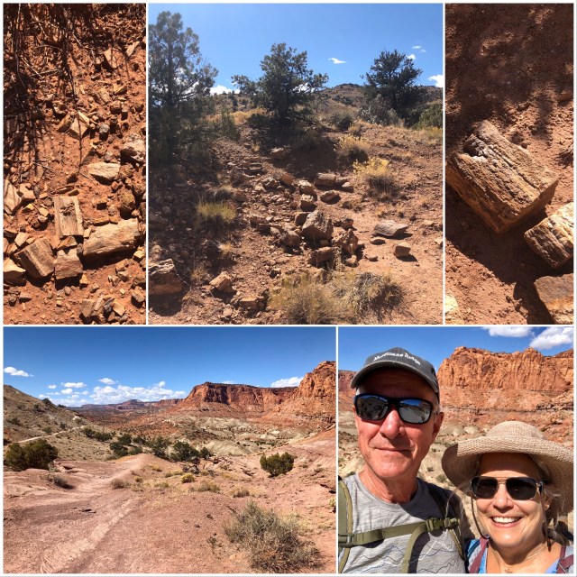
As we walked along, I noticed some rocks off the trail that looked a lot like petrified wood. I went over to see, and, sure enough, that’s what it was, completely unmentioned in all the various trail guides and descriptions I had read.
This was, without a doubt, one of the best hikes of the trip! We were amazed that there was nobody on the trail besides us.
Here’s the view at the end. You can just make out the trail, bottom left.
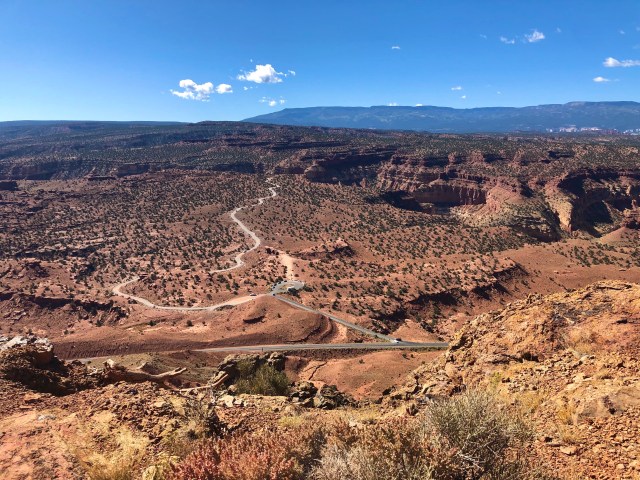
After returning to the Jeep, we drove to the overlook at Panorama Point to see the Goosenecks canyon. One theory is that the Sulphur River that created the Goosenecks simply cut its way down through the upper Moenkopi rock layer from the surface to expose the 270 million year old Kaibab Sandstone, below. That Kaibab Sandstone, by the way, is the same rock as the top strata of the Grand Canyon, 160 miles to the southwest.
It was a great day. Tomorrow we’ll see what else this area has to offer.

I enjoyed your post related to Capital Reef. I did quite a bit of backpacking/hiking this summer to include Zion and a couple of the Alpine Lakes in Northern Utah before moving on to Yellowstone and Glacier National Parks, the Pacific North West and then back down through Northern California. I have been to Bryce Canyon, Navaho National Monument, Escalante, Lake Powell, Monument Valley, and the Grand Canyon during my mid-life crisis years ago, but not Capital Reef, and your post has me putting it on my list, thanks!
Roger Jenkins
Pursuing Balance Through Adventure
https://utahhikingpursuingbalancethruadventure.wordpress.com/
LikeLike
Happy Hiking! I’ve also been to many of the same places (and blogged about them).
LikeLiked by 1 person