Arches NP lies due north of Moab. To the southeast is another National Park: Canyonlands, NP, the largest in Utah. Between the two is Dead Horse Point State Park, the bluffs of which you can see in the photograph, below, in front of the distant La Sal Mountains.

The road into the northern district of Canyonlands NP passes the entrance to Dead Horse Point SP, but having visited Dead Horse when we were here in 2008 – and determined to see as much of Canyonlands in one day as possible – we passed it by.
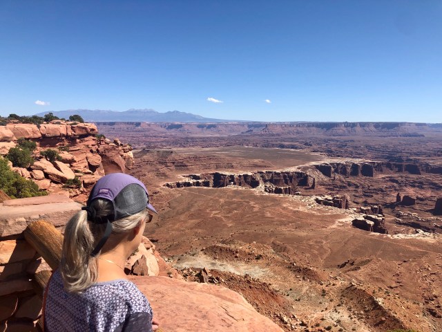
Our first stop this day was Mesa Arch, an easy half-mile walk to the overlook from which I took the photos above and below. Dale is sitting on a part of the Arch, the opening just visible where the rock snakes along to the right.

Here’s the full panorama of what is known as Buck Canyon, viewed through Mesa Arch

After enjoying the view from Mesa Arch for awhile, we headed north on the internal park road to Upheaval Dome, an atypical geologic feature for this area, the origin of which has been in dispute since its discovery over 100 years ago.
Viewed from directly above, Upheaval Dome looks like a circular crater, 3 miles in diameter. Indeed, one theory – the more sensational of the two – is that it is, in fact, a crater, the result of an oblique meteor strike. But the duller theory, that Upheaval Dome is the result of what its name implies – the upward push of a pinched off salt dome, a salt diapir – seems to be the more likely explanation.
[Note: the poster, below, located at the trailhead to Upheaval Dome, asserts that “recent evidence favors the impact hypothesis.” I suspect this poster predates more recent scientific study; see here.]
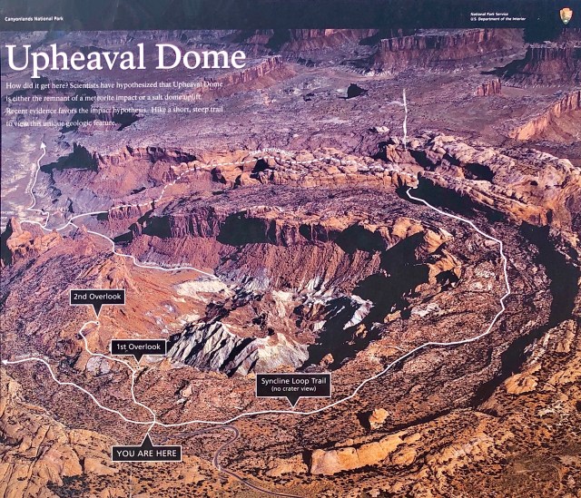
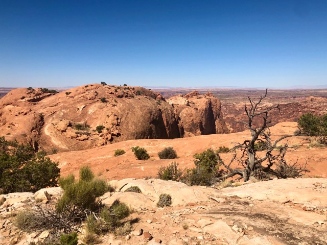
While we would have liked to have hiked the entire 8.3 mile Syncline Loop Trail, we didn’t have time, contenting ourselves with trekking to both the 1st and 2nd Overlooks instead. Here’s the approach to the 1st Overlook:

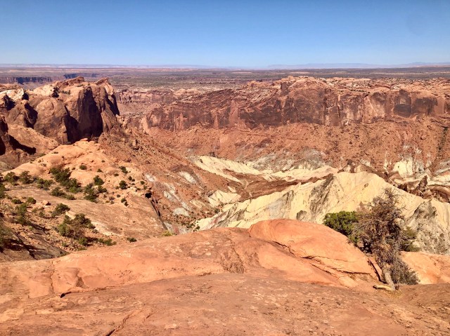
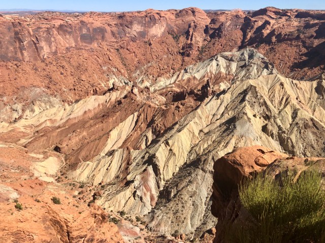
And here’s the view of the interior of Upheaval Dome with the 2nd Overlook to the left at the top of the cliff:
The hike from the 1st to the 2nd Overlook was … um, interesting. At one point, the trail crossed a narrow, rounded, sandstone ridge about 8 feet wide with steep dropoffs to either side. Ordinarily, this would not be a big deal, but today there was a 20 mph crosswind which made it somewhat challenging to traverse.
Below is the view of the uplifted center of the crater of Upheaval Dome. The white rock is the oldest: White Rim Sandstone from the Permian Period, something like 250 million years old. The rocks become younger as they near the rim of the crater, ending with Navajo Sandstone from the Jurassic Period, say 150 million years old, exposed near and along the surface.
From Upheaval Dome, we drove south on the park road to its terminus at Grand View Point Overlook to hike the cleverly-named Grand View Point Trail to its vista over the confluence of Utah’s two mightiest rivers, the Green and Colorado.

Study the Park map, above, and you will notice a pattern: a Y within a Y. The larger Y is comprised of the Green and Colorado Rivers, the arms of that Y, combining at Confluence Overlook and continuing south through Cataract Canyon as the unified Colorado River.
Over the eons, the Green and Colorado Rivers have eroded the surrounding rock creating the Stillwater and Meander Canyons and leaving an intervening thin, high mesa known as the Island in the Sky upon which the NPS has constructed a smaller Y: the park service road.
In between Island in the Sky mesa and the rivers there’s a rim of White Rim Sandstone (the same as at Upheaval Dome). It’s 1,200 feet from the top of Island in the Sky to White Rim and another 1,000 feet from there down to the rivers.
These two immense canyons – Stillwater and Meander – have necessitated that Canyonlands NP be administered as distinct districts: Island in the Sky (between the rivers); The Needles (to the east); and, The Maze (to the west). Island in the Sky is the most popular, garnering over 75% of the Park’s visitor traffic, followed by The Needles at 20%. [Note: there’s a barely-known fourth, non-contiguous district to the northwest called the Horseshoe Canyon Unit.]
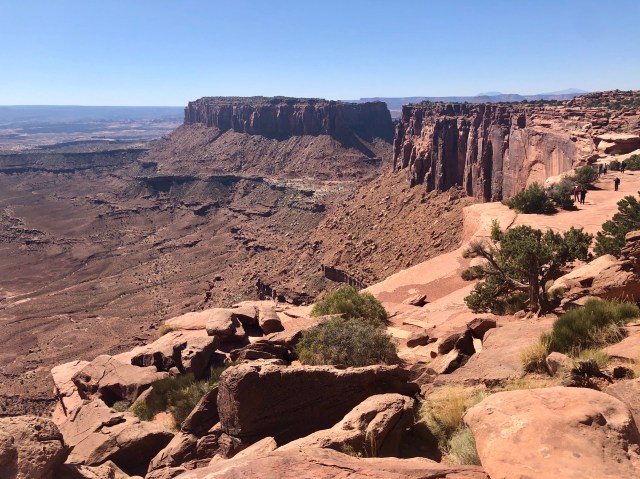
Here’s the view looking east from Grand View Point Overlook at White Rim with Meander Canyon and the Colorado River below and beyond:
If you look closely at the photos above and below, you’ll see a dirt road running along the edge of the cliffs on White Rim mesa. That’s White Rim Road, a 100-mile loop around Island in the Sky that normally takes 2 to 3 days to cover, suitable only for high-clearance, 4-wheel-drive vehicles or mountain bikes (permits required), an expedition for a future visit.

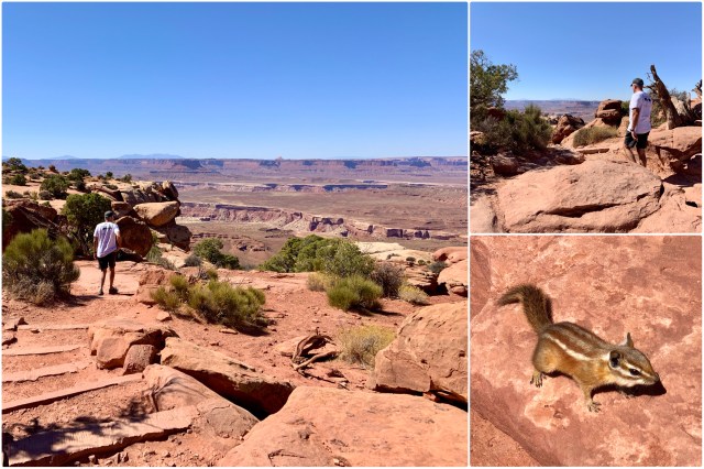
The Grand View Point Trail starts at the Overlook on the Colorado River and Meander Canyon side and continues along the cliff edge to the Point, overlooking Junction Butte:
It’s an easy, 2-mile round-trip walk to the Point and back. Near the end, the trail makes its way over to the Green River and Stillwater Canyon side where we were greeted by two Hopi Chipmunks:
Here’s the view from the Point looking: first, at Junction Butte; then a panorama of the confluence of the Colorado and Green Rivers; and, finally, Stillwater Canyon:

In William Shakespeare’s Romeo and Juliet, Act 2, Scene 2, Juliet famously says,
O, be some other name! What’s in a name?
Oh, wait, the famous part is:
That which we call a rose, by any other name would smell as sweet.
That sentiment may be true concerning Montagues and Caputlets, but it doesn’t hold here on the Colorado Plateau. This place requires names. Can you imagine Canyonlands, Upheaval Dome, White Rim, Mesa Arch, Meander Canyon or Grand View Point being called anything else?
As the ancient Chinese saying goes, at least as human comprehension is concerned,
Naming is the origin of all particular things. Tao Te Ching, ch.1
