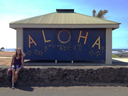
Yesterday, we drove to Ka‘u, the southwestern district of the Big Island, home of the real southernmost point of the United States, contrary to what they think in Key West.
The drive along Highway 11, the Hawaii Belt Road, descended 4,000 feet from Volcano to sea level. Our first stop was the black sand beach at Punalu‘u.
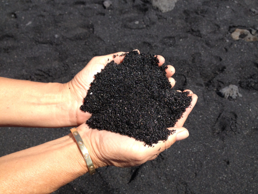
The black sand is pulverized volcanic rock…

It’s not like the sand we have in Florida. This stuff really glistens; it’s almost glass-like. And the grains are a little courser, kind of like the grit on rough sandpaper; and it doesn’t stick to you like our sand does.
After Punalu‘u Beach, we continued to South Point Road, the turnoff to Ka Lae, the southernmost point of Hawaii, believed to be the first landing site of the polynesians that were the ancestors of the Hawaiian people.
The 12 mile drive down South Point Road took us through ranch country. Dale couldn’t resist pulling over to feed the horses.

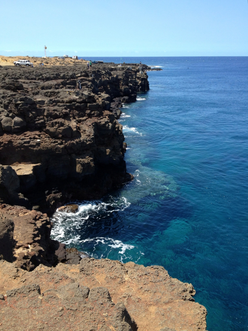
Ka Lae is a desolate, windswept area where the gently sloping base of the Mauna Loa volcano reaches the Pacific Ocean. But it juts out into the sea and marks the beginning of the western (Kona) coast of the Big Island.
Because of the way it reaches out into the ocean, Ka Lae is a fisherman’s dream, one of only two places in the world that it is possible to successfully fish for pelagic fish from shore. Some ingenious fishermen prefer fishing on the water, though, so they have rigged up hoists to lower and raise small fishing boats from the top of the cliff.
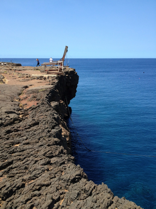
Dale quizzed one of the local fishermen about his technique. He told her that he uses deep sea trolling gear, but rather than attempt to cast, he attaches balloons to his line and leader and the wind blows his rig out into the deep water. You can see the balloons (in black) in the distance in this photo, one just to the right of Dale, the other further to the right of the fishing pole:
This fisherman told us that he has caught marlin and sailfish from this cliff top. The tricky part is landing them! It’s a 40 foot drop from the top to the water.
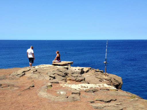
After talking with our fisherman friend, we walked on down to the real Southernmost Point where Dale took this picture of me:

Behind me is the rough southern coast with choppy seas from the prevailing southeasterly winds. But just to the right, the Southern Point blocks the wind and the current at the start of the Kona coast of Hawaii.
We walked around to that side of the point and searched for life in the tide pools. You can see how calm the water is, just around the corner.

In a couple days, we’ll be visiting the Kona coast.
