Yesterday, as we began our travels south in Maine, we took a wrong turn out of Calais and – purely by accident – ended up at West Quoddy Head State Park. We continued driving, looking for somewhere to turn around, which isn’t as easy as it sounds when you’re on a rural road, driving an RV, towing a Jeep.
A typical travel lane is around 9 feet wide on rural roads, one of the many odd trivia facts I learned during my many years of handling eminent domain litigation around the country. So, one lane each direction, plus minimal swales on each side, gives you a 22-foot wide roadway in areas like the one we were in.
I know that our RV is 28 feet long, according to the manufacturer, but with the Jeep in tow we’re 47 feet long (we were measured at the Ferry in Digby because the ferry rates are based on length). Try turning a 47-foot rig around on a 22-foot wide roadway – not gonna happen.
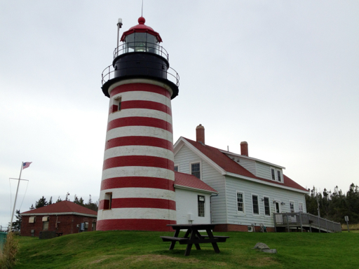
Anyway, we keep driving east, looking for somewhere to turn around until we came to the end of the road. And there, in front of us, was a candy-striped lighthouse:
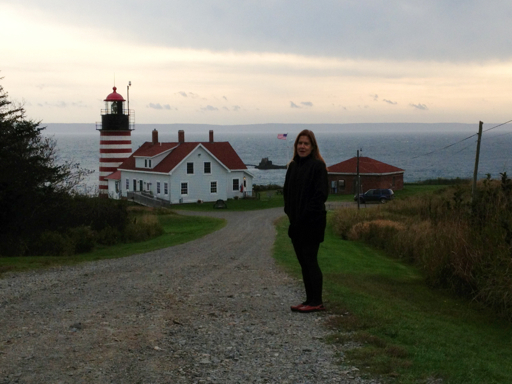
We figured that since we were there, we’d go take a look. Lo and behold: it turns out that we were standing on the easternmost point of the United States of America!

As with everything along the coast on this trip, it was very scenic.
So, this year we’ve inadvertently been to the southernmost point of the USA in Hawaii, the southernmost point of the continental USA in the Keys and the easternmost point in the USA in Maine. Last year, we inadvertently found ourselves at the geographic center of the continental USA in, I think, Kansas.
I guess we have a couple more places to add to our “Bucket List.”
Oh, by the way, there was a turn-around in the lighthouse parking lot.
