Not long after we crossed into the Yukon, the Cassiar Highway ended at a T-junction with the Alaskan Highway, also known as the Alaska-Canada Highway or the “Alcan.” We took the Alcan from that junction all the way to Whitehorse, the capital of the Yukon territory (Yukon is not yet sufficiently populated to become a province).
The Alcan was built by the U.S. Army Corps of Engineers in a single year (1942) during WWII to link the lower 48 states with the then-territory of Alaska in order to move troops and equipment there in defense of a possible Japanese invasion which, as we all know now, never materialized (the Great Generation’s version of the “Slam Dunk” of WMDs in Iraq, I suppose). The deal was that the U.S. would pay for and build the road and after the war it would be turned over to Canada, which it was. The Alcan was opened to the public in 1948. Unlike the other roads we traveled in BC, the Alcan is marked – somewhat inconsistently – with mileposts (the same goes for the northern part of the Cassiar, generally marked every 5 km).
The border between British Columbia and the Yukon Territory is the 60th parallel, that is, latitude 60°N, two-thirds of the way from the equator to the north pole. It separates Canada’s 3 northern territories from its southern provinces, and passes through Alaska, the northern tip of Canada’s Quebec Province, the southern tip of Greenland, the Shetland Islands north of Scotland, Norway, Sweden, Finland and Russia. Besides these countries, only Iceland lies north of the 60th parallel.
As soon as we left Teslin, the character of the land changed, everything seeming somehow more majestic. It’s easy to see why the Yukon’s motto is: “Larger Than Life.”

We pulled into Whitehorse on Saturday, July 14, around 2:00 in the afternoon and checked in at the Hi-Country RV Park on the outskirts of the city. In every respect, Whitehorse is a typical, modern, North American city with big box retail stores, over 70 restaurants and fast food joints, grocery stores, bars, offices, service establishments, you name it. There were even RV sales and repair facilities and the most amazing auto parts store, Canadian Tire, where I was able to get all the miscellaneous supplies and parts I had been looking for since we left Washington.
The total population of the Yukon territory is around 38,000, of which about 70% live in Whitehorse. The next biggest town is Dawson City with a mere 1,375 people. All the other settlements in the Yukon have fewer than 1,000 inhabitants. American Indians, known here as First Nations people, are about 20% of the population of the territory. From what I’ve seen, they make up most of the population outside of Whitehorse.
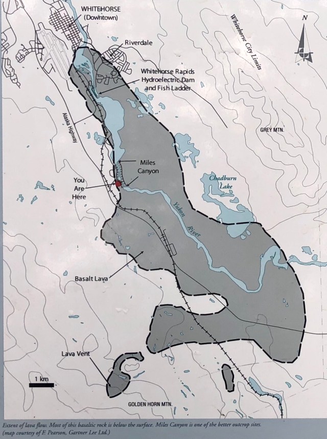
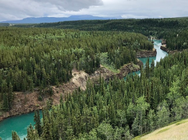
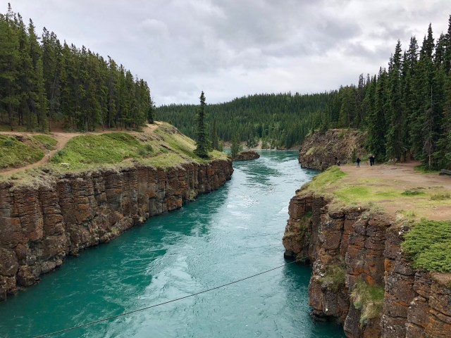
The Yukon River flows right through the center of Whitehorse, continuing north and west into Alaska where it empties into the Bering Sea, 2,000 miles from its headwaters. Just a couple miles from where we camped, the Yukon narrows and flows through the steep and narrow Miles Canyon, carved out of an ancient basalt lava flow. That’s the “You Are Here” on the map, below (we are camped at the “H” in “Alaska Highway”).
Here’s a view of Miles Canyon from “You Are Here:”
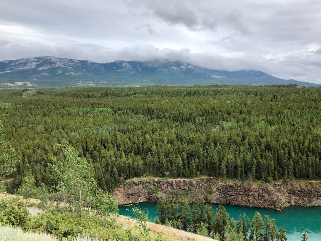
Beginning Sunday morning and continuing until we left Whitehorse on Tuesday, there was sporadic rain, but we were able to get out to do two hikes: one along the east bank of the Miles Canyon; the other to the summit of Grey Mountain which is also visible on the map, above (to the right of Miles Canyon), and in the distance in the photo below, taken from the same viewpoint as the photo, above.
Miles Canyon was feared by the “stampeders” that flooded into the area in 1897-98, anxious to make their fortunes as prospectors in the Klondike Gold Rush taking place downriver to the northwest in Dawson City. Over 100 boats sank trying to navigate Miles Canyon and the Whitehorse Rapids just downstream and 10 prospectors lost their lives here.
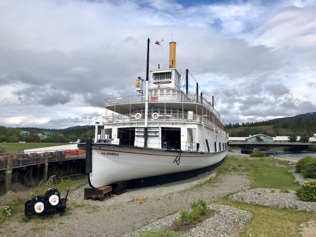
Years later, after the city of Whitehorse developed, a hydroelectric dam was built across the Yukon River between Miles Canyon and Whitehorse (see the map, above) which caused the water upstream to rise, erasing the rapids and causing the current to slow, though it still rips through here at a pretty good clip. The S.S. Klondike, the old paddleboat that used to ply the waters below Whitehorse Rapids in the early 1900s, was ultimately retired and literally dry-docked in Whitehorse where it’s now a National Historic Site:
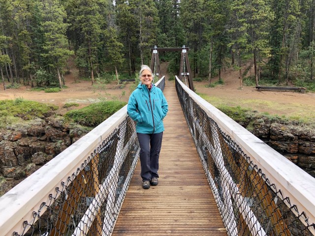
We drove down from the overlook and crossed a suspension bridge to the canyon’s edge trail on the east side of the Yukon River.
This photo is looking south, up-river:
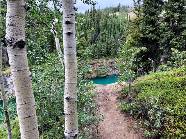
It was a beautiful 2 mile hike,…
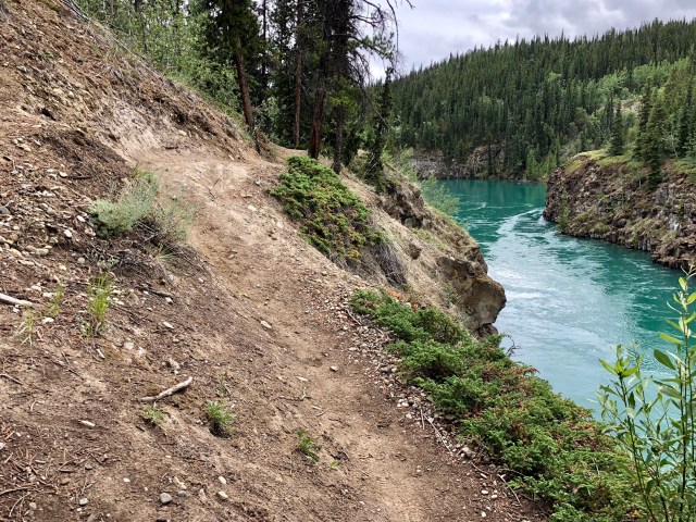
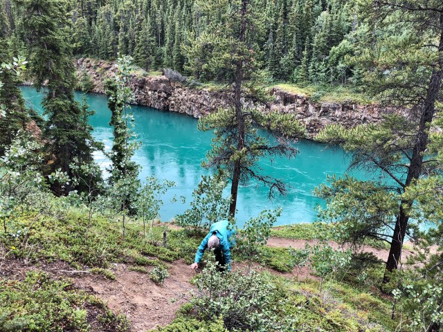
… but the trail did get a little dangerous here and there with a sloped and narrow path that dropped straight off into the rushing Yukon about 40 feet below.

We had to finish with a little scrambling up the embankment to avoid the really bad sections that you can see in the photo just following the map, above – the area that looks like a landslide.
Our hike the following day was to the summit of Grey Mountain, several miles to the east of Miles Canyon. Dale made sure to point out the fresh bear scat at the trailhead with her hiking pole.
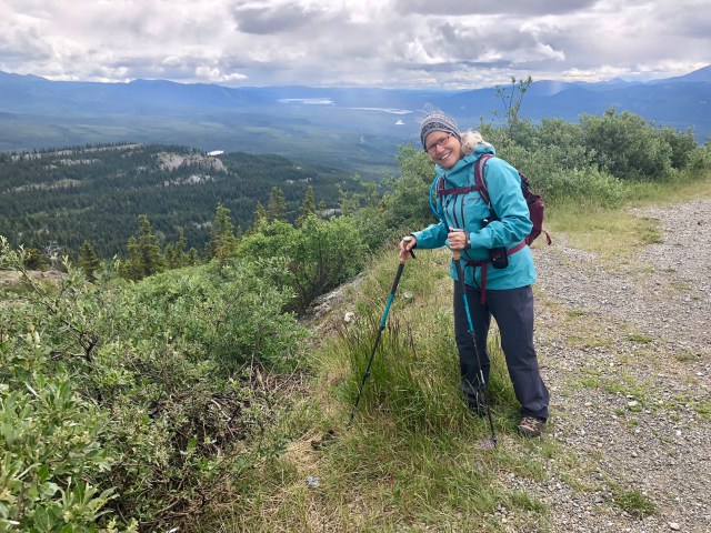
The trailhead is adjacent to a radio tower on the lower ridge of Grey Mountain at an elevation of around 4,300 feet. It gradually, but steadily, rises to the summit at 4,900 feet:

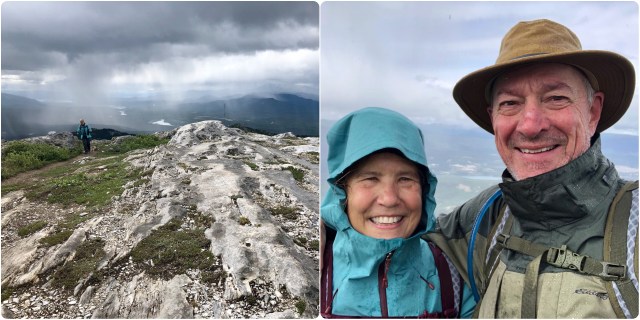
We could see rain showers to the east in the valley, below, but they looked like they would miss us.

About halfway to the summit, we came upon a particularly challenging section; fortunately, we found an alternate route on the return trip (note the radio tower at the trailhead behind us in the distance):

A selfie to congratulate ourselves for having made the summit as the rain shifted our way:
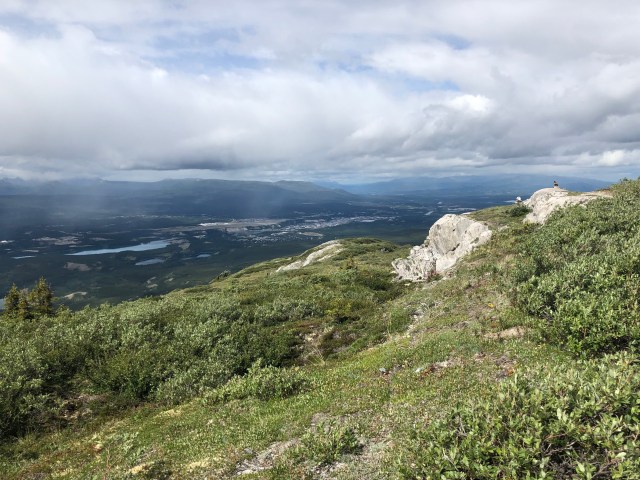
A nice view of Whitehorse from the top:
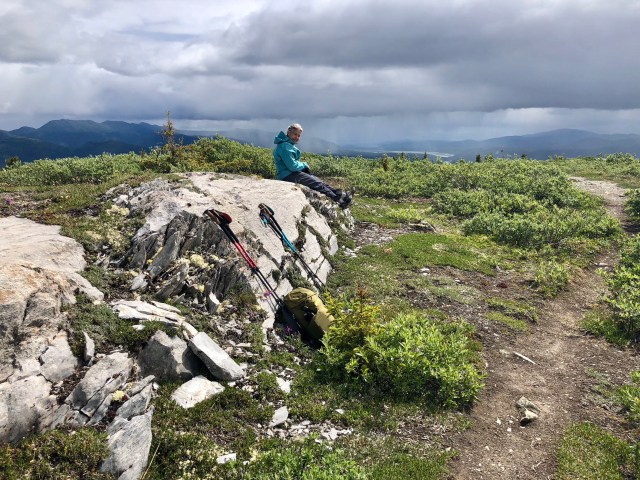
And time for a lunch break in between rain showers:
Then it was time to return along the ridge to the Jeep for the drive back to the campground.

Most Alaska-bound travelers head north from Whitehorse to Dawson City, but we’re detouring south to Skagway and Haines in Alaska, for a side trip to Glacier Bay National Park before returning to the Yukon for some more hiking.
