We left Whitehorse late Monday morning and drove south for 10 miles on the Alcan to where the Klondike Highway (Yukon Hwy 2) veers off to Skagway, Alaska, 98 miles distant.
The Klondike Highway’s northern terminus is Dawson City and its route and name are a result of the Klondike Gold Rush of 1898, gold having been discovered near Dawson City on August 16, 1896, when North America was suffering from an economic depression.
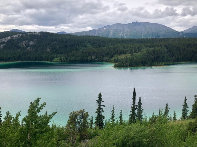
Perhaps an hour out of Whitehorse, we stopped for lunch at a pull-off overlooking Emerald Lake. It was serene. For about a minute. And then the tour buses arrived.
The Klondike Highway is not only the route that the stampeders took from Skagway to Dawson City in hopes of striking it rich in the Klondike gold fields, it is also the route that the cruise ships use to ferry tourists from the terminal at Skagway on excursions into the scenic Coastal Mountains – a more modern way of extracting gold.
You’ll recall my recitation of vehicular traffic on the Cassiar Highway in an earlier post. Well, the Klondike Highway is a different animal entirely. On the Klondike, we were constantly passing and being passed by tour buses, big and small, always in a hurry. At every pull off, they stop and let the cruise ship tourists out to snap their pictures, then they all pile back in to zip down the road to the next photo op. They – and their ship – are on a tight schedule.
We are not, thank goodness. Canada and Alaska are not places to be rushed.

It’s 92 miles from our campground in Whitehorse to the Alaska border, but only 57 miles of that drive is in the Yukon, the other 35 miles traversing British Columbia.
About halfway to the USA/Canada border, we passed by the settlement of Carcross. Prior to the 1950s, there was just a railroad and two trails – the White Pass and Chilkoot Trails – between Carcross and Skagway. This southern section of the Klondike Highway wasn’t completed until 1978 and it wasn’t open to year-round traffic until 1986, which, coincidentally, was the year the adjacent railroad shut down its commercial operations.
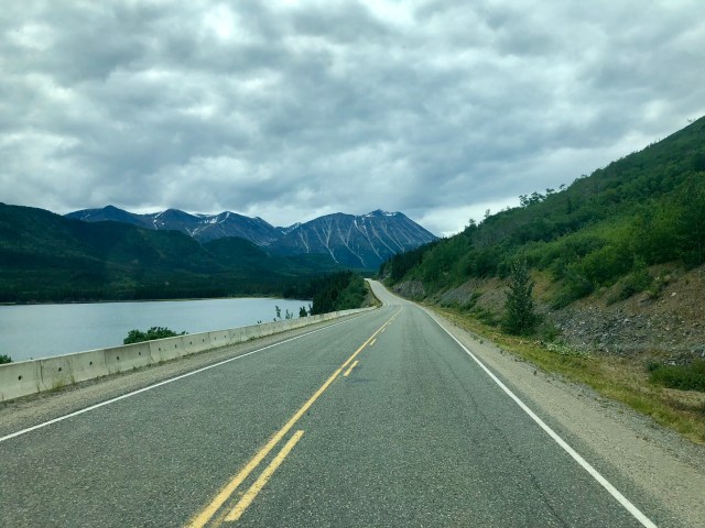
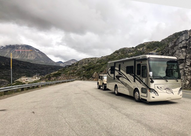
I took the photo, below, just as we crossed the “state line” between the Yukon and British Columbia, 35 miles from Alaska:
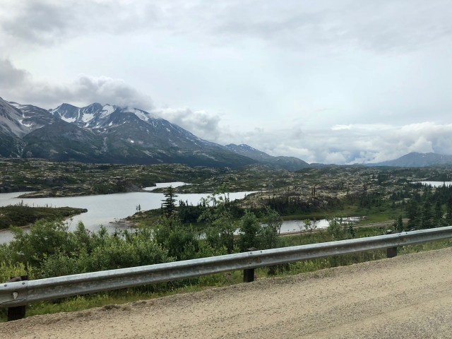
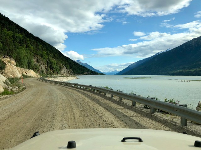
As we got closer to the border, the sun peaked from behind the clouds, brightening the alien landscape of scattered boulders and glacial till.
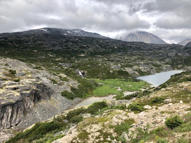
The actual, physical border between the United States and Canada is at the top of White Pass, elevation 2,867 feet, 14 miles from Skagway. But the immigration and customs border crossing is several miles downhill, it being too difficult to maintain facilities at the actual border during the winter snows and avalanches.
This is the view from just before the border (sensors and antennae on the left), looking into Alaska:

And here’s a photo looking back into Canada from the same spot:
Just beyond the border and the “Welcome to Alaska” sign, the Klondike Highway is Alaska Route 98 (as in 1898, the gold rush year).
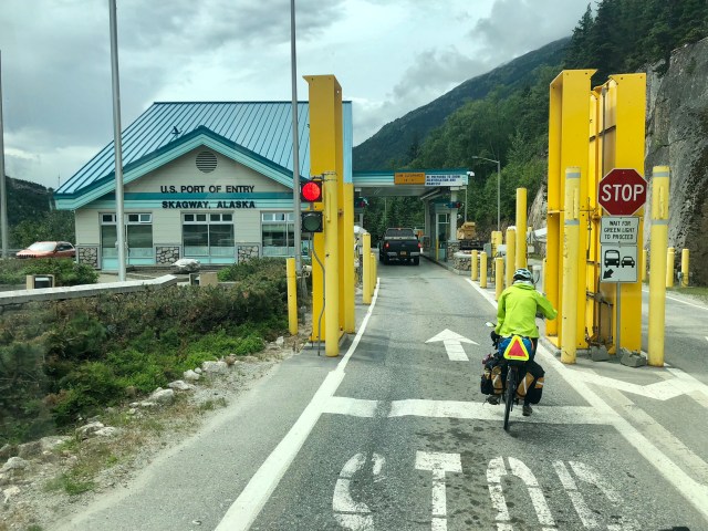
After a several mile 6% downhill grade, we reached the U.S. border entry station, just behind another of those hardy cyclists.
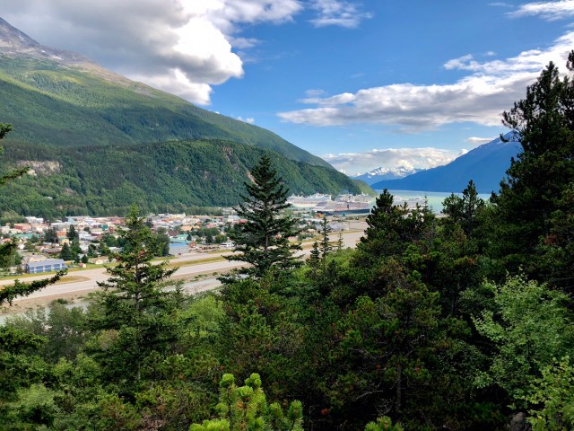
And, then, the cruise ship terminal of Skagway. Here’s a photo of the main street through town, Broadway, looking south at the port.
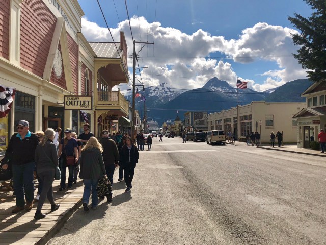
Skagway sits at the northern end of the Inside Passage through southeast Alaska at the northern terminus of the Lynn Canal. When we arrived, there were five cruise ships in port and about 10,000 passengers milling about. It reminded me of Key West and how opening the harbor there to cruise ships had made the merchants happy, but had destroyed the ambiance of the town. The same thing has happened here. Good for business, bad for the place, itself.

We checked in and set up at the municipally-owned Pullen Creek Campground down on the waterfront, walked the town and then drove the Jeep over to the inlet west of Skagway, the former Indian settlement of Dyea.
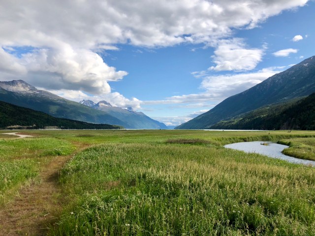
I took the photo, below, from the location of the town of Dyea that grew here during the gold rush days. It was short-lived, though, because a railroad was built from Skagway to Carcross which made Skagway the center of commerce for the area.
It was a beautiful drive around Taiya Inlet on the way back to Skagway…
… with a nice panoramic view of Skagway around the point:
The White Pass & Yukon Railway still operates from Skagway to Carcross as a tourist attraction and we’ll be taking it to White Pass tomorrow, rain or shine.
