The day after our last hike in Kluane NP, July 29, we drove northwest on the Alaska Highway to the U.S./Canada border, then on to Tok (“Toke”) where we turned southwest onto the Tok Cut-Off, Alaska Route 1. Not long after leaving Tok we saw a cow moose and her calf grazing on the edge of the right-of-way. About 60 miles later, we pulled off the Tok Cut-Off at Nabesna Road and stopped at the National Park Service’s (NPS) Slana ranger station near the junction.
After picking up maps and pamphlets at the ranger station, we drove 1/4 mile further down Nabesna Road to the Hart D Ranch to camp for the night. The owner and operator, Mary Frances DeHart, is an artist. She’s also the local Postmaster, having built the post office, shown below (she’s the lady in the photo). Quite a handy-woman.
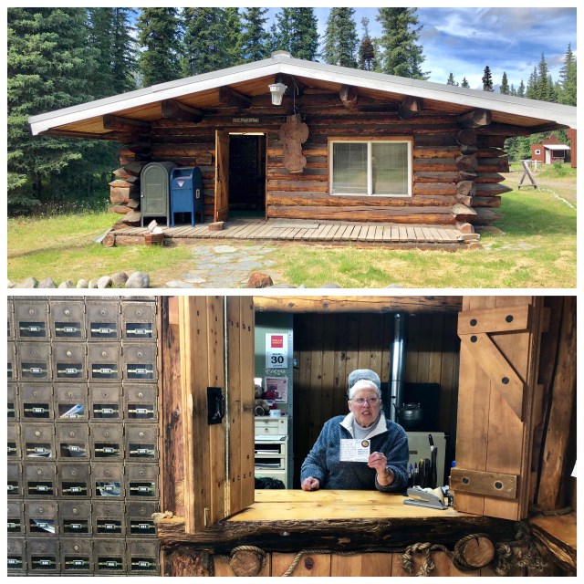
Mary Frances has led quite a life. She came to the Wrangell Mountains in the 1950s and has survived 65 harsh Alaskan winters, two husbands, and the taking of her 60,000 acre grazing lease by the NPS for the Wrangell-St.Elias National Park in 1980, an event for which no compensation was paid by the government, grazing leases not being considered constitutionally-protected property. She has been living here in the Alaskan outback handling the mail and operating her Hart D Ranch alone since 1997. I asked her where she goes for groceries way out here in the woods and she answered, “Honey, I haven’t been to town since November of last year!” Write your memoirs, Mary, you’d sell a million copies.
Wrangell-St.Elias National Park and Preserve is the largest single land unit in the National Park system, covering a total of 13.2 million acres or 20,587 square miles, 65% of which is National Park, the other 35% being National Preserve. Hunting and fishing are allowed in National Preserves, but not in National Parks, with the exception of subsistence hunting and fishing which is allowed in both, recognizing humans as part of the natural ecosystem.
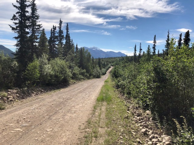
On Monday we drove the Nabesna Road to its end, 42 miles distant. The Nabesna Road was built to access a gold mine that operated in the Wrangells in the early part of the 20th century between the great wars.
At mile 4 of the drive, we turned down cleverly named 4-Mile Road which heads off to the north to the Slana Settlement. In 1983 the federal Bureau of Land Management released 10,000 acres here for homesteading. Nearly 800 claims were filed, but most were abandoned and only about 50 people live in Slana today.
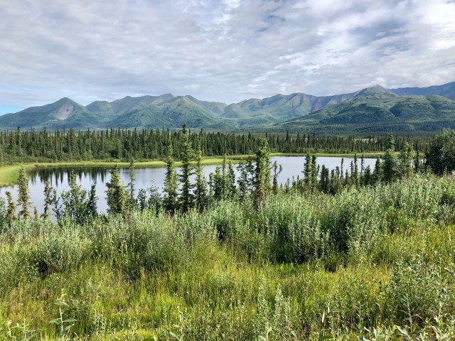
Returning to Nabesna Road and continuing our drive east, we stopped to look south, trying to discern one of the higher, snow-capped mountains of the volcanic Wrangell Range, Mt. Sanford (elev. 16,237 feet), miles off in the distance.

The scraggly trees you see in the pictures above and below are black spruce which typically grow in the shallow soils that lie above the permafrost. We continued our drive east, stopping to take the photo below of the Mentasta Mountains on the north side of the road.
Around mile 25, we crossed the Watershed Divide, the highest point on the Nabesna Road at an elevation of 3,320 feet. Waters flowing west from here flow into the Copper River and then into the Gulf of Alaska; waters flowing east go to the Yukon River and ultimately the Bering Sea.
Beyond mile 29 we forded two creeks (a third was dry), then passed Skookum Volcano, a ancient, deeply eroded volcano on the south side of the road.

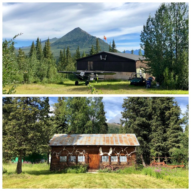
At mile 42, we arrived at Devil’s Mountain hunting lodge and its grass runway with several bush pilots milling around by their big-tired Piper Super-Cub bush planes. As we drove by, we noticed a couple of the lodge guests, modern-day prospectors, loading up their SUV with metal detectors.
A half mile further, the road appears to dead-end in a parking area at the trailhead for the Rambler Mine Trail. The terrain here is overgrown and the trail description says this is bear territory. Since we hadn’t brought along our bear spray or air horns – nor had we packed today for a strenuous hike – we opted to turn around here and returned to the RV back at Hart D Ranch, a total drive of 85 miles.
Reading about the area later, I discovered that – hidden from view at the Rambler Mine Trail parking area – the road continues through the brush for another 2 miles along a now-overgrown dirt track to the abandoned Nabesna Gold Mine, listed on the National Register of Historic Places in 1979, that operated here from 1925 until 1945! Yet, no mention of this anywhere! I wonder why?
According to the NPS application for listing on the National Register, the Nabesna mine produced a total of 2.5 tons of gold and 5.0 tons of silver while it was in operation. At its peak in the late 1930s about 70 men worked here. Here’s a map I copied from the NPS application compared to a current aerial photo of the place:

The NPS application also said that up the road from the mine was an old prospector’s cabin, built in 1912, that served as the DoDrop Inn, a brothel, during the heyday of the mine. Was that the cabin we passed on the way in (photo, below)?
In a couple days, we’re driving another old mining route, the McCarthy Road to the abandoned Kennecott Mine. Like Nabesna, Kennecott Mine is a designated National Historic Landmark, but Kennecott has been preserved and is being renovated. Perhaps I’ll be able to solve the mystery of the old Nabesna Mine there.
We only stayed at Hart D Ranch one night, then headed south on the Tok Cut-Off to Glennallen at the far western edge of the Wrangell-St.Elias NP where the Tok Cut-Off becomes the Richardson Highway at the intersection with the Glenn Highway to Anchorage.

Pingback: Yellowstone | The Road Less Traveled