While we were camped at Crescent Beach for the week (map, below, top left at arrow), we drove through Port Angeles and up Hurricane Ridge Road several times, once visiting the main Olympic National Park Visitor Center to talk to the rangers about recommended hikes on the north side, and twice to go hiking from the Hurricane Ridge Visitor Center near the end of the road. The distance between the two visitor centers is 18 miles, a little over a 1/2 hour drive.
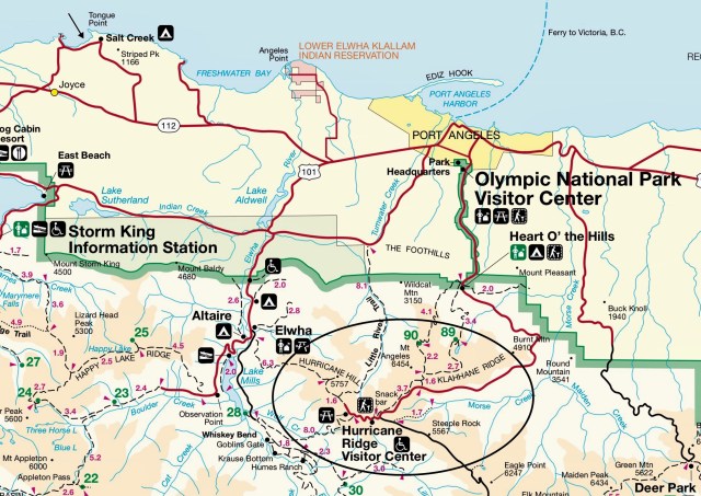
In this post, I’m going to write about our hike up to Hurricane Hill. Ordinarily, hikers park at the trailhead at the end of the road, about 1/4 mile past the Hurricane Hill Visitor Center, but the parking lot at the trailhead is currently under construction and closed (as is the trail on some days), so we parked along the road and walked to the trailhead.
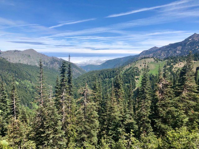
Here’s the view from near the start of the trail, looking north at Victoria on Vancouver Island which you could see if not for the cloud layer in the valley below:
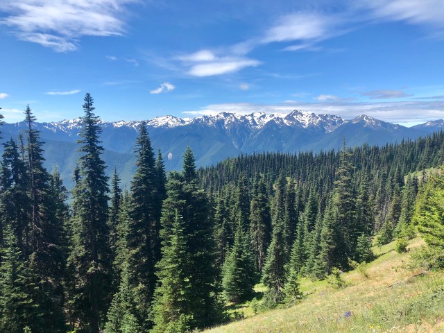
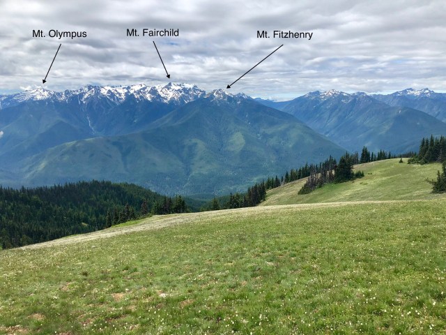
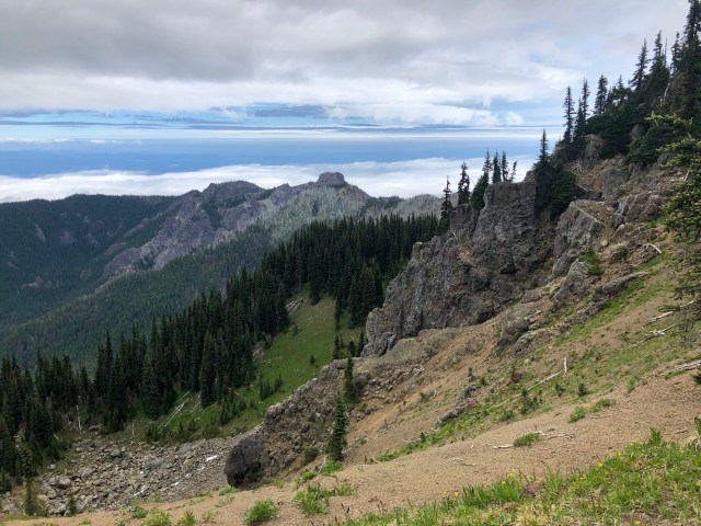
Looking south from the same point on the trail, we had a fantastic view of the Bailey Range of the Olympic Mountains and its highest peak, Mount Olympus (elev. 7,979 ft):
In Bellingham, we live in the foothills of the North Cascade Range of the Cascade Mountains. The Olympics were formed by a completely different geologic process than the Cascades which are volcanic (the highest mountain, Mt. Baker, is an active, but currently dormant, volcano).
The drawings below, taken from the Park Service’s brochure, describe the traditional view of how the Olympic Peninsula and Mountains were formed. The first step in the process, which occurred more than 30 million years ago, is believed to have been the creation of a large volume of basaltic volcanic rock (24,000 cubic miles of it) on the ocean floor as a result of undersea volcanoes (that is, seamounts) or by cracks in the earth’s mantle through which lava oozed. Over the eons, sediments were deposited over and around the basalt forming sedimentary rock (such as sandstone, shale and slate) about 20 million years ago.
These rocks sat on the ocean floor, riding the Juan de Fuca Oceanic Plate slowly to the east in a slow-motion collision with the much larger and thicker North American Plate. As the plates collided, intense pressure pushed the seamounts and sediments up as the Oceanic Plate dove below the North American Plate – a process called subduction – scraping the volcanic and sedimentary rocks off the diving Oceanic Plate and piling them up layer upon layer like a pile-up of cars on the highway. You can see the result of this process in the drawing, below, top left, where the basaltic rock is labeled “Crescent Formation” and the sedimentary rock is labeled “Core Rocks.”
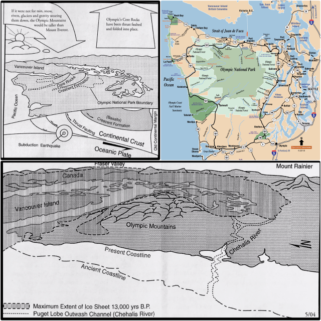
As the Oceanic Plate continued its ever-so-slow march eastward, the rocks continued to crush against the American continent and Vancouver Island, folding and buckling into the Olympic Mountains we were hiking this day.
About 13,000 years ago, during the last Ice Age, an ice sheet descended from the north filling what is now Puget Sound and wrapping around the Olympic Peninsula (drawing, above, bottom), eroding some of the peaks and valleys as it melted and withdrew.
From our vantage point on the trail, we could just make out Mt. Olympus in the distance to the south:
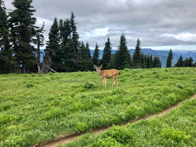
At the top of Hurricane Hill, we took a side trail westward across a beautiful meadow that – if I didn’t know it wasn’t the case – I would have thought had been planted and mowed. We sat and had lunch, watching two young Black-tail bucks graze nearby. They were soon joined by a third, then a fourth, then a fifth.
Once we had finished eating, we resumed our hike to the west, stepping off the trail to give this guy some room:
A little further along, two more young bucks came out of the trees to follow us:
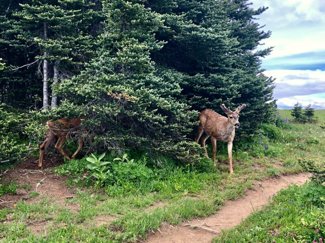
At times, we couldn’t decide whether to stand still or walk on – this “herd” of eight young bucks seemed to be all around and hiking with us!
Ultimately, we continued, easing along the north edge of the ridge.
It really was a beautiful trail, though not many hikers seem to have taken it, staying on the main trail instead.

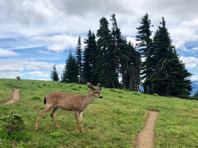
As we rounded a bend, the largest buck challenged us for right-of-way on the trail:
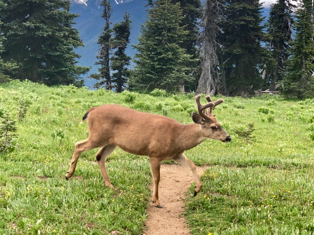
We stopped, then followed him and his younger compatriots for a short distance:

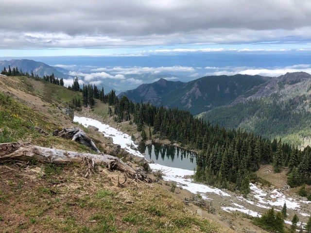
We eventually turned around and made our way back to the main trail and the overlook on Hurricane Hill. There’s still snow up there in mid-June, at least on the northern faces of the mountains (this view is to the northwest):
Hurricane Hill Trail: not an exceptionally challenging hike (I recorded 5.5 miles and a 770 foot ascent), but memorable nonetheless.
