We realize now that our hikes in Arches NP and Canyonlands NP were consecutively more challenging: slick-rock and cliff edges on our way to Delicate Arch; scampering across fins at Upheaval Dome; climbing and stemming in narrow slot openings in Fiery Furnace; and, ascending and descending high-elevation fins in Devil’s Garden.
Now, time to put all those skills together for a singular test: a canyoneering expedition with Moab Canyon Tours (its Rock of Ages excursion) in the rugged Behind the Rocks Wilderness Study Area, a maze of sandstone fins and narrow canyons just southwest of Moab.
Our guide was Alex, a Utah native, lifelong hiker and rock climber, who picked us up at the campground and drove us out Kane Creek Road along the south side of the Colorado River to the Kane Creek parking and staging area used primarily by off-roaders for the 4×4 Pritchett Canyon road.
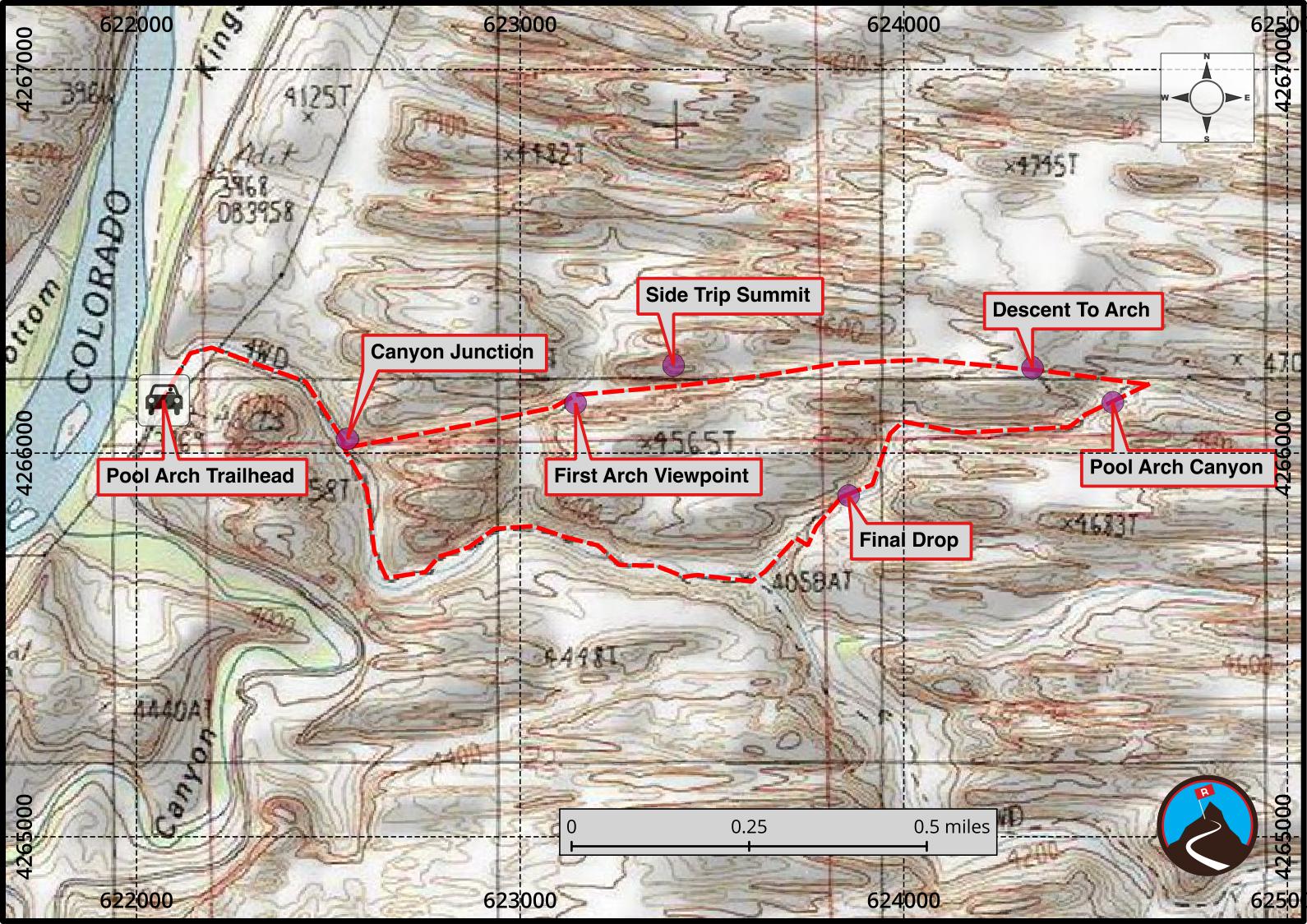
Upon arrival, Alex handed out hardhats and climbing harnesses and we headed east to the trailhead for our ascent up to Pool Arch Canyon. After turning off the Pritchett Canyon 4×4 Road (“Canyon Junction” on the map, further below), the trail meandered through a dry wash lined with Poison Ivy (photo, below, bottom left).
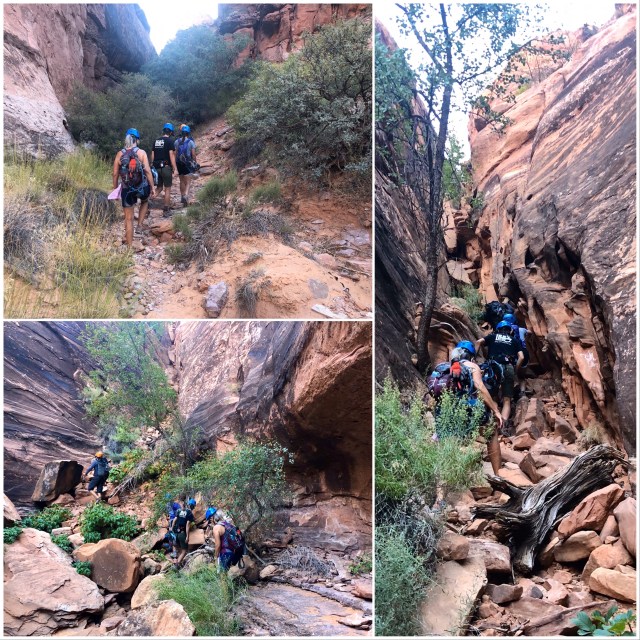
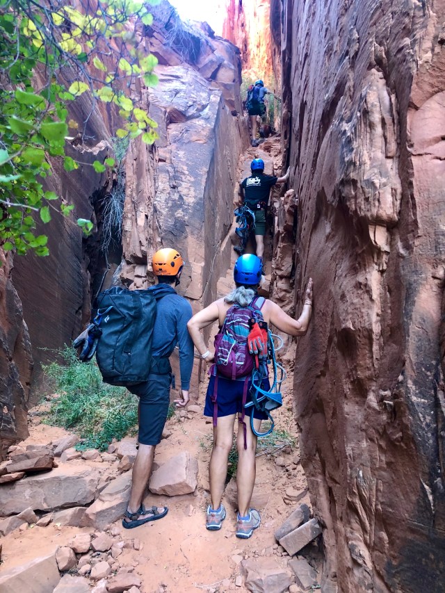
We soon found ourselves at the base of a steep scrambling section. We had to “chimney” up near the top, feet on one canyon wall and back pressed up against the opposing one.

When we surfaced, I stopped to look back and to take a photo of the narrow slot canyon we had just ascended (photo, below, left). We rested briefly, then continued up across dry-fallen rock…
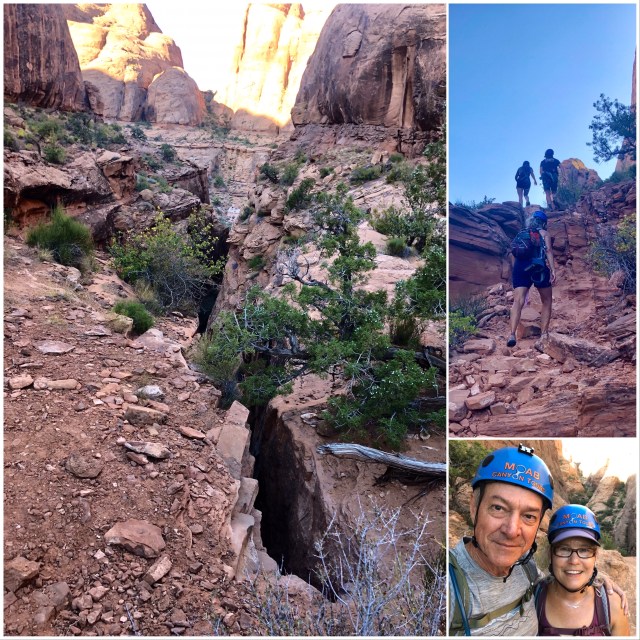
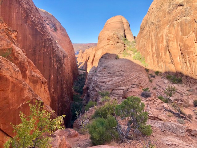
… to a smooth, sandstone area in between fins where I again looked back down the canyon we had just hiked up, noticing an oddly shaped “handle arch” to the left (“First Arch Viewpoint” on the map).
Dakota, Kelly, Alex and Dale had already taken seats in order to admire the same scene. Refreshed, we continued the hike up.
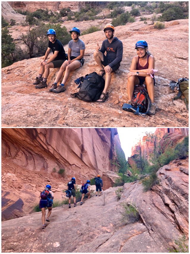
Ahead of us was another challenging ascent. I later learned that the entire ascent from the trailhead is rated “advanced” (Class 4). Kelly, being the only rock climber in our group besides Alex, our guide, led the way all the way up.
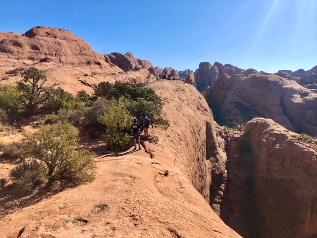
By now, we were approaching the halfway point of our ascent, the location labeled “Side Trip Summit” on the map, below, downloaded from Road-Trip-Ryan’s website.

This second ascent emerged from the slot canyon into sunlight on a smooth, sandstone area (photo below). This was the end of our upward climb. From here to our destination at Pool Arch is a more gentle hike (the dome in the center of the photo is Ryan’s Side Trip Summit).
[Note: if you’re having trouble orienting the photos, just remember that we were hiking east in the morning, into the sun; whenever you see sunlit scenes, like the one below, the photo is being taken looking back toward the west where we began our hike.]
We were pretty proud of ourselves having made it this far. It was a fairly strenuous climb.

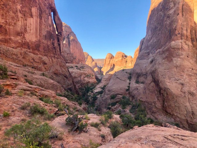
After leveling off, the trail descended slightly as it approached the sandstone fins of Pool Arch Canyon.

Finally at our destination, the end of the trail: the headwall opposite Pool Arch, the void between the two making up Pool Arch Canyon.
But, you know what they say, what goes up, must come down.
