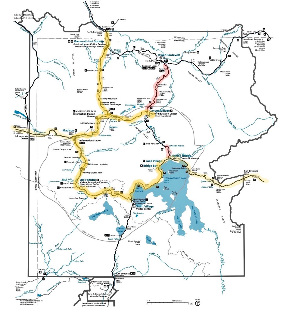
We were informed upon entering the park when we first arrived that the road from Canyon Village to Tower-Roosevelt was closed for the year for maintenance and that there had also been an unexpected closure of the road between Canyon Village and Fishing Bridge due to an overturned fuel truck and the environmental clean-up that accident had made necessary. [Road closures are shown in red on the map, below.]
Consequently, on the day after our visit to Old Faithful, we decided to take the Jeep and visit as much of the rest of Yellowstone NP as possible, our plans to hike the Mud Volcano and several trails on the east side of the park having been interrupted by the road closures.
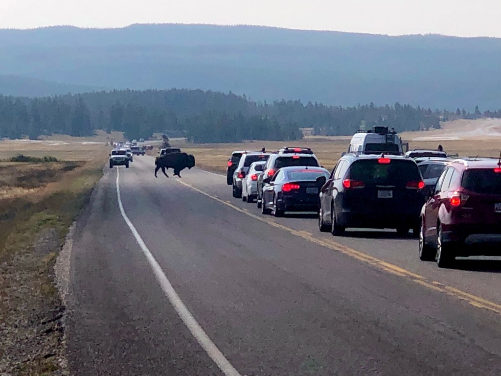
We headed back past Old Faithful from the campground at Bridge Bay, bound for Mammoth Hot Springs at the northern entrance to the park, some 90 miles distant. [Our route for the day is shown in dark yellow; entry and exit from the park in light yellow.] On the way, we encountered a relatively common sight here in Yellowstone:
With traffic and occasional stops for wildlife, it took about two hours to drive from our campsite to Mammoth. After parking and grabbing a quick picnic lunch, we headed off to walk the boardwalk through the Lower Terraces of Mammoth Hot Springs.
As explained by the Park Service:
At Mammoth, a network of fractures and fissures form the plumbing system that allows hot water from underground to reach the surface. The water comes from rain and snow falling on the surrounding mountains and seeping deep into the earth where it is heated. Small earthquakes may keep the plumbing open. Limestone, deposited here millions of years ago when a vast sea covered this area, provides the final ingredient. Hot water with dissolved carbon dioxide makes a solution of weak carbonic acid. As the solution rises through rock, it dissolves calcium carbonate, the primary compound in limestone. At the surface, the calcium carbonate is deposited in the form of travertine, the rock that forms the terraces of Mammoth Hot Springs.
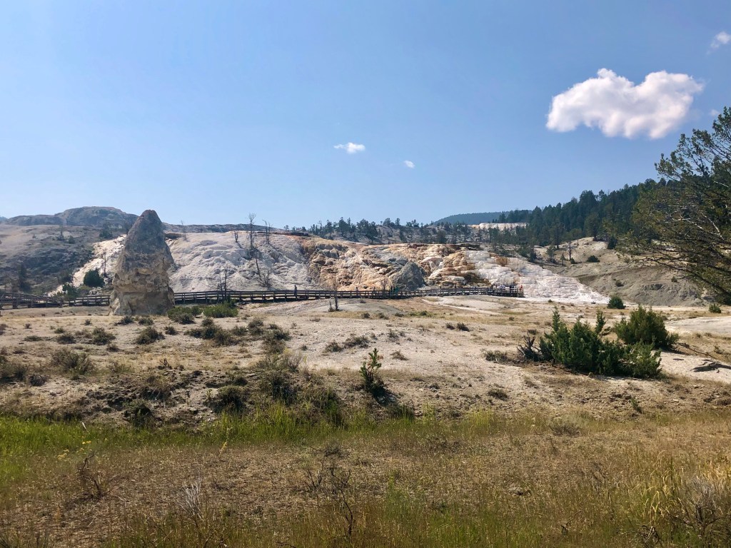
Although travertine is often referred to as a marble, it is actually a type of limestone. We have visited travertine formations like this in Turkey and in Vietnam and have found them to be always beautiful and fascinating.
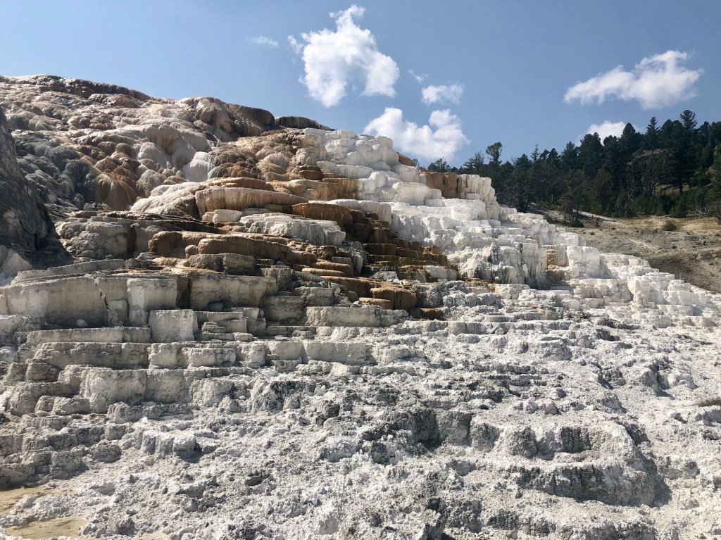
Walking uphill on the boardwalk, we first came to the Palette Spring formation.
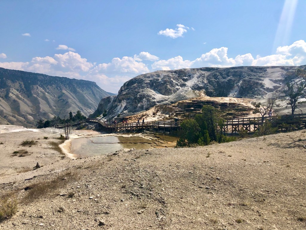
Here’s the view from above Palette Spring with Mammoth Hot Spring Hotel and the visitor center in the background.

We continued up to the top, past New Blue Spring,…
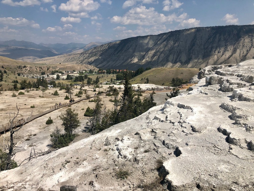
… then made our way back down to the Mound and Jupiter Terraces.
These terraces had been dry for decades, but began flowing and reforming again in the 1980s.

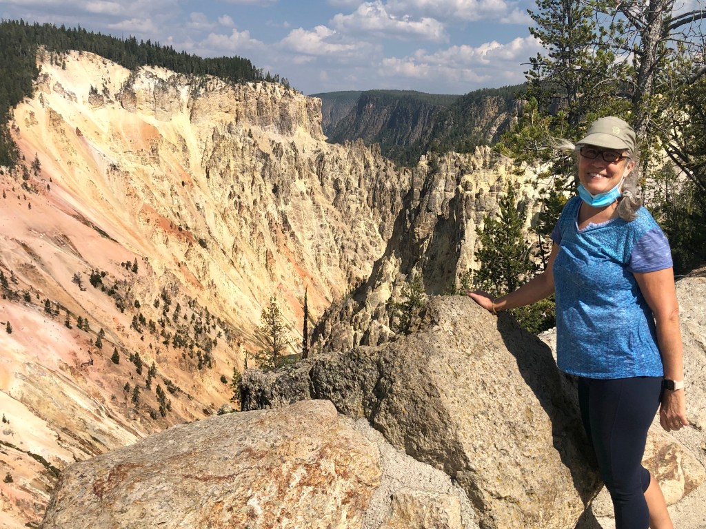
Back in the car, we drove the scenic road through the Upper Terraces, then headed east to see the Grand Canyon of the Yellowstone River. Here’s the view from Artist Point:
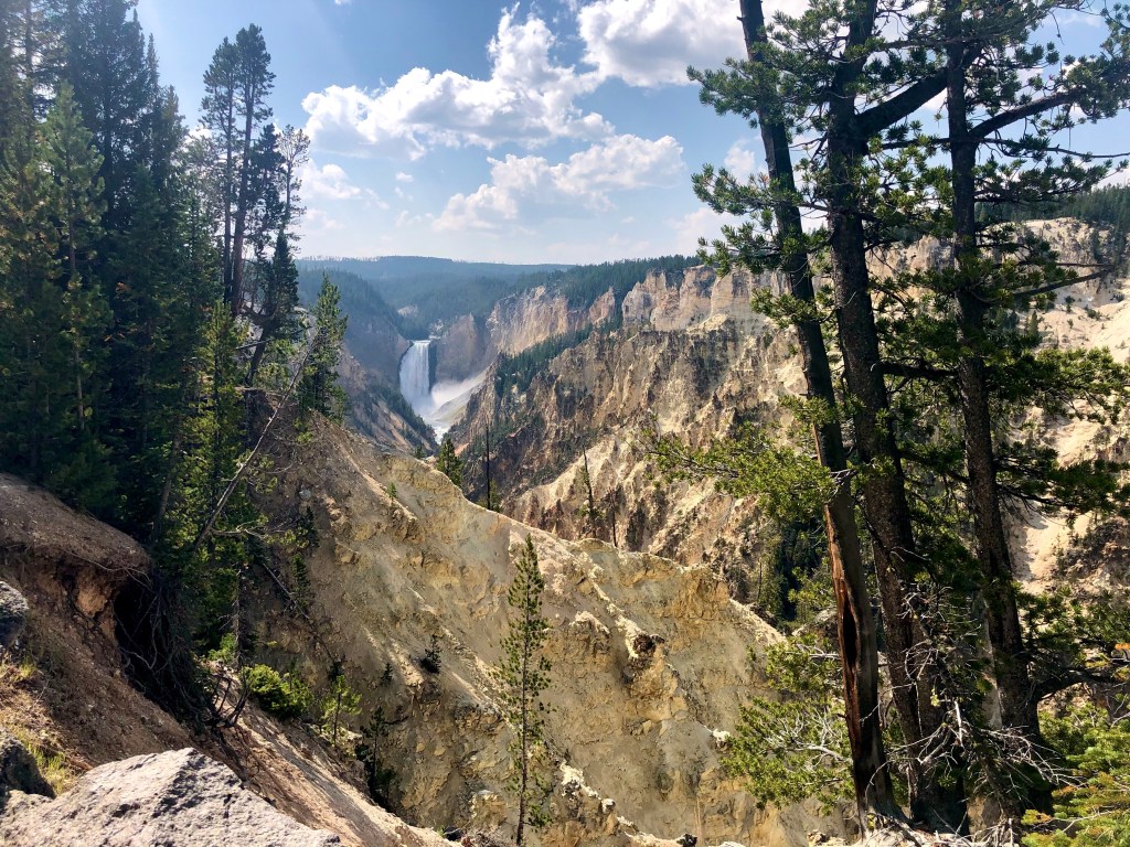
The headwaters of the Yellowstone River are found in the adjacent Absaroka Mountains from which it flows into the southeast corner of Yellowstone NP, then north into Yellowstone Lake from which it continues north to where it has carved its Grand Canyon over the last 150,000 years or so. The falls you see in the photos above and below are of the Lower Falls, a 308 foot drop. The Yellowstone River was explored by Lt. William Clark (of Lewis & Clark fame) in 1806 on his return from the Pacific. The river continues north from the park into Montana, then west across that state to North Dakota, parallel to I-90 and I-94, the route that we, too, will soon follow.
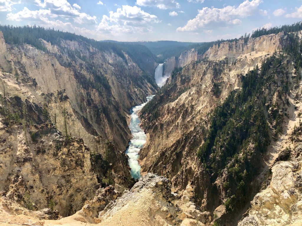
Ultimately, the Yellowstone River, joined by its tributaries, the Bighorn, Tongue and Powder Rivers, flows into the Missouri River, then ultimately south to the Gulf of Mexico at New Orleans. Here’s a view looking downstream, the river some 500 feet below:
Cutting our stay in Yellowstone a day short, we exited the park the next morning via the East gate, taking US 20 to Cody, a scenic Sunday drive.
