The Little Bighorn Battlefield National Monument is located inside the Crow Indian Reservation in southeastern Montana. You probably know the Little Bighorn as the site of “Custer’s Last Stand,” referring to Lt. Col. George Armstrong Custer (1839-1876) and his final battle against the Plains Indians. We visited the Monument Monday afternoon after my trip to Fort Phil Kearny.
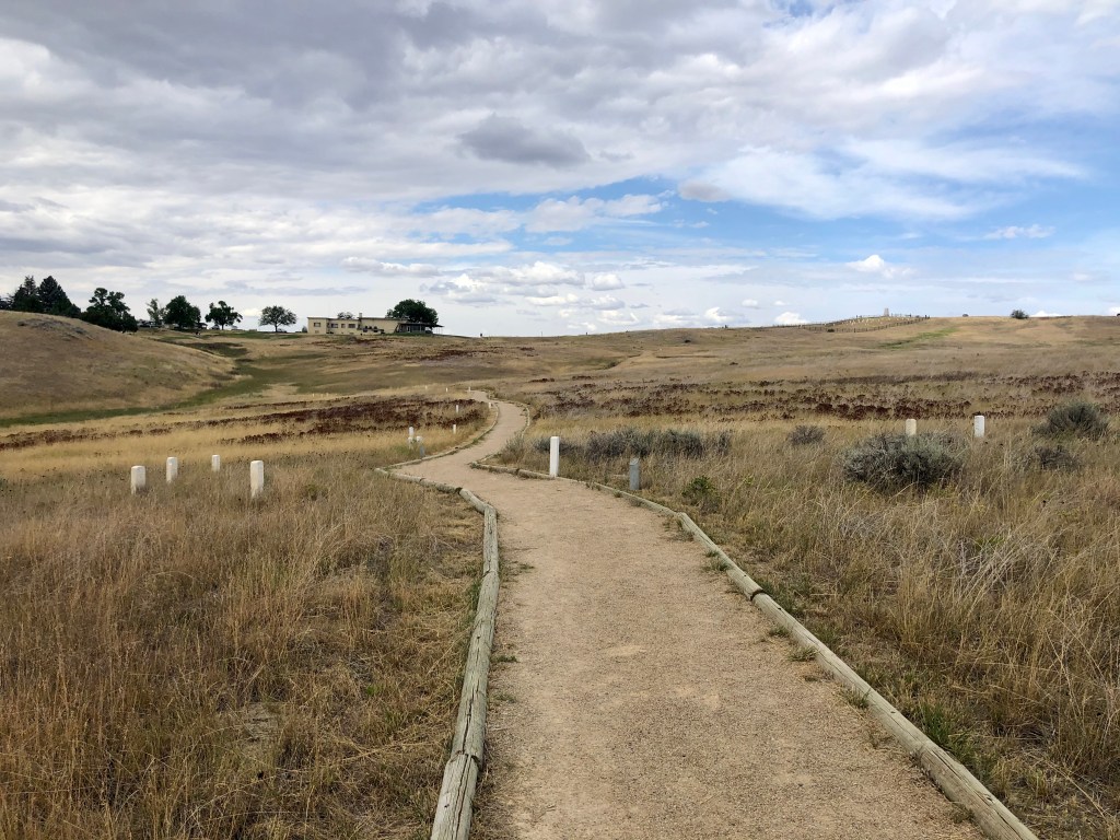
The Battlefield is just off I-90 with a visitor center (temporarily closed), parking lot and military cemetery near the entrance next to “Last Stand Hill.” From the Hill, there’s a 4.5 mile drive called “Battlefield Road” that follows the field of this ranging cavalry conflict (black wiggly line, map, below), with several pullouts and interpretive trails at each end.

Most people stop at the visitor center, park and walk around Last Stand Hill, then drive Battlefield Road to its end, turn around and leave (that is, they travel left to right on the map, above). But the fighting here unfolded in the opposite direction. So, in order to really understand what happened here, it’s best to drive to the end of Battlefield Road first for a walk there, then drive back and finish with a walk around Last Stand Hill.
But before I describe what happened here, let’s review what transpired between Red Cloud’s War in 1868 and the battle that took place here eight years later.
The main character in our story is George Armstrong Custer who was known in his day as a fierce yet somewhat reckless warrior, a talented leader, a warhawk and a flamboyant self-promoter that liked to play politics and who graduated last in his class at West Point – you could call him a 19th century John McCain.
To the Indians, he was known as “Long Hair,” commander of the U.S. Army’s 7th Cavalry, who had his military band play the Irish drinking song “Garryowen” whenever he was on the march. So, it made sense to me that the only RV campground anywhere near Custer’s Last Stand – the 7th Ranch RV Camp – would be found just off the Garryowen exit. We stayed there two nights.
Custer was a distinguished veteran of the Civil War. At the age of 23, he was elevated to the rank of brevet brigadier general of U.S. Volunteers and fought in many of the major battles: at the beginning of the war at the First Battle of Bull Run (1861); at Gettysburg (1863), the turning point at the war; under Gen. Sheridan in the Shenandoah Valley Campaigns of 1864; and, even at the end at Appomattox Court House, Virginia (1865).
In July 1866, with the Civil War now over, Custer was mustered out of the Volunteer Service, but he was soon offered a posting in Kansas with the regular Army as a lieutenant colonel, commander of the newly formed 7th Cavalry. Many of the Union’s officers had been moved West to pacify the Plains Indians at the end of the Civil War and one of them was Custer’s former superior officer, Gen. Philip Sheridan (1831-1888), who, as it turned out, was given command of the entire Indian pacification program from 1867 until 1883. Sheridan sent Custer south to wage war against the Cheyenne and Arapaho in 1868-1869.
Recall from my prior posts that war with the Sioux in the Northern Great Plains (Red Cloud’s War) was brought to an end with the Fort Laramie Treaty of 1868. That treaty required the United States to:
- close the Bozeman Trail and remove the Army’s forts protecting it, including Fort Phil Kearny;
- acknowledge the sovereignty of the Lakota Sioux over vast “reservation” lands surrounding the Black Hills and encompassing the western half of modern-day South Dakota (shaded area on map, below);
- prevent non-Indians from entering the Sioux reservation, except for those that the Sioux allowed in; and,
- acknowledge that the Sioux had hunting rights in a vast “unceded” territory west of their reservation and east of the Bighorn Mountains.
Some of the Sioux bands were content to reside permanently in the reservation, but others chose to live outside the reservation in the unceded hunting lands.
For several years, the treaty held and peace prevailed in the Northern Great Plains. But pressure for western expansion could not be suppressed and by 1873, the Northern Pacific Railroad was knocking at the door, seeking to purchase a right-of-way through Sioux lands. The Sioux rejected the railroad’s offer and attacked surveying parties that entered the reservation without permission. The railroad turned to the U.S. government for help and the government also sent a commission to the Sioux in an attempt to negotiate a purchase, which was also rejected.
Under the command of Gen. Sheridan – famous for having said that “the only good Indian is a dead Indian” – Lt. Col. Custer was next dispatched to protect a surveying party on an excursion up the Yellowstone River in the unceded territory, leading to several skirmishes with the Sioux. In the Spring of the following year, 1874, Sheridan sent Custer and the 7th Cavalry on a reconnaissance mission to scout the Black Hills to determine if an Army garrison could be established there. Custer not only reported back in the affirmative; he also asserted that he had discovered gold in the Black Hills, a claim he also made known beyond the military, triggering the Black Hills Gold Rush and flooding the Hills with down-on-their-luck prospectors from back East, eager to escape the serious depression that had begun several months earlier in September, known as the Panic of 1873.
Realizing that the Army could not now comply with the terms of the Fort Laramie Treaty of 1868 that required it to protect the Sioux’s exclusive possession of the Black Hills, the government looked for something that could trigger a conflict with the Indians through which the U.S.A. could confiscate the Black Hills as spoils of war. The pretext the government settled upon was the assertion that the off-reservation Indians in the unceded hunting lands had been attacking settlers and other tribes in violation of the treaty. Thus, the Army issued an ultimatum that all Indians must return to their reservations by January 31, 1876, or the Army would force them to do so by military action.
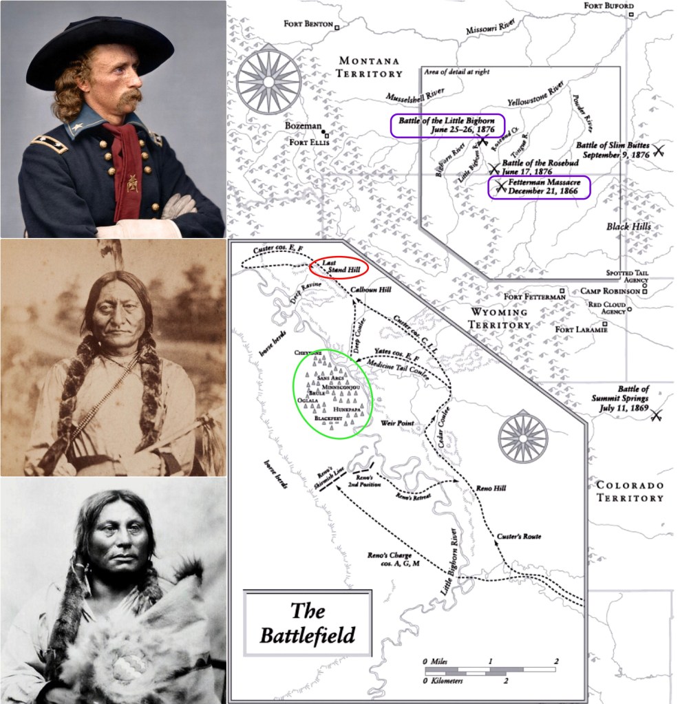
Sheridan then devised a plan by which three forces would converge on any Indians that remained in the unceded hunting grounds in the vicinity of the Little Bighorn River: Gen. Gibbon from the west; Gen. Crook from the south; and Gen. Terry and Lt. Col. Custer from the east (map, below, left). The Little Bighorn Campaign of June 1876 was underway.
[In the photo, below, right, Lt. Col. Custer is seated on the right, Gen. Crook is seated in the center, and Gen. Sheridan is standing on the left.]

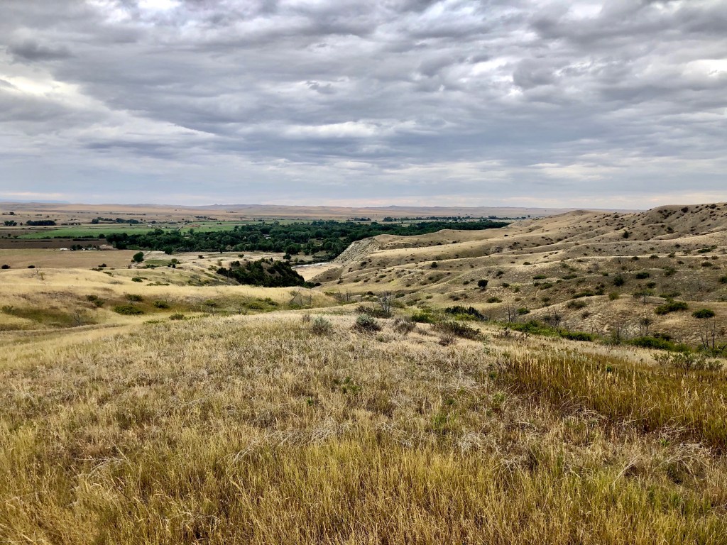
The Army’s scouts and agents had estimated that there would be no more than 800 Indians to be rounded up and that they would submit, rather than fight. As it turned out, however, there were far more Indians in the unceded lands than Sheridan, Custer or any other Army officer could have imagined. The Sioux had been joined by their Cheyenne and Arapaho allies, as well as a number of “reservation Sioux,” including members of all seven Lakota bands. Altogether, it is estimated that there were over 7,000 Indians encamped along the Little Bighorn River in the unceded territory (vegetated area in photo, below) that summer, including 1,800 warriors with some 25,000 ponies. The Indian village (map, below, green oval) was a mile long and consisted of 960 lodges; the Cheyenne camped at the northern end and the Hunkpapa Lakota Sioux were on the south with the Oglala Lakota Sioux in between.
The assembled tribes looked to Chief Sitting Bull (1831-1890; photo, below, center) of the Hunkpapa band for overall leadership, but the main war chiefs present were Chief Gall of the Hunkpapa (c.1840-1894; bottom, below) and Chief Crazy Horse of the Oglala band (c.1840-1877; Crazy Horse was never photographed).
Sheridan’s plan seemed to go sideways from the beginning. Gen. Gibbon was delayed crossing the Yellowstone River and Gen. Crook was attacked and repelled by Crazy Horse at Rosebud Creek to the south where he went into bivouac. Gen. Terry, concerned that any delay might result in his approach being discovered by the Sioux with sufficient time for the Indians to decamp and escape, authorized Lt. Col. Custer (below, top) and his cavalry to ride ahead and attack, if necessary, in Custer’s discretion.
As Custer approached the Indian village from the southeast, opposite the Little Bighorn River from where the village lay, his regiment came upon a small group of Indians who fled, leading Custer to believe he and his troops had been discovered and that any opportunity for a surprise attack had been lost. Now believing now that his best strategy would be an immediate multi-prong attack on the village, Custer divided his 650-man regiment into four groups:
- Capt. McDougall to remain out of the battle with the pack-horses and 136 men;
- Capt. Benteen to reconnoiter bluffs to the southwest with 115 men;
- Maj. Reno to attack the village from the south with 175 men; and,
- Lt. Col. Custer to take the remaining 221 men north along the river for an attack on the village from that end.
Reno headed downhill, crossed the Little Bighorn and approached the village from the south, surprised by its enormity. Within 600 yards of the Hunkpapa teepees and lodges, Reno had his troops dismount and form a skirmish line and fire several volleys into the village (two of Chief Gall’s wives and several of his children were killed). But, rather than scattering as Reno had expected, the Indian braves rushed forward in attack. Reno ordered his men into the adjacent trees along the river and when the Indian attack grew more fierce, he retreated across the river to the top of the adjacent ridge where he took up a defensive position. Not long after, Capt. Benteen, returning from his reconnaissance to the west, joined him:
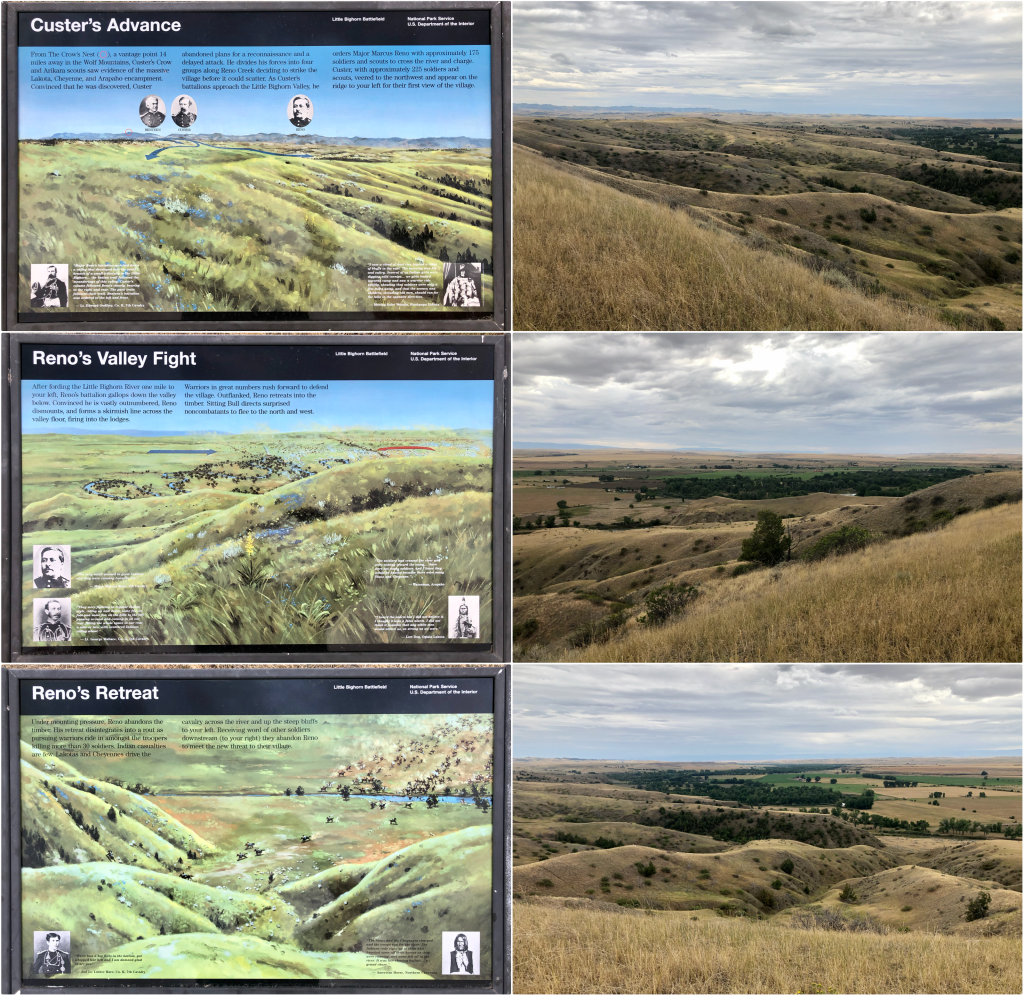
Custer, meanwhile, dropped out of sight behind the rise above the river and galloped north, never to be seen again. It is believed that Custer and his cavalry descended to the Little Bighorn River from the ridge in the photo, below, where he was met not only by the Indian braves joining the battle from this northern end of the village, but also by those coming from the southern end after driving Capt. Reno and his troops up the hill, led by Crazy Horse and Gall.
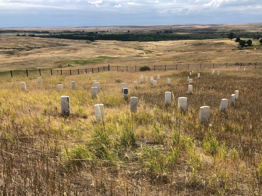
There is evidence that after making a disastrous foray down into a ravine by the river, the survivors of Custer’s cavalry retreated back up the hill to the ridge where they took defensive positions at what later became known as Last Stand Hill, the area to the left, below, marked by tombstones:
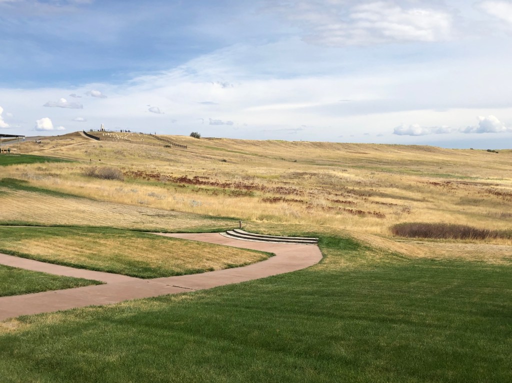
We parked near the visitor center and walked down to the ravine and from there turned and took the photo, below, of Last Stand Hill at the top of the ridge on the right. It is from here that Crazy Horse and Gall are thought to have attacked.
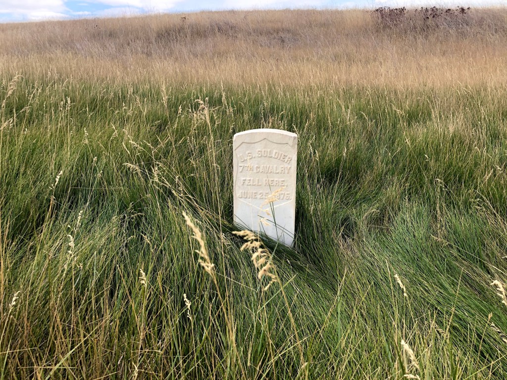
After the battle, the Indians mutilated the soldiers’ bodies. So, when Gen. Terry and his troops finally arrived to relieve Captains Reno and Benteen the following day, the Army was able to take the field and recover the remains of the dead, marking the location of each fallen soldier with a stake, later replaced with a tombstone for an unknown “U.S. Soldier.”
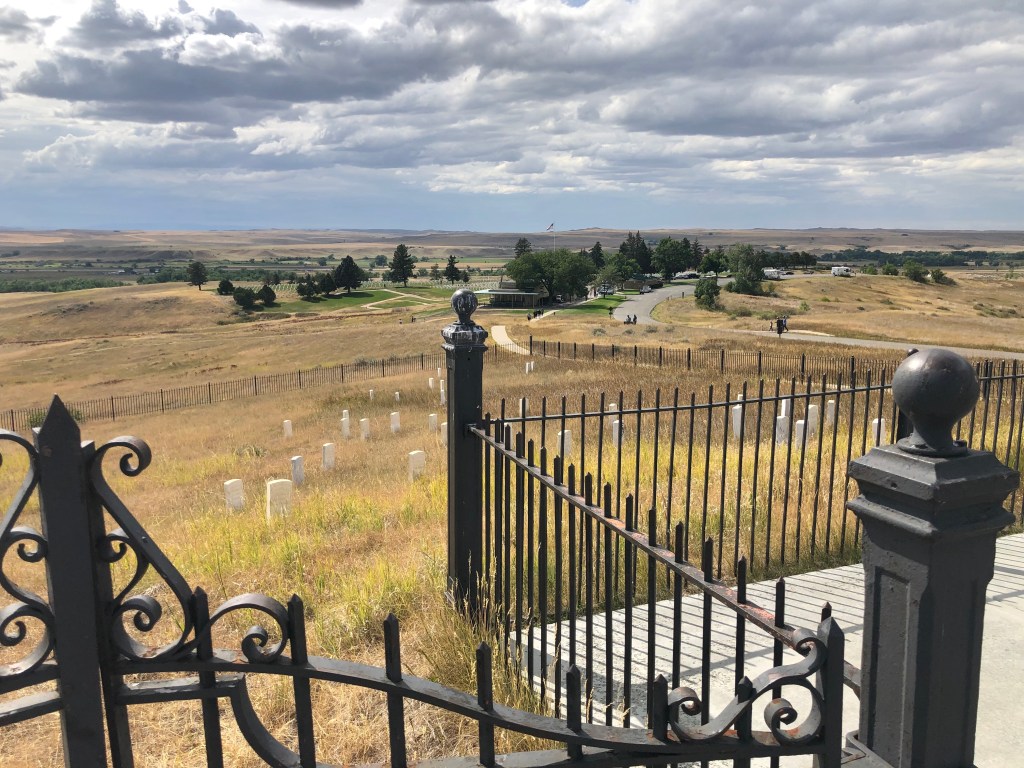
At the top of Last Stand Hill, Custer and those still able to fight killed their horses and used the horses’ dead bodies as cover, firing away until they had exhausted their ammunition. By then the Indians had surrounded and fallen upon them, killing every man. The tombstone with the bronze plaque on it in the photo, below, is where Custer is believed to have died, identified later by his uniform.
We continued to the memorials at the top of the hill
There is a tall monolith there with the names of the fallen soldiers (top right, below), as well as a tombstone commemorating the horses that were sacrificed (bottom left). There are also several marked graves identifying Indians known to have died in the attack (top left).

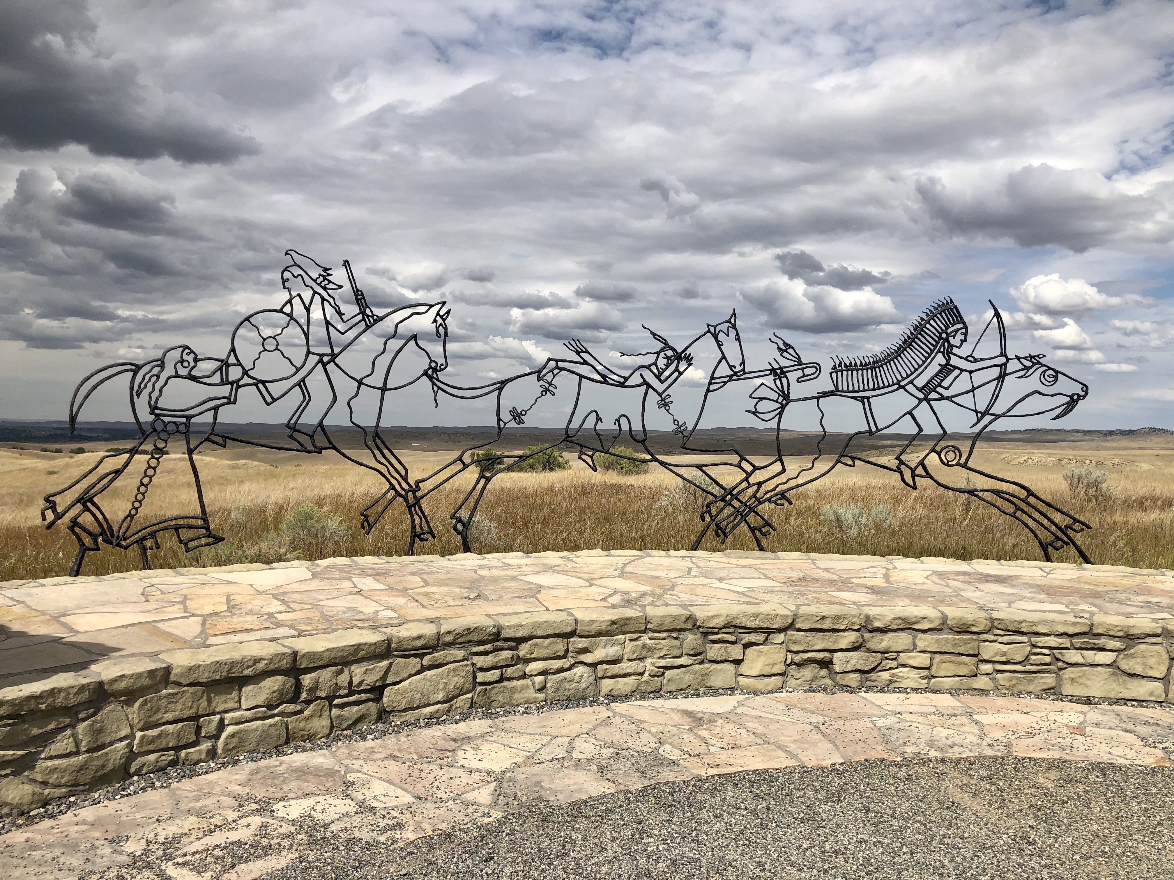
On the north side of Last Stand Hill, a more recent memorial has been constructed to commemorate the Indians that died here defending their homeland. The ghostly wire apparitions of that monument seemed all too fitting, half in the land, half in the sky, slowly disappearing.
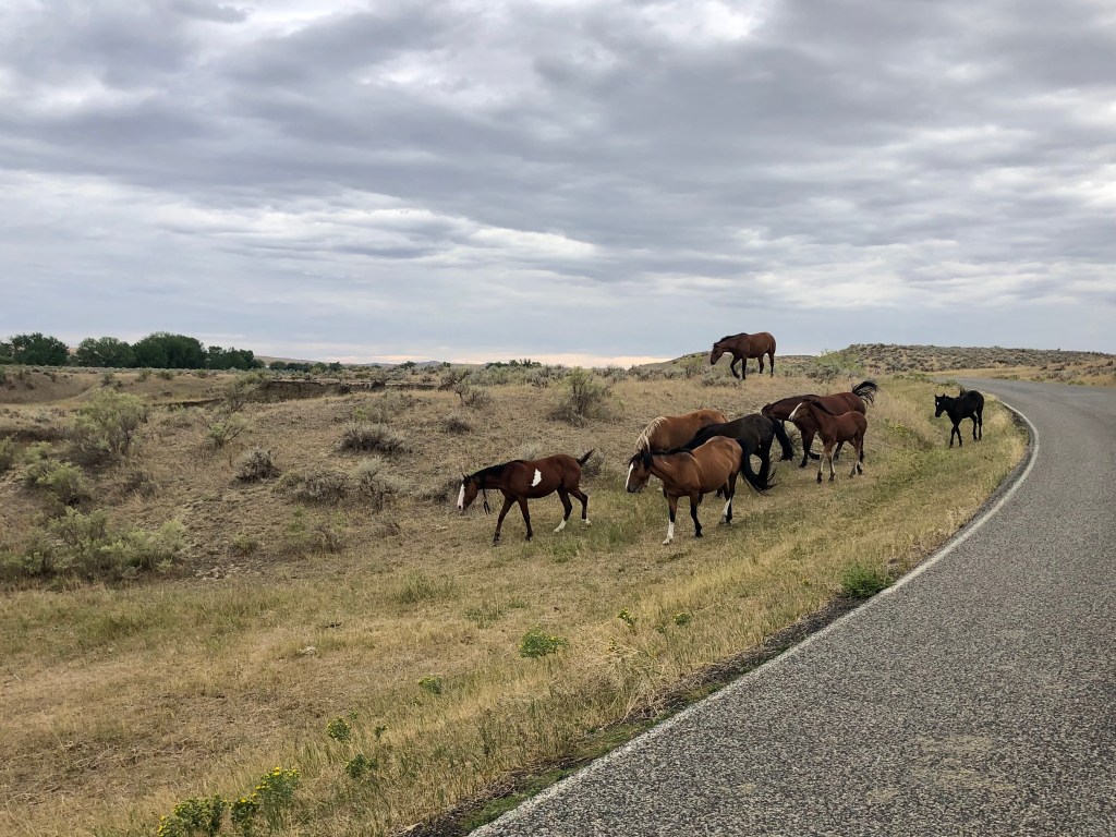
On our way out, we passed the only remaining inhabitants, a herd of wild horses.
After the battle, Chief Sitting Bull led his Hunkpapa band north and the Army pursued him all the way to Canada. Other bands went elsewhere, some returning to the reservations once the bison had all been killed at the behest of the railroad. Crazy Horse was captured and murdered in 1877, as was Sitting Bull in 1890.
Chief Gall ultimately returned from Canada where he had fled with Sitting Bull. Gall and his band surrendered in 1880 and were taken to the Standing Rock Indian Reservation in the Dakotas where he became a farmer, served as a judge on the reservation’s Court of Indian Affairs, converted to Christianity and took the biblical name “Abraham.” He peacefully died in his home in 1894, the last man standing.

Pingback: Buffalo Nickels | The Road Less Traveled