The Little Bighorn River flows north from Garryowen to the town of Hardin, Montana, where it joins the Bighorn River. Leaving the campground Tuesday, we likewise headed north, backtracking on I-90 to Hardin and continuing from there on MT47 to I-94, about 50 miles northeast of Billings, where the Bighorn merges into the Yellowstone River. From that junction, we raced the Yellowstone northeast, leaving it about 100 miles from its confluence with the Missouri River and veering east at Glendive, headed for Medora, North Dakota.
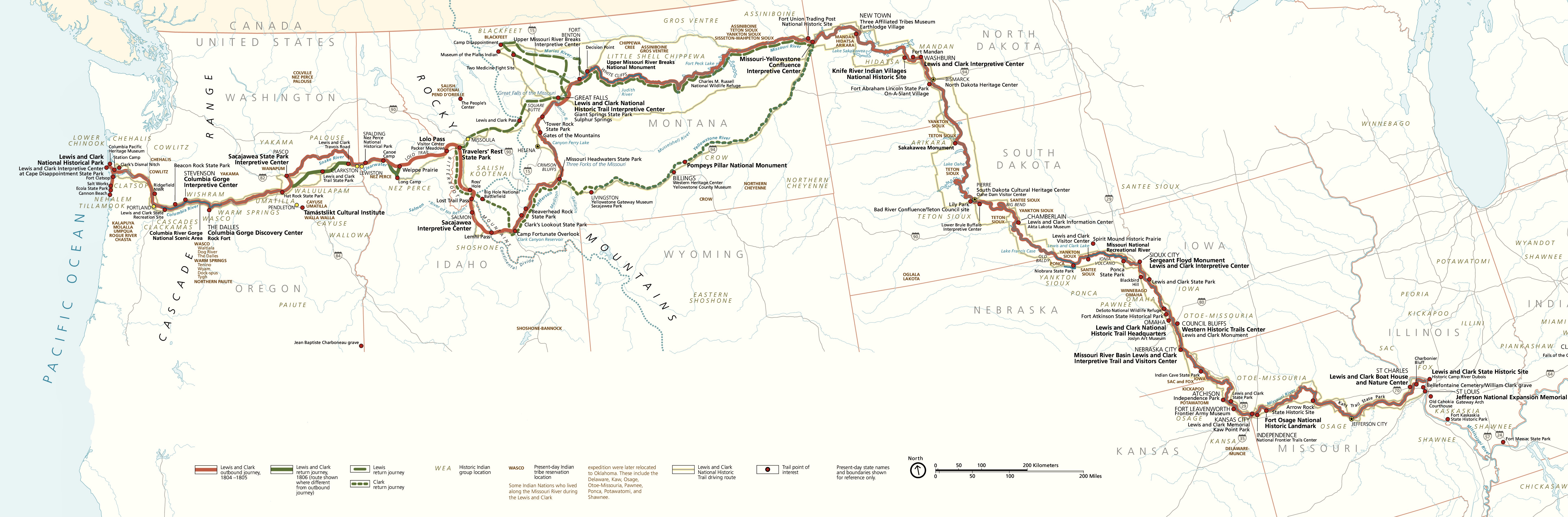
On their return from the Pacific in 1806, Lewis and Clark split up near modern-day Missoula, Montana, and Lewis and nine of his men explored to the north, then returned downstream on the Missouri River. Clark, meanwhile, took 23 of the party, including his interpreters, Sacajawea and Charbonneau, on a more southerly route, returning by way of this very stretch of the Yellowstone River.
This part of the northern Great Plains, known to geologists as the Missouri Plateau (below, left), is a rolling, treeless grassland, the watershed of the Missouri River Basin (below, right). These hard-packed, dry prairies are the remains of an ancient seabed, drained about 70 million years ago by the gradual uplift of the North American continent. As the Rocky Mountains rose in the west, water flowing off the mountains carried the eroding overburden down onto this great, flat plain. Over the millennia, layer upon layer built up on the plain, hardening over the years into rock with a gradual eastward decline.
About 5 million years ago, the western part of the continent rose higher still and the water that had been spreading evenly onto the plains from the mountains gained momentum, cutting ravines and canyons and carving buttes and plateaus in the old seabed, carrying the sediment away to the northeast toward Hudson Bay. Then, beginning 2 million years ago, the Laurentide Ice Sheet advanced southward from Canada, covering much of North America with ice, but halting at the Missouri Plateau due to its slightly higher elevation (see below, left where the Northwest Glaciated Plains lie mostly in Canada). The ice acted as a dam between the Rockies and Hudson Bay, collecting the rivers and streams along the base of the ice sheet into a single massive channel that was diverted south, today’s Missouri River.

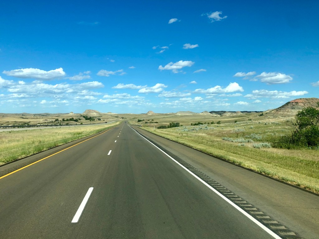
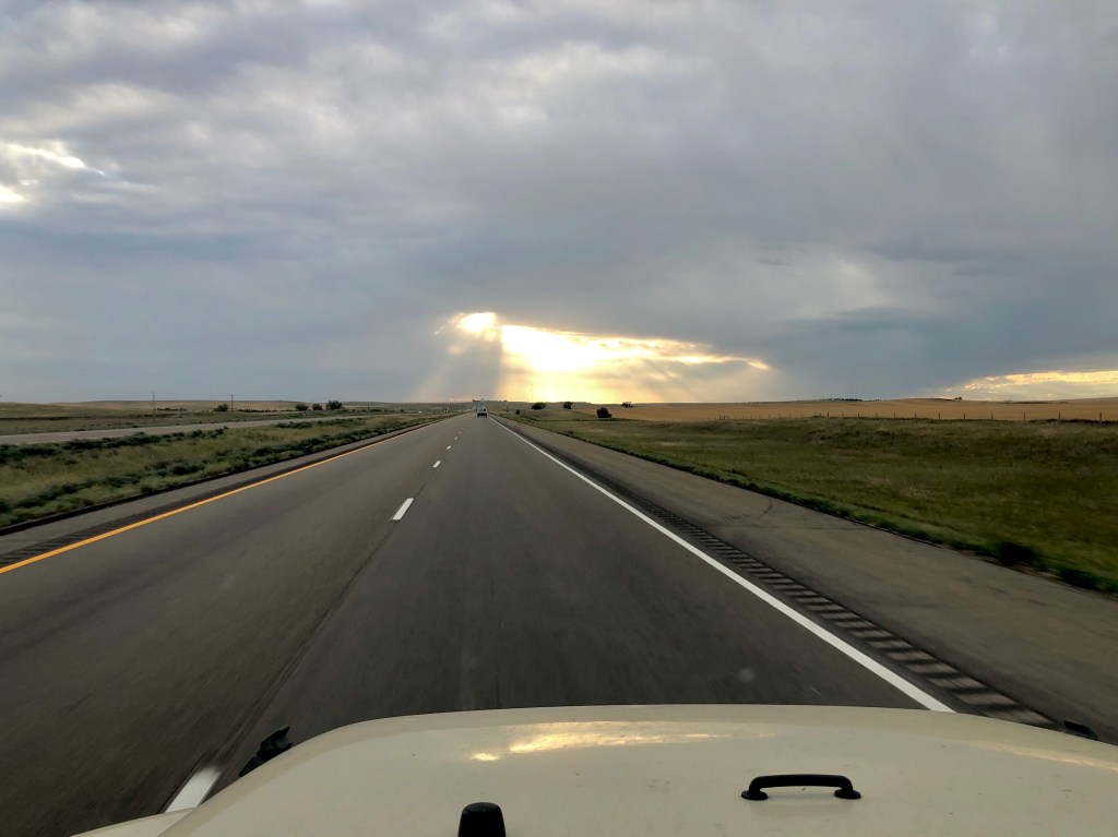
Getting back to the present, for the most part the drive across the Missouri Plateau looks like this:
Arriving in Medora in the late afternoon, we checked in at the Red Trail Campground for the next four nights, then briefly explored this quaint little town before making our way to Boots Bar & Grill for dinner. The Dakotas did not engage in mandatory masking and lockdown in fear of COVID-19, unlike most of the rest of the country, so, inside the restaurant, where only one person wore a face-mask, it was like going back to pre-coronavirus days and – hopefully soon – back to the future.
Wednesday morning we were up early, headed for the Knife River Indian Villages National Historic Site, the Mandan and Hidatsa settlements visited by Lewis & Clark when they wintered nearby on their journey west with their Corps of Discovery. The Knife River Indian Village NHS is 150 miles from Medora, so, including a return via Bismark, it was going to be a 350-mile driving day.
North Dakota, sitting atop the Bakken Shale formation, is the second largest oil-producing state in the U.S.A. (Texas is first with production more than 3 times that of North Dakota). According to the North Dakota Department of Commerce, there were 8,000 oil wells in the state in 2012 and with fracking being more ubiquitous today, that number has surely increased, so we weren’t surprised to see numerous oil derricks and collection depots as we drove.

From Medora, we headed north on US85 to ND200 which we took east across the state to the west bank of the Missouri River at Stanton; the Knife River Indian Village site is just a few miles north of there at the confluence of those two rivers.
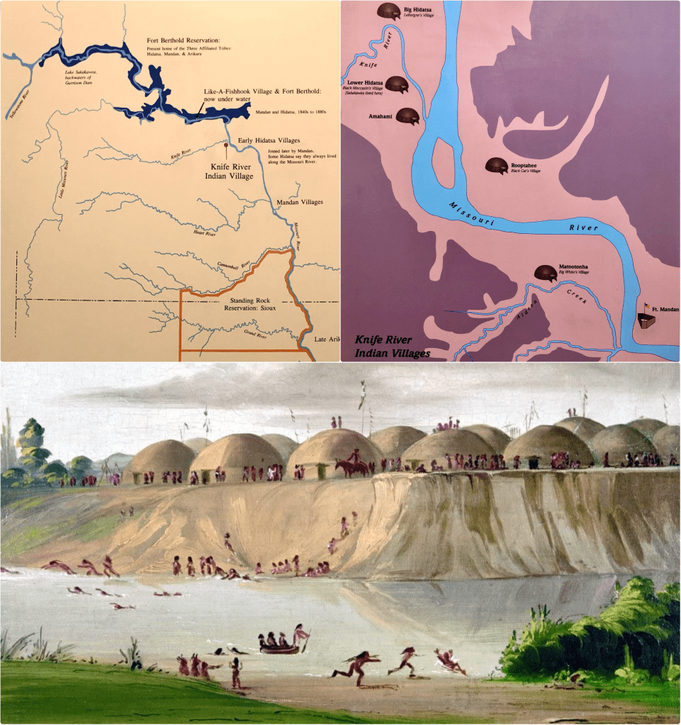
When Lewis and Clark arrived here in their keelboat and pirogues in late October 1804, they set up camp on the east bank of the Missouri River, about 1,600 miles (and 5 months) from their start at Camp Dubois near St. Louis on May 14. There they built a palisade fort they called Fort Mandan (map, below, right).
In the early 1800s, Indians from many different tribes came here to trade with English, French and American traders and among themselves, swapping horses, furs, vegetables, meat, weapons and other goods. At that time, there were five earth-lodge Indian villages in close proximity here: two Mandan; three Hidatsa. These two tribes – whose ancestors had lived here for hundreds of years – were allied and sedentary, raising corn, squash and beans in the floodplain and fishing in the river, their young braves venturing west onto the prairies to occasionally hunt bison and make raids upon the Shoshone and Blackfeet tribes.
Depicted below is the Lower Hidatsa village, also known as Awatixa, home to about 400 Hidatsa Indians living in some 50 earth-lodges built along the banks of the Knife River, as it existed in 1832 when it was visited by the artist George Catlin.
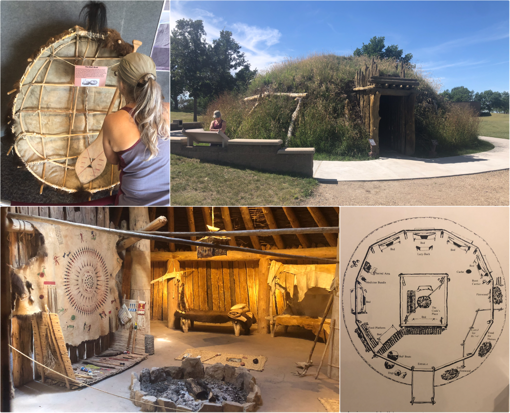
Before making our way down to the village site, we stopped to visit the displays in the small NPS visitor center (including a bull-boat, similar to the basket boats of Vietnam) and a reproduction of an earth-lodge dwelling. These lodges were built and “owned” by the women of the tribe, inherited through the matriarchal line. Because the four main uprights were buried in the ground, thus rotting over time, the lodges had to be taken apart and reassembled every 7 years. Each lodge accommodated about 10 residents with raised beds around the periphery and a central cook-fire, vented through a hole in the roof that could be covered with a bull-boat in the event of rain.
Sacajawea, then a 15-year-old Shoshone captive, owned by and married to the French trader, Charbonneau, lived in Awatixa (photo, below, top and center-right) when Lewis and Clark arrived. The Hidatsa had built Awatixa in the 1790s after abandoning another site slightly to the south. Awatixa was raided by Lakota Sioux in 1834, two years after Catlin painted it, and burned to the ground. Today, only the surface depressions left by the earth-lodges remain.
After the Sioux raid, the residents of Awatixa moved north into the Big Hidatsa Village (photo, below, bottom and center-left). In 1837, the viral killer of the day, smallpox, took away half the inhabitants and in 1845 the survivors abandoned the village and moved 40 miles north, joined by their Mandan neighbors, where they built Like-A-Fishhook Village; they were relocated to nearby Fort Berthold Reservation by the federal government in 1885.

After visiting the Knife River Villages, we drove north to Lake Sakakawea where we crossed the Missouri River, then traveled south along the east bank on US83 to Washburn where we visited the museum at the North Dakota Lewis & Clark Interpretive Center and the reproduction of Fort Mandan that the State of North Dakota has built on the Missouri River near its original location:
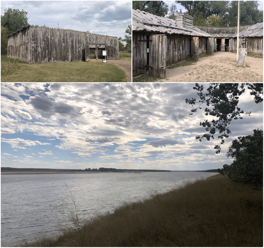
It was nearing closing time, so we didn’t linger long here, hopping back into the Jeep and continuing our drive south to Bismark, the state capital, where we stopped for a quick dinner, then headed west on I-94 into the setting sun and back to our campsite in Medora.

Pingback: Little Missouri | The Road Less Traveled