After visiting the Buffalo Bill Center, we headed north on WY120 into Montana near Billings where we hopped onto I-90 eastbound, then southbound, to the Little Bighorn Battlefield NM, arriving just before dinnertime on Sunday, August 30.
In preparation for this trip, I read several books about the Sioux and the Indian Wars of the Great Plains which made me want to visit Fort Phil Kearny, the location of the decisive battle of Red Cloud’s War (1866-1868). The fort and its associated sites were added to the National Register of Historic Places in 1978.
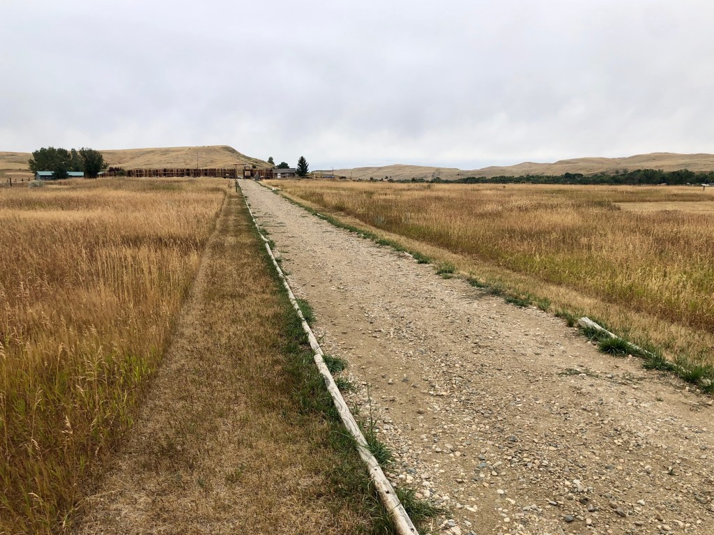
The next day, a chilly Monday morning, I took off early in the Jeep for the 100 mile drive south back into Wyoming on I-90 to the Fort Phil Kearny State Historic Site, just south of Sheridan, Dale being content to relax in the RV. Following backroads to the site of the old fort, I could see the slight rise upon which the fort previously existed:

In 1863, gold miners and frontiersmen from Virginia City in western Montana Territory had blazed the Bozeman Trail through Indian lands to connect to the Oregon Trail at Fort Laramie on the Platt River. You might recall that on our way to Yellowstone, we had stopped at a pullout to see the western section of the Bozeman Trail.
While the Fort Laramie Treaty of 1851 stated that such trails could be established by the United States, it is not clear that all the Indians understood this to be the case. Furthermore, at the time that treaty was signed, the Crow Indians controlled these lands, but by 1860, they had been attacked and displaced by their mortal enemies, the Lakota Sioux, and their Cheyenne and Arapaho allies, who aggressively defended their newly acquired hunting grounds. So when wagon trains started rolling along the Bozeman Trail in 1864, the Sioux and their allies attacked.
Once the Civil War ended, traffic on the trail increased. So, to protect the travelers, General Sherman, then in command of this division of the Indian Territories for the War Department, authorized construction of three forts along the trail in 1866: Fort C. F. Smith in the northwest; Fort Reno in the southeast; and the largest of the three, Fort Phil Kearny, in the middle.
Construction of Fort Phil Kearny began in July 1866 upon the arrival of its commandant, Col. Henry Carrington, to the area. The fort, an 8-foot high stockade constructed by driving over 4,000 logs into the ground in a rectangular shape, enclosed 17 acres with a perimeter measuring just under 3/4 mile.
Upon arrival, I stopped to visit the small on-site museum and excellent book store in order to orient myself to the site. A model of the fort helped me to literally get the lay of the land. The fort, itself, was destroyed by the Indians in 1868 after they defeated the U.S. Army in battle here, but the north gate (red arrow, bottom left in photo below) and a portion of the northwest stockade wall (delineated in yellow) have since been reconstructed:
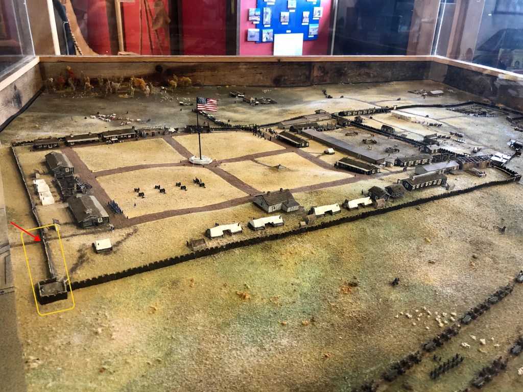
I entered the fort through the reconstructed north gate (the main gate is on is on the east side of the fort), then climbed up into the watch tower, trying to get a feel for what being one of the 400 soldiers garrisoned here might have felt like. The answer, in a word: vulnerable.

From the north gate, I walked south the length of the west wall, then turned to look back toward the gate. This fort was huge! Beyond the north gate, I could see plateau top of Sullivant Hill and, to its right in the distance, Lodge Trail Ridge.
The fort was nearing completion in December 1866 when Chief Red Cloud called the Cheyenne and Arapaho to join together with the seven bands of his Lakota Sioux to take the war to the intruder at Fort Phil Kearny. Altogether, Red Cloud had assembled around 4,000 braves. In would be incorrect to call Red Cloud the “commander” of these warriors because the Plains tribes had a decentralized and communal form of government and military organization, each brave feeling little obligation to follow group decisions. And though the Indians had a 10:1 advantage, their weapons were far inferior to those of the Army – the Indians had almost no guns.
Ever since Col. Carrington (left, below) had arrived, the Indians had harassed his troops and timber crews and attacked passing wagon trains. The soldiers were getting anxious and some of the Civil War veteran officers among them were itching for a fight. Thus, on December 21, 1866, when a group of soldiers collecting timber a few miles away were attacked by Indians and retreated to the fort, Capt. William Fetterman (center, below) sought permission to pursue the Indians with a force of 80 men, about 1/3 of which were cavalry. Col. Carrington approved the request, but presciently ordered Capt. Fetterman not to proceed beyond Lodge Trail Ridge (photo, above) where relief from the fort would be difficult. But, as Capt. Fetterman left the fort, a group of Sioux warriors led by Crazy Horse appeared on top of the Ridge, stood on their horses and mooned the Captain and his troops, luring them over the Ridge and into the trap beyond that had been set by Chief Red Cloud (right, below).

Disobeying Col. Carrington’s order, Capt. Fetterman led his company in hot pursuit, up and over Lodge Trail Ridge to their death. Concealed in the surrounding hills were more than 2,000 Indian warriors waiting in ambush who fell upon the soldiers, driving them up to the top of what is now known as Massacre Hill (photo, below) where within an hour every man was killed in what the Americans at the time called the “Fetterman’s Massacre.” Today, the battle is correctly referred to as the “Fetterman Fight,” the greatest defeat of the U.S. Army in the Indian Wars up to that day.
After the battle, with the approach of cold weather, the Sioux and their allies went into Winter lodgings, resuming their skirmishes in the Spring of the following year, 1867. By Summer, Red Cloud and his fellow chiefs determined to renew their attack on Fort Phil Kearny. Again, the Indians greatly outnumbered their foe, this time a wood cutting party out from the camp at what came to be known as the Wagon Box Fight.
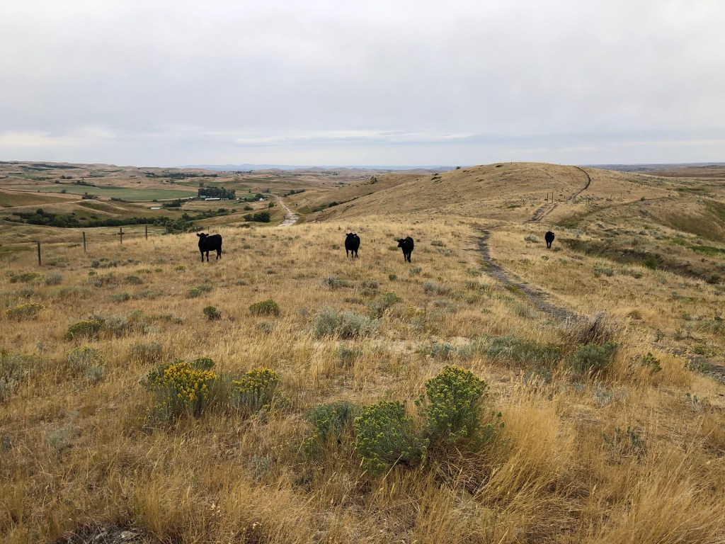
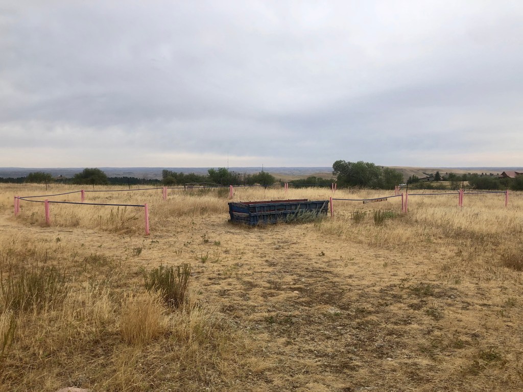
The exact location of the Wagon Box Fight is still disputed, but artifacts indicate it is where the state of Wyoming has erected a monument and several placards. As I pulled in to that site, a herd of what I think were white-tailed deer went loping by:
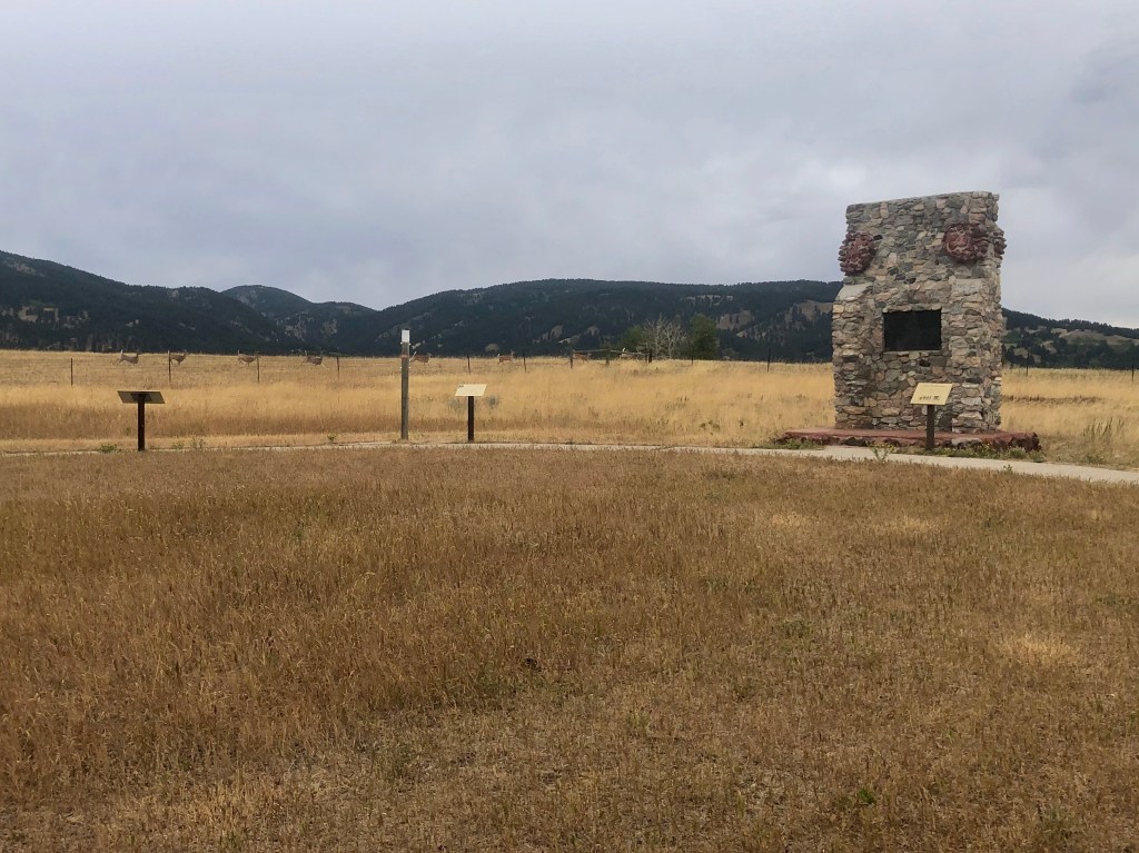
Here, five miles from the fort, a wood-cutting party of 26 soldiers and 6 civilians were attacked by hundreds of Sioux, Cheyenne and Arapaho braves. This time, the soldiers did not act rashly. They had previously removed the wooden boxes of their 14 wagons from the running gear in order to use the gear for log hauling and had laid the boxes in an oval to act as a corral and defensive position (staked out at the memorial with a single replica wagon box, photo, below).
When the Indians attacked, the men hid inside and behind the wagon boxes and from those positions they fired upon their attackers with recently-issued breech-loading rifles, surprising the Indians with their volume of fire. After repetitive failed attacks and the arrival of reinforcements from the fort, the Indians withdrew, taking with them the wood-cutters’ mule herd. Both sides considered the fight a victory.
Skirmishes continued into 1868, closing the Bozeman Trail to all but military traffic. By this time, the Union Pacific Railroad had been completed, providing an alternate route to the West. Consequently, the U.S. government concluded that the cost of protecting the trail was no longer justified. Treaty negotiations were held and concluded in 1868 with the Bozeman Trail being closed, Army troops withdrawn, and the forts abandoned. Red Cloud’s War had come to an end with the Indians victorious.
Returning to the Jeep, I realized that the mountains to the west were the Bighorn Mountains, the headwaters of the Little Bighorn River which runs through the scene of Custer’s Last Stand, our next stop.

For those interested in reading more about the Lakota Sioux and the Indian Wars of the Great Plains, here are the books that I read and recommend:
- Bury My Heart at Wounded Knee: An Indian History of the American West, by Dee Brown (1970);
- The Earth is Weeping: The Epic Story of the Indian Wars for the American West, by Peter Cozzens (2016);
- Lakota America: A New History of Indigenous Power, by Pekka Hämäläinen (2019);
Both Bury My Heart at Wounded Knee (which I had read before as a teenager) and the recent Lakota America are written from (and prejudiced toward) the Indian perspective; The Earth is Weeping is intentionally more objective, so if you read just one, this should be it. I also read and used the following, helpful guide book:
- Traveler’s Guide to the Great Sioux War, by Paul Hedren (1996).

Always great stuff bud. I’m sure you’ve also read Undaunted Courage as that was also a great read about that part of our country. Enjoy the trip!
LikeLike
Yes, I have read Undaunted Courage and really enjoyed it. Lewis & Clark coming up soon 😀
LikeLike