The northern edge of the Black Hills of South Dakota lies almost exactly 200 miles due south of the South Unit of Theodore Roosevelt NP, an easy drive on US85 from Medora. It’s relatively mundane scenery, looking across rolling prairie, until you are within sight of the Black Hills, about the same time as US85 intersects with I-90 near Spearfish.
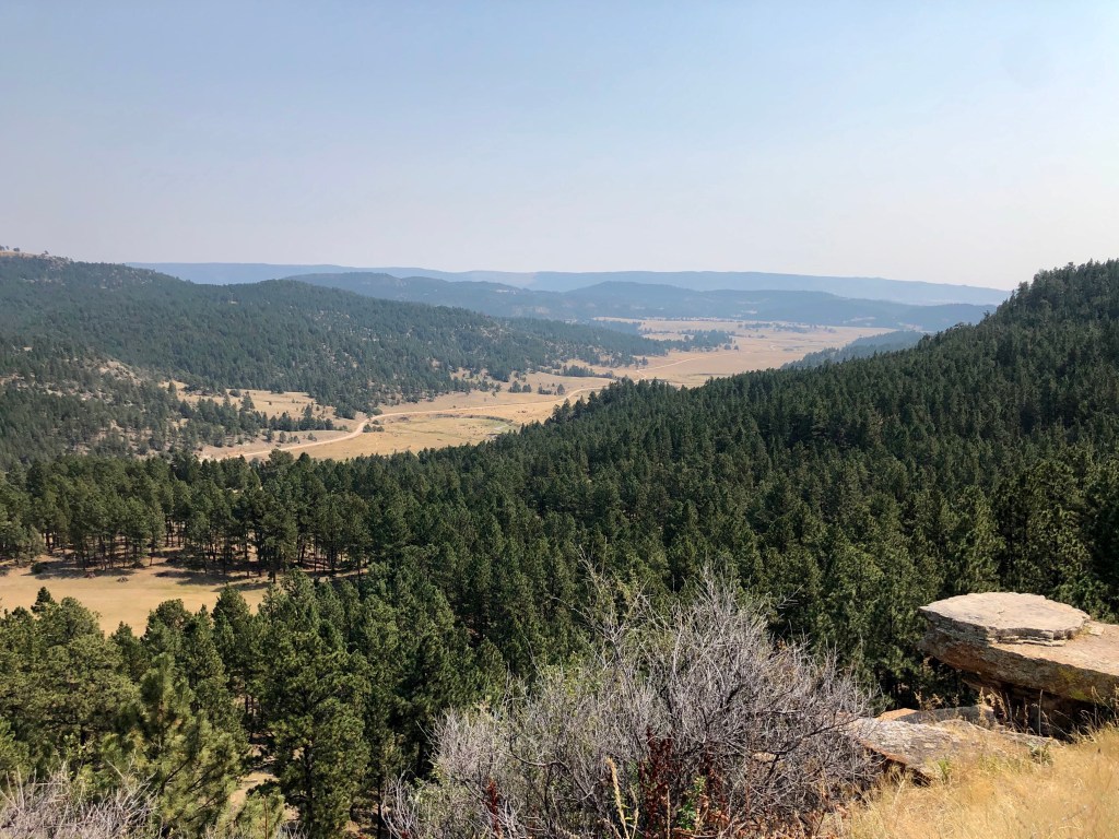
Just beyond there, the road climbs into the Hills through ponderosa pine, passing through the historic Wild West gold-mining town of Deadwood. We thought about stopping, but had arrived on the Saturday afternoon before Labor Day and the place was packed with tourists, well into their weekend revelry. We continued on toward Lead, but veered off onto US385 which we followed to Beaver Lake Campground near Custer, our destination, dodging ATVs and UTVs the entire way.
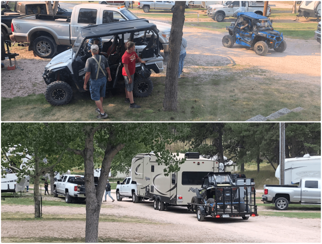
ATVs, that is, all-terrain vehicles, also known as “Quads,” are as prevalent in the Black Hills as jet skis are in the Florida Keys – and just as much of a nuisance to those, like us, that don’t drive them. UTVs – utility terrain vehicles – are close cousins, the difference being that ATVs are ridden by a single individual, straddled like a motorcycle, while UTVs carry multiple passengers seated side-by-side, more like a high-powered golf cart. In the campground, both versions were everywhere, buzzing around like mosquitos at all hours. Most of them had been towed in on trailers which, in turn, were towed behind 5th-wheel RVs or travel trailers which were being towed behind pickup trucks, like the combo in the bottom of the photo, below (this is illegal in 22 states):
I previously mentioned that the Black Hills were the heart of the lands reserved to the Lakota Sioux by the Fort Laramie treaties, but the discovery of gold here triggered a final conflict between the growing United States and the Sioux Nation in the 1870s. The history I’m going to discuss now – the natural history of the Black Hills – goes back much further.
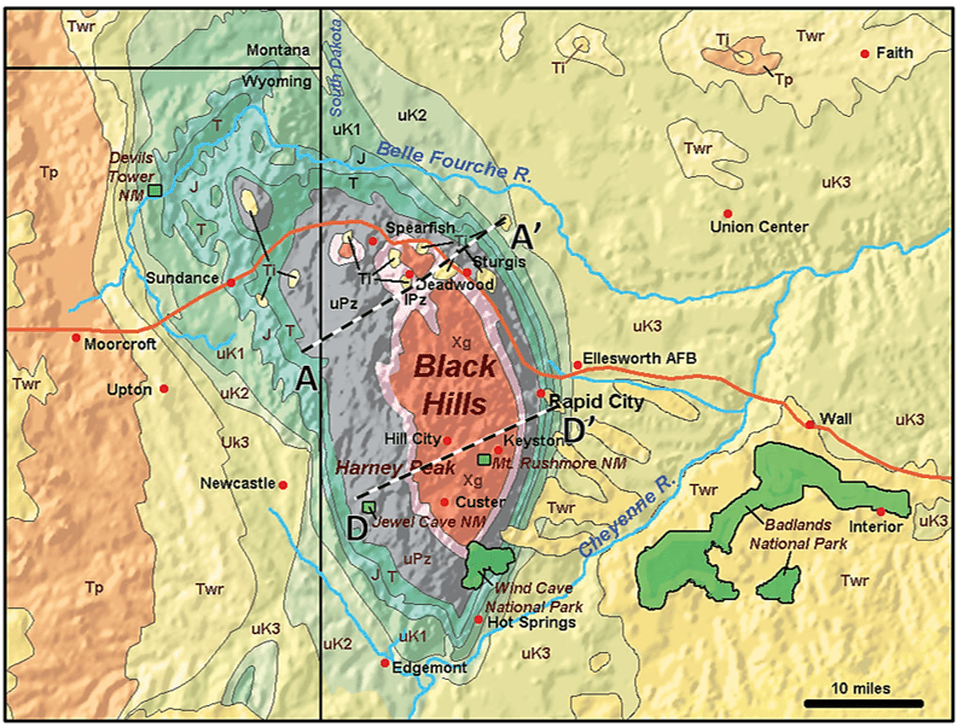
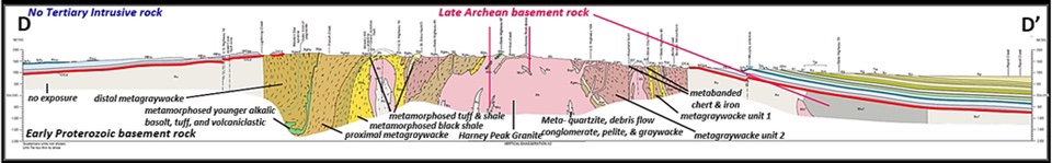
The Black Hills appear as an island in a sea of prairie grass, rising 3,000 feet above the surrounding plains. The Hills, which measure approximately 125 miles N/S and 65 miles E/W, are considered the easternmost extent of the Rocky Mountains. The formation’s granite core (red area, map, below) is approximately 2 billion years old, pushed toward the surface by volcanic uplift 60-70 million years ago and exposed since then by erosion. Moving away from the core, the rock layers are progressively “younger.” Surrounding the core is a ring of limestone (grey area), then a ring of soft, red shale, followed by hard Dakota Sandstone (see cross-section D-D, below).
There are a number of well-known attractions in and around the Black Hills:
- Mount Rushmore National Memorial and Crazy Horse Memorial carved into the granite of the core;
- Badlands National Park, Custer State Park, Rapid City and the Minute Man Missile National Historic Site to the east;
- Wind Cave National Park and Jewel Cave National Monument buried in the limestone south of the granite core; and
- Devils Tower National Monument rising out of the sandstone to the northwest in adjacent Wyoming.
Given that our campground was overflowing, we decided that our best bet to avoid the holiday weekend crowds would be to visit the most distant and remote site, Devils Tower NM:
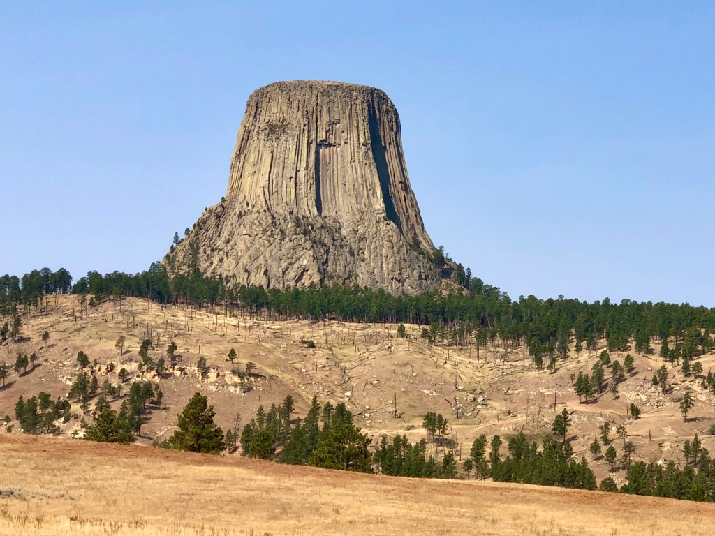
Established in 1906 by Pres. Theodore Roosevelt, Devils Tower was named America’s first National Monument. Today it rises 1,200 feet above the surface of the surrounding land, but 70 million years ago, it was buried beneath many layers of sedimentary rock. Although several theories have been advanced to explain how Devils Tower came to be, they all have one feature in common: what we see today is an “igneous intrusion,” that is, the forcible entry of magma from below into the now-eroded sedementary rock layers.
There has always been an aura of mystery surrounding Devils Tower. The Indians had several creation myths; the one I like best goes like this:
Seven little girls were playing when a bear appeared and chased them. They jumped up onto a rock to escape the bear and atop it they prayed that the rock would carry them further upward to safety. Their prayers were answered and the rock grew skyward as the bear clawed its sides in an effort to reach them. The rock continued to grow until it reached the sky and the girls were transformed into stars, today known as the “Pleiades,” the Seven Sisters constellation.
Let’s call that a Close Encounter of the First Kind. The Second Encounter was the American settlement of the West and the creation of Devils Tower NM. You know about the Third Encounter.

As it turned out, we were not the only ones trying to avoid crowds by going to the Devils Tower. By late morning when we arrived, there was already a long line of cars there, waiting for permission from the ranger at the entrance booth to enter. Apparently, there is a limit on how many cars are allowed in at any given time. When the line didn’t move for half an hour, we gave up and drove back to Custer, stopping at Jewel Cave NM on the way back, only to discover that the caverns here and at Wind Cave NP were closed due to Coronavirus fears. Something to do with elevators, supposedly.
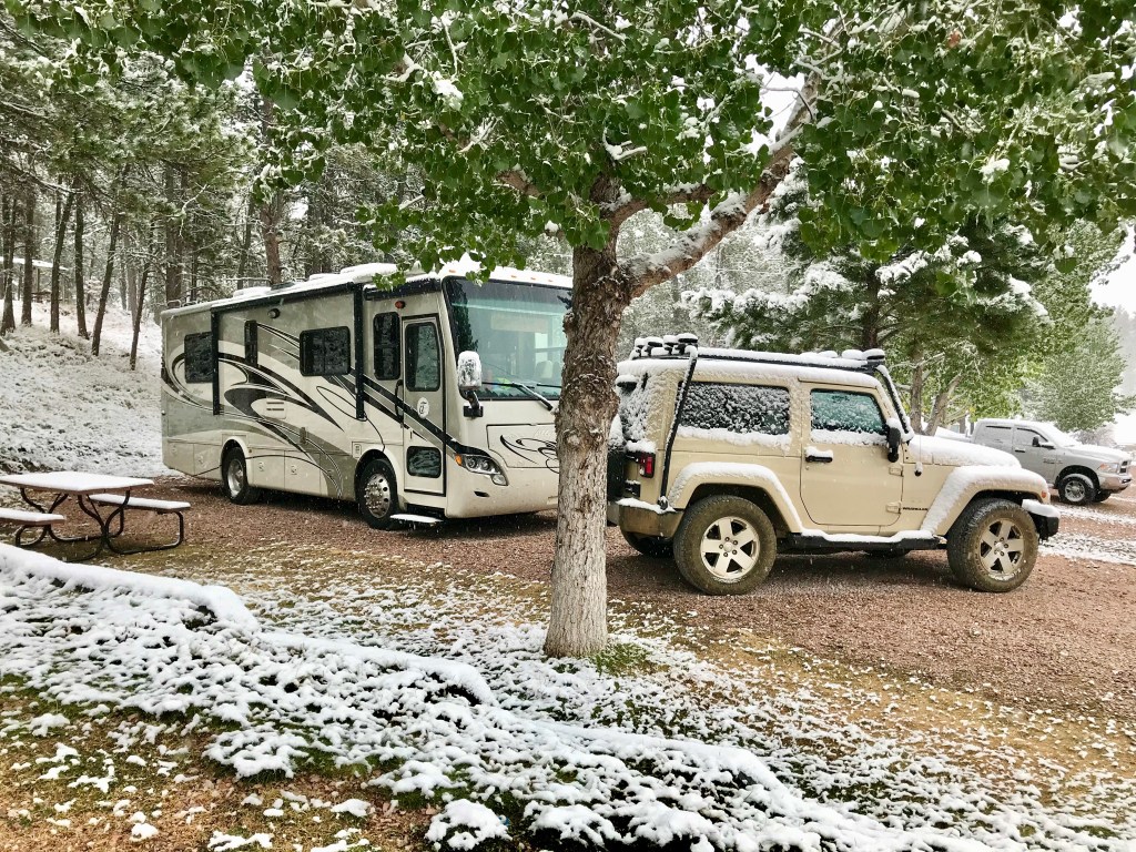
Our plan had been to go on a hike the next day, but given the crowds and racket from the ATVs and UTVs, we decided instead to make Labor Day a laundry and cleaning day. The next morning, September 8th, it snowed:
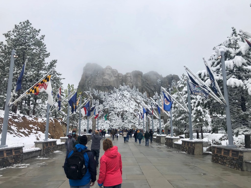
That afternoon, as the snow abated, we went to see Mount Rushmore. When we first arrived, low clouds and fog completely obliterated the famous faces of the presidents. We stood at the viewing area for about 20 minutes, but the visibility wasn’t improving, so we went back to the concessionaire to see if we could get some coffee or hot chocolate. Wandering back outside, we noticed that the presidents were just starting to peek through the mist:
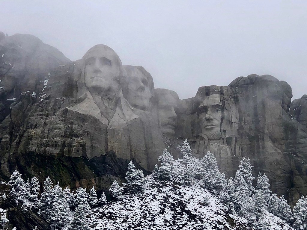
I’m sure the monument is stunning on a sunny day, but it would be hard to improve on the snow-speckled scene we were treated to on this crisp, cool Autumn day.
The Presidents, from left to right are: George Washington, founder of the Nation; Thomas Jefferson, drafter of the Constitution; Theodore Roosevelt, the Conservationist; and, Abraham Lincoln, the Great Emancipator.
Some may question why Teddy Roosevelt has been given the same recognition as the other three presidents here. The man behind the fund raising and establishment of Mount Rushmore in the 1920s was superintendent of South Dakota’s State Historical Society and Teddy Roosevelt (who had died in 1919, a decade after serving as president) was one of the great heroes of the day, as well as one of the great promoters of the Dakotas from its territorial days. From that reference point in time, it makes perfect sense. Had the monument been carved in the 1970s, John F. Kennedy would likely have been up there instead. At any rate, the Mount Rushmore project lasted from 1927 to 1941, although the actual carving only took 6.5 years; the rest of the time was for planning and fund-raising. As we left, we spotted the profile of George Washington through a gap in the rock:

After visiting Mount Rushmore, we drove over to see the Crazy Horse Memorial, a private endeavor dedicated to the Oglala Lakota Sioux war chief, Crazy Horse. I say “dedicated” because the carving does not depict Crazy Horse since his likeness was never recorded for posterity and nobody has any idea what he really looked like. The visionary for this project was another Oglala chief, Henry Standing Bear, who recruited the sculptor Korczak Ziolkowski in 1940 to design and carve the monument. Here’s the sculptor’s model with the on-going work visible in the distance:
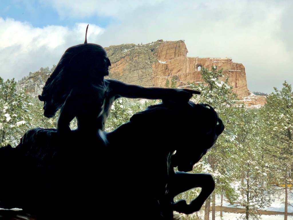
Ziolkowski started work on the mountain in 1948, knowing the project was so immense that it could not be completed in his lifetime. He was right; he died in 1982 and the work has been continued since then by his descendants.
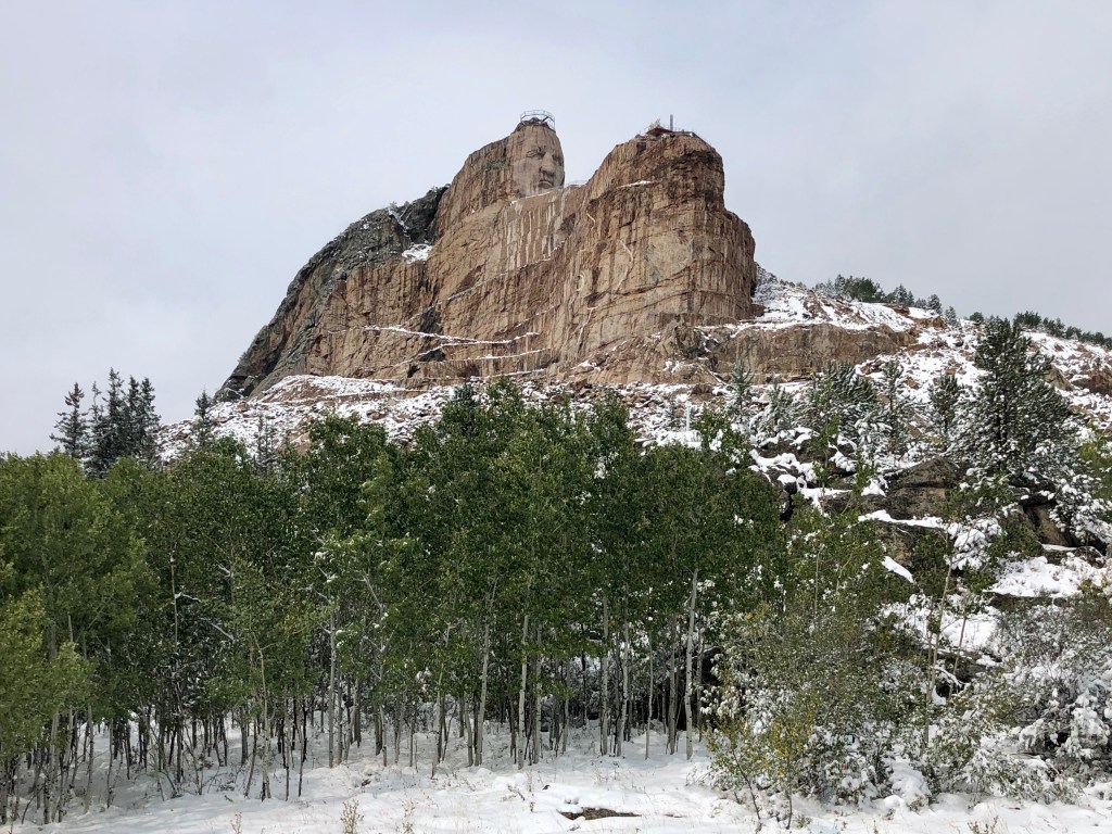
From the visitor center and museum, there’s a bus that will take you closer to the monument in order to get a better view.
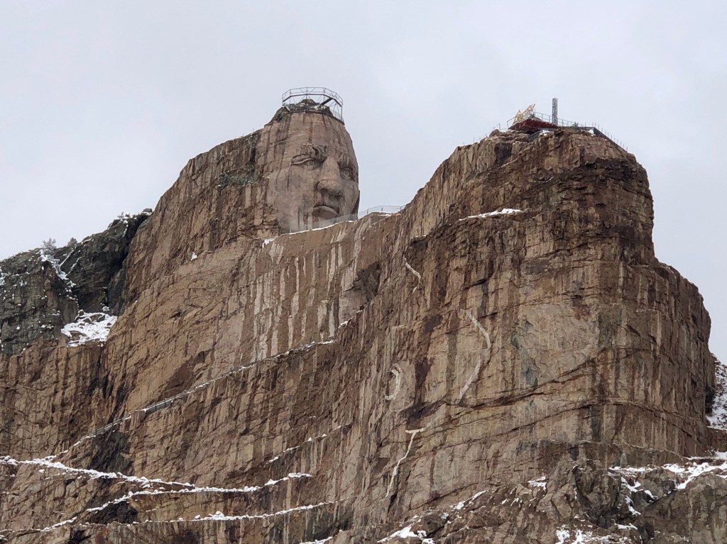
They still have a long way to go, but so far they have completed the face – which is 87 feet high – and developed a method for removing the rock by cable saw, rather than blasting, so the work progresses a little more quickly now, “quickly” being a relative term.
From here, we returned to the RV for the night. The next morning, given the surprising turn in the weather, we decided to decamp a day early to go for a hike in the Badlands of South Dakota at a lower and warmer elevation.
