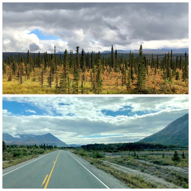
Leaving Denali, we drove north on the Parks Highway into Alaska’s interior on our way to North Pole.
No, not THAT North Pole. We were headed to a small town just east of Fairbanks that some marketing genius in the 1950s named North Pole, Alaska. Another opportunist immediately cashed in on the name, opening a trading post named “Santa Claus House” that has since evolved into a roadside attraction. It’s also where all those kids’ letters to Santa Claus get delivered.
Since Mrs. Claus is my co-pilot, we had to stop. The actual North Pole, by the way, is 1,700 miles away and much colder.
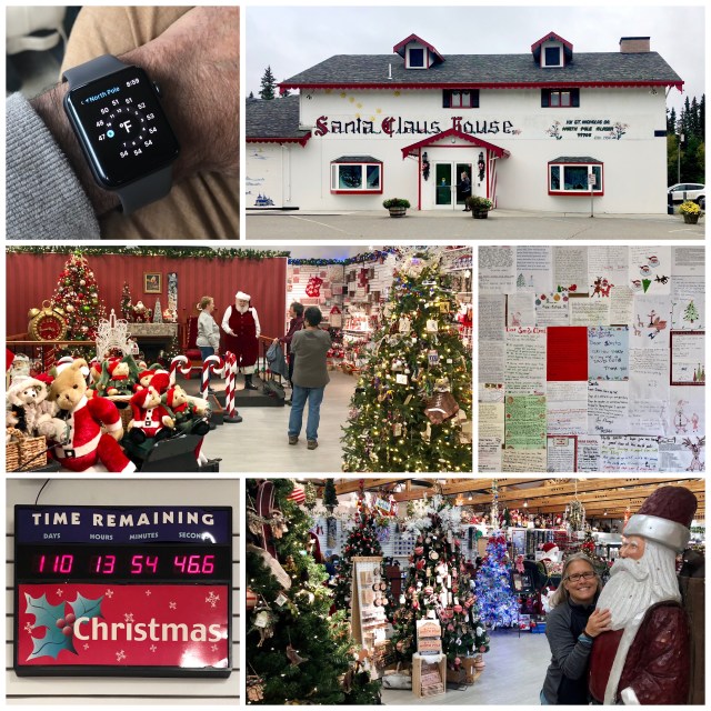
We spent the night in North Pole at the Riverview RV Park. After visiting Santa Claus House the next morning, we headed south on the Richardson Highway, the northern terminus of which is in nearby Fairbanks; the Richardson Highway connects Fairbanks to Valdez, 368 miles to the south. About a month ago we drove the southernmost section of the Richardson Highway from Glennallen to Valdez and now we’re driving the rest of it.
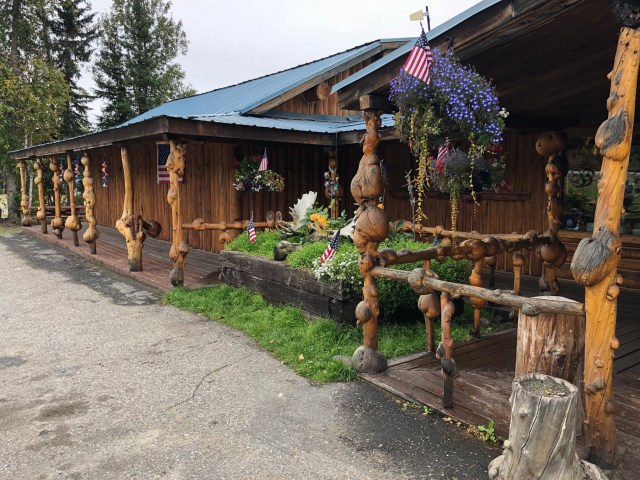
Being in a touristy mood, we also stopped at the Knotty Shop, another roadside attraction about 15 miles down the road from Santa Claus House. Given that the place is known for the spruce burls that hold up its roof and fence its front porch, we hoped to find some of those woody growths for sale, but the place was mostly stocked with T-shirts and “souvenirs.”
Interior Alaska, through which we have been traveling since leaving Denali, lies north of the Alaska Range and south of the Brooks Range. Coincidentally, these boundaries also generally follow the limits of the Arctic Circle on the north and the Denali Fault line on the south. The region comprises the Yukon River drainage basin and for at least the last 2 million years it has remained mostly glacier-free, notwithstanding the numerous ice ages that have buried the rest of Alaska under hundreds of feet of glaciers and ice fields (ice ages occur about every 120,000 years).
Archeologists and geologists refer to this part of Alaska as Beringia, which in millennia past extended from North America into Asia. It is believed that the first humans to reach the Americas did so by crossing the Beringia land bridge before the end of the last ice age about 10,000 years ago, after which the rising sea submerged what we now call the Bering Strait, 56 miles wide today at its narrowest point.

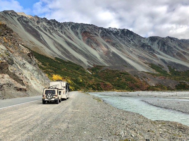
We continued south on the Richardson Highway along the Tanana River to its confluence with the Delta River. The Richardson Highway was Alaska’s first road, blazed around 1905 as a 10-foot wide pack-horse trail in summer and dog sled route in winter to access the gold mining town of Fairbanks. In 1910, under the direction of General Wilds Richardson, the Alaska Road Commission improved the trail as a military wagon road and started operating a ferry across the Tanana River. Work on the road continued until WWI when many of the workers were diverted to the war effort and the road fell into disrepair. After the war, work on the road resumed and in 1922 it opened as a permanent summer road sufficiently developed to accommodate automobiles.
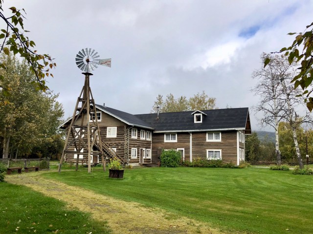
In those days, there were roadhouses about every 15 to 20 miles along the road for travelers to stop for a meal or for the night, the forerunners of the motels that still line America’s highways. On the south side of the Tanana River, a former trading post and roadhouse was acquired by Rika Wallen, a Swedish immigrant, who opened it to passing travelers as Rika’s Roadhouse in the 1920s (photo, below). Rika operated her roadhouse until the 1940s when the Alaska Highway was completed 12 miles to the south at Delta Junction and a bridge was built here over the Tanana River, eliminating the ferry and diverting traffic from the roadhouse and landing. Rika’s Roadhouse is now listed on the National Register of Historic Places and open to the public as the feature of the Big Delta State Historical Park. We stopped and had lunch.
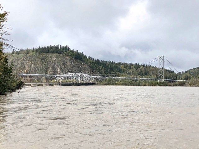
From the old ferry landing, I took a photo of the Tanana River bridge; it’s the lower trestle structure. The suspension works to the right lift the Trans-Alaska oil pipeline, enabling it to cross over the river.
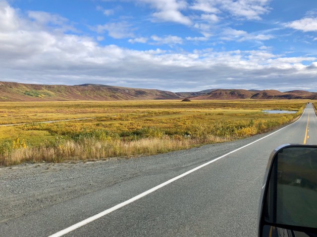
Continuing south on the Richardson Highway, we took the righthand fork at Delta Junction, the road designated AK-4 from here to its terminus at far-away Valdez. From Fairbanks the Richardson Highway had been labeled AK-2, the number assigned to the Alaska Highway at Delta Junction where it begins its journey south.
Fort Greely, a U. S. Army anti-ballistic missile defense installation, straddles the Richardson Highway for about 25 miles beginning at Delta Junction. At the southern end of these lands, there is a pull-out with great views of the Trans-Alaska Pipeline (I’ve previously written about the pipeline, here).
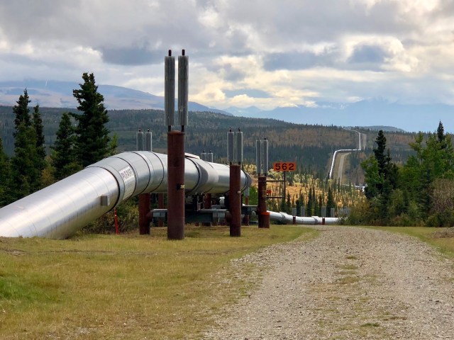
As we traveled south parallel to the east of the Delta River, the pipeline kept porpoising around us, first above ground on our left, then diving below the surface only to reappear again on our right.
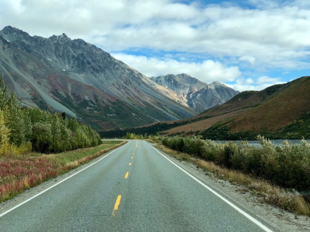
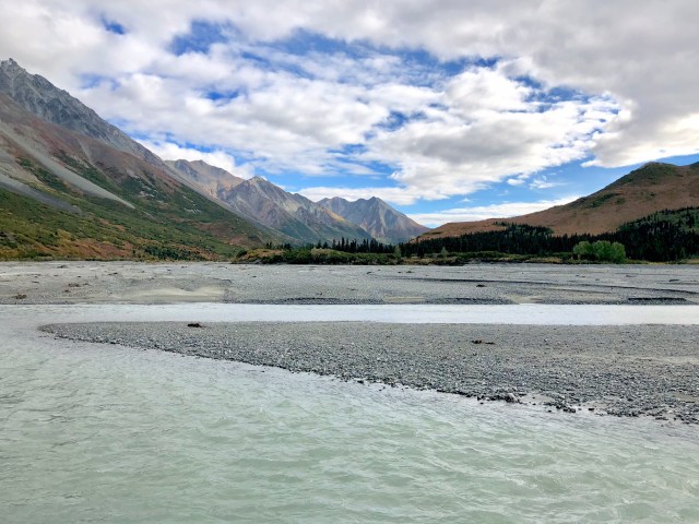
Another 30 miles south, we came to a bend in the Delta River where the Richardson highway crosses the Denali Fault just north of Rainbow Ridge.
Like most of the rivers we have seen in Alaska, the Delta River runs very wide and shallow in many locations formed by glacial progress and retreat over the eons.
After taking the photo of the riverbed, above, I turned to photograph incredibly beautiful Rainbow Ridge, made colorful by its composition of oxidized iron- and magnesium-rich rocks.
We have now crossed the Alaska Range and the Denali Fault three times: here at Rainbow Ridge; at Denali NP; and, on the Tok Cut-Off Road at Nabesna Road. I have outlined the fault line in yellow on the map near the top of this post.
From Roadside Geology of Alaska, by Cathy Connor (2d ed. 2014) (a generally informative book about Alaska):
The Alaska Range has been lifted up along the Denali Fault, a right-lateral strike-slip fault that extends for 1,240 miles (2,000 km) across south-central Alaska. For the last 60 million years, this suture zone has been a focus of lots of topographic drama. Geologists have estimated fault slip rates at 0.28 to 0.5 inches (7 to 13 mm) per year in Quaternary time by measuring the fault offset of moraines deposited from 16,000 to 12,000 years ago.
In other words, since I have been alive, south-central Alaska has shifted nearly 3 feet to the northwest in relation to the rest of North America!
A recent highlight of the “topographic drama” Connor refers to was the 2002 earthquake, the locus of which was not far from here. Connor continues:
The November 3, 2002, Denali Earthquake of magnitude 7.9 was the strongest quake ever recorded in interior Alaska. Its shock waves were felt as far away as Louisiana. The epicenter was located on a previously unstudied thrust fault in the eastern Alaska Range about 90 miles (145 km) south of Fairbanks. The ground surface ruptured for 209 miles (336 km) along the Susitna Glacier, Denali, and Totschunda Faults.
We continued our drive south, crossing the drainage divide at Isabel Pass (elev. 3,000 feet), just north of appropriately named Summit Lake. From here, all waters flow south.
As we descended toward Glennallen, we could once again see the great mountains of Wrangell-St.Elias NP off in the distance: to the left, Mt. Sanford (elev. 16,237 feet), and to the right, Mt. Drum (elev. 12,011):

Not long afterward, we reached Glennallen and pulled into Northern Nights Campground for another visit. Most tourists have gone home. We were alone in the campground.

The following day, we made the 2.5-hour drive west on the Glenn Highway, back to Palmer in the Mat-Su Valley. The Glenn Highway is a beautiful drive, especially at this time of year and even on a cloudy day.
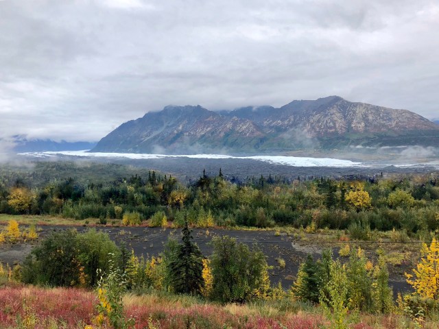
As we passed the Matanuska Glacier, we made a note to return for a hike onto the ice. Matanuska is one of the few glaciers in Alaska that can be reached on foot from the road.
Our trip is winding down, but we have one more adventure before heading to Whittier to catch the ferry home.

I’ve enjoyed reading about y’alls trip. We’re planning on heading to Alaska in 2020 and I’m wondering how/what you used to plan your daily excursions. Is there some resources available that could help us? We don’t want to get back home and realize we missed something that was on our path.
LikeLike
John, thanks for reading my blog. In answer to your question, my wife did the planning regarding what sites to see and I took care of routing and scheduling.
Of course, you will need to get a copy of the Milepost (I bought the digital version). Here’s the website: http://www.themilepost.com/
I also found the Bell’s Guides to be helpful: https://www.bellsalaska.com/
And the Explore North website was very informative: http://www.explorenorth.com/
As was the Alaska tourism site: http://www.alaska.org/
My wife used these two RV blogs:
https://www.gonewiththewynns.com/alaska-canada-adventures
You’ll have a great time. If you want more details, feel free to email me directly at mark@ulmermail.com.
LikeLike
I, too, have really loved reading your blog of the trip to Alaska. Your detail, pictures, and writing are all excellent. Thank you for all the links mentioned above as we are headed to Alaska in 2019. I would love to see the visual of a map of Alaska with your entire trip routed on it.
Again, thank you for your outstanding blog.
LikeLiked by 1 person
I have maybe 2 or 3 more posts before we’re home and I’ll do my best to remember to put a map of the complete trip in the last one. Thank you for reading and commenting!
LikeLike