Olympic National Park, just a couple hours from our home in Bellingham, Washington, is the 10th most visited national park in the United States. And though we’ve been in Washington for nearly 5 years now, we are just getting around to exploring the Olympic Peninsula.
We left early Monday for the beginning of a 2-week trip, driving south on I-5 from Bellingham to SR-20 which we took west to Fidalgo Island, then south over Deception Pass onto Whidbey Island to the Coupeville ferry dock. We were able to catch an earlier ferry than the one we had booked and had soon crossed over the Strait of Juan de Fuca to Port Townsend (we towed our Jeep and were able to remain hooked-up on the ferry, $70 one-way). Once on the Olympic Peninsula, we continued on SR-20 to US Hwy 101, the Pacific HIghway, which we took through Port Angeles.
Both SR-20 and US Hwy 101 are Washington State Scenic Byways, but after leaving Port Angeles, we turned onto SR-112, a National Scenic Byway, one of only 7 in the state of Washington, and this was an entirely different driving experience.
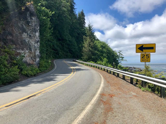
From the east, SR-112 is an easy drive, a fluid road with minimally paved shoulders and occasional guardrails. But, a few miles west of Joyce the pavement narrows, the shoulders and guardrails fall away, and the road begins to twist and turn as it dips and dives through unmanicured forest, distracting driver and passenger with glimpses of the Strait through the trees.
 
Starting at Sekiu, the road, prone to washouts, runs directly along the water, clinging to the adjacent cliff face, until it reaches its terminus at Neah Bay in the Makah Indian Reservation. It’s a beautiful and exhilarating drive, especially in a motorhome – akin to the drive to Tofino on Vancouver Island.
It had been a beautiful, sunny day from the time we left Bellingham, but within 2 miles of Neah Bay, we ran into a fog bank that announced we were now on the wettest coastal lands of the Pacific Northwest.
In Neah Bay, we made our way to our campsite for the next two nights, Cape Resort RV, and checked in. The friendly Makah woman that welcomed us to this Indian owned and operated campground told us that we should be heading into some nice weather “now that the rainy season is over.”
“Oh,” I said, “and when did it start?”
“About nine months ago,” she chuckled in reply.
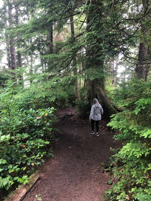
We unhooked the Jeep and drove the RV to our site, got it set up, and donned rain jackets, then drove out to Cape Flattery to take in the Pacific Ocean.
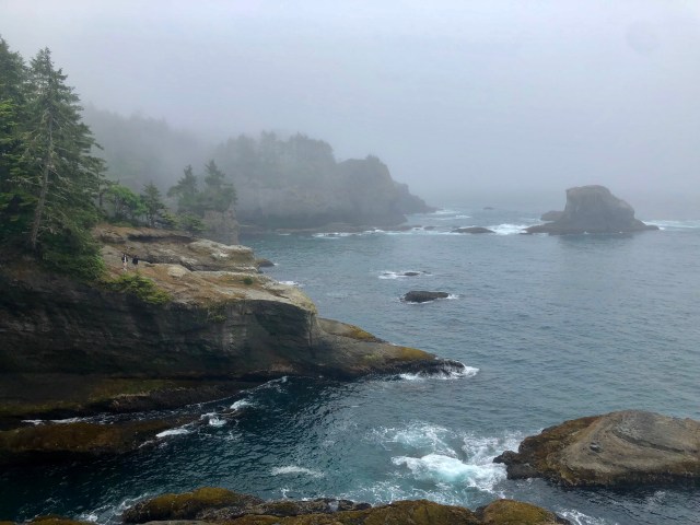
Cape Flattery, also located on the Makah Indian Reservation, is the northwestern-most point in the contiguous United States. The westernmost point is located in Olympic National Park at Cape Alava about 15 miles due south of Cape Flattery, extending 5” of longitude further into the Pacific, about 440 feet.
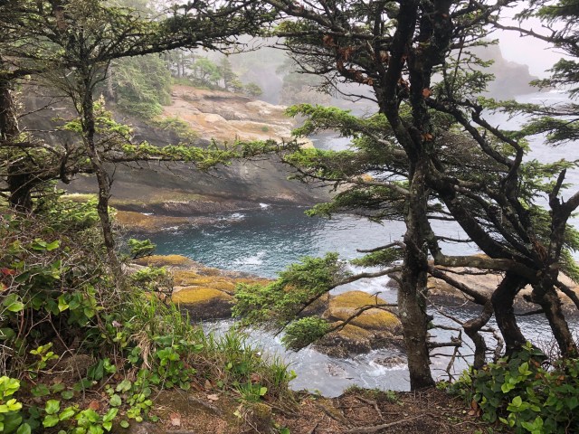
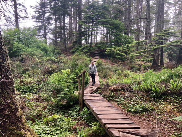
From the parking lot, we picked our way through the mist and trees …
… to the lookout point.
 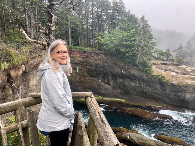
For some reason, it seemed fitting that the Cape was shrouded in fog, the air heavy and wet. Across the cove, having left the trail, two young lovers flirted with each other and with danger.
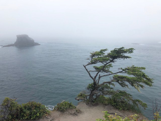
Supposedly, the winds can reach 100 mph on the point, as evidenced by some of the vegetation.
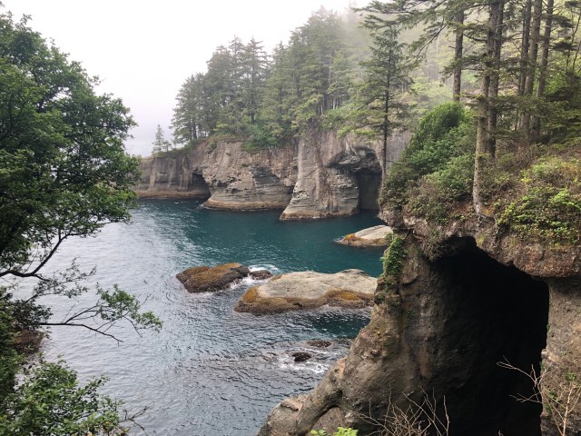
We continued our hike around to the north side of the Cape where the wave action has eroded the cliffs, forming a series of caves that reach deep back into the rock.
 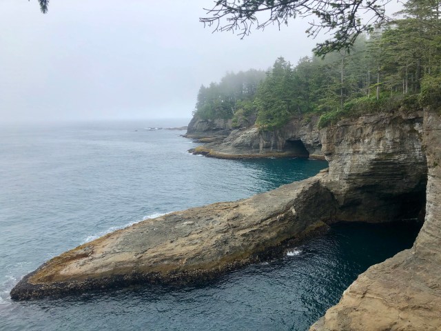
We inched closer. The water was calm on this lee shore.
We spent about an hour on Cape Flattery, taking in the sights and sounds. The peaceful aura of this place made me feel like I was everywhere and nowhere at once, timeless and ethereal. Like they say, Flattery will get you nowhere.
Time to return to the RV. We have a long day tomorrow. We’re hiking the coast to Cape Alava.

Glad to have you back in the northwest, and happy to be traveling with you again! ~April
LikeLike
Mark: Please send you home address. I’d like to forward some stuff from time to time.
Randy
LikeLike
I, too, am so glad you are posting and “on the move” again. Ironically, we are headed to the same part of the country in a few weeks (when the RV is out of the shop). As always, love your posts and pictures and thanks so much for including maps. The maps are so helpful in understanding the new terrain. Safe travels
LikeLike
Thank you for the nice comment. If you like the combination of seashore and mountains, you’ll love the Olympic Peninsula.
LikeLike